Area Overview for PE2 9PP
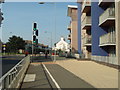
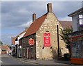
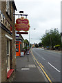
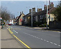
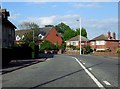
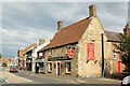
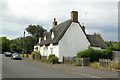
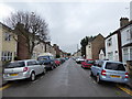
Photos of PE2 9PP


Area Information
living in PE2 9PP means residing within a specific postcode area covering a small residential cluster that contains just over 2,600 people. The total land area measures 1,547 square metres, creating a compact community where residents live relatively close to one another. This concentration results in a very high population density figure of 1,696,376 people per square kilometre, a statistical representation of how tightly packed the households are within these boundaries. Daily life here revolves around a defined group of neighbours who share the same immediate surroundings. The area serves as a distinct residential endpoint rather than a sprawling suburb, offering a sense of proximity that larger districts cannot replicate. For those considering homes in PE2 9PP, the scale is intimate and contained. You are part of a defined cluster where every property is part of the same immediate geographic footprint. The surroundings are fixed and known, providing a clear picture of where you are living before you even move. This specific identification ensures you understand exactly which neighbourhood you are entering. The small size of the cluster means that local character is consistent throughout, without the stark transitions often found between different zones in larger towns. It is a place defined by its exact coordinates and its limited footprint on the map. The community structure in PE2 9PP reflects a mature demographic profile with a median age of 47 years. Most of the population falls into the age range of 30 to 64 years, indicating an area settled by working adults rather than families with young children or younger students. Home ownership stands at 43 per cent, meaning less than half of the households reside in properties they own outright or with a mortgage. The remaining residents likely rent or live with relatives, though the exact rental split is not specified. Houses comprise the dominant form of accommodation, showing a preference for traditional family homes over flats or apartments. This housing style suits the adult population who value private space and stability over high-density living. The predominant ethnic group is White, which aligns with the broader national profile for this specific postcode sector. There is no data to suggest significant diversity beyond this majority. For those looking at homes in PE2 9PP, the social fabric appears stable and well-established. The population has settled here rather than changing frequently, creating a predictable environment. The slight imbalance in home ownership suggests a market where some residents buy to stay long term while others remain in the rental sector. This mix creates a steady local economy with residents who have deep roots. The property landscape in PE2 9PP is dominated by houses, which form the primary accommodation type for the 2,624 residents. The area functions as a residential cluster rather than a housing estate, offering a mix of property ages and styles typical of established neighbourhoods. Only 43 per cent of households are owner-occupied, indicating a substantial portion of the population rents or lives with family members. This lower ownership rate compared to the national average suggests a dynamic market where affordability or investment opportunities drive decisions rather than immediate equity building. Buyers approaching this postcode should expect a narrow range of housing types since the area is exclusively residential and small in scope. The concentration of houses means you will not find flats or purpose-built blocks for older people within the cluster itself. Property values will be influenced heavily by the local demographic of adults aged 30 to 64 years who often seek stability. When searching for homes in PE2 9PP, focus on detached or semi-detached properties that suit the existing stock. The market is specific to this small footprint, so competition may come from buyers looking for the entire cluster rather than individual streets. Understanding that 57 per cent of homes are not owned implies a steady stream of long-term tenants who form part of the community fabric. This dynamic affects both rental yields for investors and tenant stability for owners. Families considering PE2 9PP have access to two primary schools located within practical reach of the residential cluster. Brewster Avenue Infant School operates as a primary institution and currently holds a good Ofsted rating. St Augustine's CofE (Voluntary Aided) Junior School also serves as a primary school and shares the same good Ofsted rating. Both schools fall under the primary category, meaning infants and younger primary children are the immediate educational focus for students living near this postcode. There is no secondary school listed in the immediate vicinity of PE2 9PP, suggesting families may need to travel further for higher education. The presence of two good-rated primary schools indicates a solid local educational foundation for young children. This mix allows parents to choose between two options with strong regulatory standards for their children's early education. Residents in this area benefit from knowing that their younger children have access to formally inspected institutions that meet established quality benchmarks. The concentration of primary education means the area supports young families before they eventually move for secondary education. These schools are named entities that provide concrete information for anyone researching schools near PE2 9PP. The consistent good ratings across both institutions suggest a reliable standard of education in the immediate neighbourhood. Residents of PE2 9PP enjoy excellent digital connectivity that supports modern working requirements. The fixed broadband quality score reaches 96 out of 100, ranking as excellent for high-speed internet access. This score ensures that remote working, streaming services, and large file transfers proceed without significant interruptions. Mobile network coverage follows closely with a score of 85 out of 100, which classifies as very good for staying connected on the go. Both metrics indicate that digital infrastructure here is robust enough to support heavy usage patterns. For professionals working from home, the high broadband score removes a common barrier to remote employment. You can expect reliable video calls and cloud-based workflows under typical conditions. The strong mobile signal complements the fixed line, providing redundancy if one system experiences temporary issues. This level of connectivity is rare in older residential clusters and makes PE2 9PP attractive to digital-first businesses and home office workers. Daily internet use for everything from schoolwork to entertainment runs smoothly against this backdrop. The combination of top-tier broadband and solid mobile coverage creates a frictionless digital environment. Homebuyers prioritising technology infrastructure will find this area meets their needs without requiring upgrades. The scores reflect a well-maintained network that serves the small residential cluster effectively. Daily life in PE2 9PP is centred on a practical radius of amenities within easy reach of the homes. Retail options include five nearby venues, with notable locations such as Tesco Peterborough, Lidl Peterborough, and Budgens Fletton providing essential grocery needs. These supermarkets allow residents to stock up on food and household items without requiring a lengthy journey across town. Public transport accessibility is supported by four metro stops located nearby, including Peterborough, Orton Mere, and Ferry Meadows. These stations offer connections to wider regional networks, enabling residents to travel beyond the immediate cluster. Rail connectivity is further reinforced by two railway stations: Peterborough Railway Station and Whittlesea Railway Station. Two of these stations provide direct rail links, making commuting to cities outside the immediate region straightforward. The presence of both metro and rail options ensures flexibility in how residents choose to move. For those living in PE2 9PP, the ability to reach Peterborough or Whittlesea by train simplifies social and professional life. Shopping needs are met by the larger supermarkets which serve the local population efficiently. The variety of transport modes means you are never trapped by road congestion if you switch to rail or tube. This blend of shopping and travel facilities creates a functional lifestyle that balances convenience with connectivity. Safety assessments for PE2 9PP reveal a mixed picture regarding environmental risks and local crime levels. The flood risk category shows a level of PASS with a score of zero, indicating there is no flood risk coverage in this area. This low risk allows residents to build homes without concerns about water inundation or insurance premiums related to flooding. Similarly, planning constraint assessments all show a PASS level with zero scores. There is no Ramsar wetland sites coverage, no Area of Outstanding Natural Beauty coverage, and no protected nature reserve or protected woodland coverage. These clearances mean development is not restricted by strict environmental designations within the postcode. However, the crime risk assessment presents a different picture with a WARNING level and a score of 54 out of 100. This medium crime risk places the area below the ideal safety threshold of zero but above critical alert levels. Crime rates are around average for the region, suggesting standard precautions are necessary. Residents should be aware that while the physical environment is stable, vigilance regarding personal security is required. The safety score of 54 indicates that while dangerous highlights are absent, petty crime remains a presence. Balancing the low environmental risks with the average crime risk provides a realistic view of living here. Homebuyers must weigh the secure physical setting against the need for standard security measures in daily life. Who lives in PE2 9PP and what is the community like? The community in PE2 9PP consists of 2,624 people with a median age of 47 years. Most residents are adults aged between 30 and 64 years, creating a stable, settled neighbourhood. The area contains predominantly houses, and 43 per cent of households own their property. The predominant ethnic group is White, aligning with the local demographic profile. The 1,547 square metre footprint ensures a tightly knit cluster. What schools are available near PE2 9PP for young children? Families near PE2 9PP have access to two primary schools with good Ofsted ratings. Brewster Avenue Infant School and St Augustine's CofE (Voluntary Aided) Junior School both serve as primary institutions. There are no secondary schools listed immediately adjacent to the postcode. These schools provide the main educational options for children living in the residential cluster. How reliable is the transport and internet connection in this area? Digital connectivity is outstanding with a broadband score of 96 out of 100 and a mobile coverage score of 85 out of 100. This excellent infrastructure supports remote working and heavy data use. Transport links include four nearby metro stops at Peterborough, Orton Mere, and Ferry Meadows. Additionally, two railway stations are accessible, providing connections via Peterborough Railway Station and Whittlesea Railway Station. Are there supermarkets and shops close to PE2 9PP? Yes, five retail venues are within practical reach of the postcode. Notable locations include Tesco Peterborough, Lidl Peterborough, and Budgens Fletton. These supermarkets cover essential grocery and household needs for residents. The proximity of these amenities ensures that daily shopping requires no long travel into the city centre. Is PE2 9PP a safe place to live regarding crime and environment? The area has zero risk for flooding and no constraints from protected nature reserves or woodlands. All environmental safety assessments passed with a score of zero. However, the crime risk assessment shows a WARNING level with a score of 54 out of 100. This indicates medium crime risk with rates around average. Standard security precautions are advisable despite the stable physical environment.
- Area Type
- Postcode
- Area Size
- 1547 m²
- Population
- 2624
- Population Density
- 4527 people/km²
The property landscape in PE2 9PP is dominated by houses, which form the primary accommodation type for the 2,624 residents. The area functions as a residential cluster rather than a housing estate, offering a mix of property ages and styles typical of established neighbourhoods. Only 43 per cent of households are owner-occupied, indicating a substantial portion of the population rents or lives with family members. This lower ownership rate compared to the national average suggests a dynamic market where affordability or investment opportunities drive decisions rather than immediate equity building. Buyers approaching this postcode should expect a narrow range of housing types since the area is exclusively residential and small in scope. The concentration of houses means you will not find flats or purpose-built blocks for older people within the cluster itself. Property values will be influenced heavily by the local demographic of adults aged 30 to 64 years who often seek stability. When searching for homes in PE2 9PP, focus on detached or semi-detached properties that suit the existing stock. The market is specific to this small footprint, so competition may come from buyers looking for the entire cluster rather than individual streets. Understanding that 57 per cent of homes are not owned implies a steady stream of long-term tenants who form part of the community fabric. This dynamic affects both rental yields for investors and tenant stability for owners. Families considering PE2 9PP have access to two primary schools located within practical reach of the residential cluster. Brewster Avenue Infant School operates as a primary institution and currently holds a good Ofsted rating. St Augustine's CofE (Voluntary Aided) Junior School also serves as a primary school and shares the same good Ofsted rating. Both schools fall under the primary category, meaning infants and younger primary children are the immediate educational focus for students living near this postcode. There is no secondary school listed in the immediate vicinity of PE2 9PP, suggesting families may need to travel further for higher education. The presence of two good-rated primary schools indicates a solid local educational foundation for young children. This mix allows parents to choose between two options with strong regulatory standards for their children's early education. Residents in this area benefit from knowing that their younger children have access to formally inspected institutions that meet established quality benchmarks. The concentration of primary education means the area supports young families before they eventually move for secondary education. These schools are named entities that provide concrete information for anyone researching schools near PE2 9PP. The consistent good ratings across both institutions suggest a reliable standard of education in the immediate neighbourhood. Residents of PE2 9PP enjoy excellent digital connectivity that supports modern working requirements. The fixed broadband quality score reaches 96 out of 100, ranking as excellent for high-speed internet access. This score ensures that remote working, streaming services, and large file transfers proceed without significant interruptions. Mobile network coverage follows closely with a score of 85 out of 100, which classifies as very good for staying connected on the go. Both metrics indicate that digital infrastructure here is robust enough to support heavy usage patterns. For professionals working from home, the high broadband score removes a common barrier to remote employment. You can expect reliable video calls and cloud-based workflows under typical conditions. The strong mobile signal complements the fixed line, providing redundancy if one system experiences temporary issues. This level of connectivity is rare in older residential clusters and makes PE2 9PP attractive to digital-first businesses and home office workers. Daily internet use for everything from schoolwork to entertainment runs smoothly against this backdrop. The combination of top-tier broadband and solid mobile coverage creates a frictionless digital environment. Homebuyers prioritising technology infrastructure will find this area meets their needs without requiring upgrades. The scores reflect a well-maintained network that serves the small residential cluster effectively. Daily life in PE2 9PP is centred on a practical radius of amenities within easy reach of the homes. Retail options include five nearby venues, with notable locations such as Tesco Peterborough, Lidl Peterborough, and Budgens Fletton providing essential grocery needs. These supermarkets allow residents to stock up on food and household items without requiring a lengthy journey across town. Public transport accessibility is supported by four metro stops located nearby, including Peterborough, Orton Mere, and Ferry Meadows. These stations offer connections to wider regional networks, enabling residents to travel beyond the immediate cluster. Rail connectivity is further reinforced by two railway stations: Peterborough Railway Station and Whittlesea Railway Station. Two of these stations provide direct rail links, making commuting to cities outside the immediate region straightforward. The presence of both metro and rail options ensures flexibility in how residents choose to move. For those living in PE2 9PP, the ability to reach Peterborough or Whittlesea by train simplifies social and professional life. Shopping needs are met by the larger supermarkets which serve the local population efficiently. The variety of transport modes means you are never trapped by road congestion if you switch to rail or tube. This blend of shopping and travel facilities creates a functional lifestyle that balances convenience with connectivity. Safety assessments for PE2 9PP reveal a mixed picture regarding environmental risks and local crime levels. The flood risk category shows a level of PASS with a score of zero, indicating there is no flood risk coverage in this area. This low risk allows residents to build homes without concerns about water inundation or insurance premiums related to flooding. Similarly, planning constraint assessments all show a PASS level with zero scores. There is no Ramsar wetland sites coverage, no Area of Outstanding Natural Beauty coverage, and no protected nature reserve or protected woodland coverage. These clearances mean development is not restricted by strict environmental designations within the postcode. However, the crime risk assessment presents a different picture with a WARNING level and a score of 54 out of 100. This medium crime risk places the area below the ideal safety threshold of zero but above critical alert levels. Crime rates are around average for the region, suggesting standard precautions are necessary. Residents should be aware that while the physical environment is stable, vigilance regarding personal security is required. The safety score of 54 indicates that while dangerous highlights are absent, petty crime remains a presence. Balancing the low environmental risks with the average crime risk provides a realistic view of living here. Homebuyers must weigh the secure physical setting against the need for standard security measures in daily life. Who lives in PE2 9PP and what is the community like? The community in PE2 9PP consists of 2,624 people with a median age of 47 years. Most residents are adults aged between 30 and 64 years, creating a stable, settled neighbourhood. The area contains predominantly houses, and 43 per cent of households own their property. The predominant ethnic group is White, aligning with the local demographic profile. The 1,547 square metre footprint ensures a tightly knit cluster. What schools are available near PE2 9PP for young children? Families near PE2 9PP have access to two primary schools with good Ofsted ratings. Brewster Avenue Infant School and St Augustine's CofE (Voluntary Aided) Junior School both serve as primary institutions. There are no secondary schools listed immediately adjacent to the postcode. These schools provide the main educational options for children living in the residential cluster. How reliable is the transport and internet connection in this area? Digital connectivity is outstanding with a broadband score of 96 out of 100 and a mobile coverage score of 85 out of 100. This excellent infrastructure supports remote working and heavy data use. Transport links include four nearby metro stops at Peterborough, Orton Mere, and Ferry Meadows. Additionally, two railway stations are accessible, providing connections via Peterborough Railway Station and Whittlesea Railway Station. Are there supermarkets and shops close to PE2 9PP? Yes, five retail venues are within practical reach of the postcode. Notable locations include Tesco Peterborough, Lidl Peterborough, and Budgens Fletton. These supermarkets cover essential grocery and household needs for residents. The proximity of these amenities ensures that daily shopping requires no long travel into the city centre. Is PE2 9PP a safe place to live regarding crime and environment? The area has zero risk for flooding and no constraints from protected nature reserves or woodlands. All environmental safety assessments passed with a score of zero. However, the crime risk assessment shows a WARNING level with a score of 54 out of 100. This indicates medium crime risk with rates around average. Standard security precautions are advisable despite the stable physical environment.
House Prices in PE2 9PP
Showing 4 properties
| Address | Type | Beds | Baths | Last Sale Price | Last Sale Date | |
|---|---|---|---|---|---|---|
| 3, Kariba Court, Brewster Avenue, Woodston, Peterborough, PE2 9PP | Flat | - | - | - | - | |
| 4, Kariba Court, Brewster Avenue, Woodston, Peterborough, PE2 9PP | Flat | - | - | - | - | |
| 1, Kariba Court, Brewster Avenue, Woodston, Peterborough, PE2 9PP | Flat | - | - | - | - | |
| 2, Kariba Court, Brewster Avenue, Woodston, Peterborough, PE2 9PP | Flat | - | - | - | - |
Energy Efficiency in PE2 9PP
Daily life in PE2 9PP is centred on a practical radius of amenities within easy reach of the homes. Retail options include five nearby venues, with notable locations such as Tesco Peterborough, Lidl Peterborough, and Budgens Fletton providing essential grocery needs. These supermarkets allow residents to stock up on food and household items without requiring a lengthy journey across town. Public transport accessibility is supported by four metro stops located nearby, including Peterborough, Orton Mere, and Ferry Meadows. These stations offer connections to wider regional networks, enabling residents to travel beyond the immediate cluster. Rail connectivity is further reinforced by two railway stations: Peterborough Railway Station and Whittlesea Railway Station. Two of these stations provide direct rail links, making commuting to cities outside the immediate region straightforward. The presence of both metro and rail options ensures flexibility in how residents choose to move. For those living in PE2 9PP, the ability to reach Peterborough or Whittlesea by train simplifies social and professional life. Shopping needs are met by the larger supermarkets which serve the local population efficiently. The variety of transport modes means you are never trapped by road congestion if you switch to rail or tube. This blend of shopping and travel facilities creates a functional lifestyle that balances convenience with connectivity. Safety assessments for PE2 9PP reveal a mixed picture regarding environmental risks and local crime levels. The flood risk category shows a level of PASS with a score of zero, indicating there is no flood risk coverage in this area. This low risk allows residents to build homes without concerns about water inundation or insurance premiums related to flooding. Similarly, planning constraint assessments all show a PASS level with zero scores. There is no Ramsar wetland sites coverage, no Area of Outstanding Natural Beauty coverage, and no protected nature reserve or protected woodland coverage. These clearances mean development is not restricted by strict environmental designations within the postcode. However, the crime risk assessment presents a different picture with a WARNING level and a score of 54 out of 100. This medium crime risk places the area below the ideal safety threshold of zero but above critical alert levels. Crime rates are around average for the region, suggesting standard precautions are necessary. Residents should be aware that while the physical environment is stable, vigilance regarding personal security is required. The safety score of 54 indicates that while dangerous highlights are absent, petty crime remains a presence. Balancing the low environmental risks with the average crime risk provides a realistic view of living here. Homebuyers must weigh the secure physical setting against the need for standard security measures in daily life. Who lives in PE2 9PP and what is the community like? The community in PE2 9PP consists of 2,624 people with a median age of 47 years. Most residents are adults aged between 30 and 64 years, creating a stable, settled neighbourhood. The area contains predominantly houses, and 43 per cent of households own their property. The predominant ethnic group is White, aligning with the local demographic profile. The 1,547 square metre footprint ensures a tightly knit cluster. What schools are available near PE2 9PP for young children? Families near PE2 9PP have access to two primary schools with good Ofsted ratings. Brewster Avenue Infant School and St Augustine's CofE (Voluntary Aided) Junior School both serve as primary institutions. There are no secondary schools listed immediately adjacent to the postcode. These schools provide the main educational options for children living in the residential cluster. How reliable is the transport and internet connection in this area? Digital connectivity is outstanding with a broadband score of 96 out of 100 and a mobile coverage score of 85 out of 100. This excellent infrastructure supports remote working and heavy data use. Transport links include four nearby metro stops at Peterborough, Orton Mere, and Ferry Meadows. Additionally, two railway stations are accessible, providing connections via Peterborough Railway Station and Whittlesea Railway Station. Are there supermarkets and shops close to PE2 9PP? Yes, five retail venues are within practical reach of the postcode. Notable locations include Tesco Peterborough, Lidl Peterborough, and Budgens Fletton. These supermarkets cover essential grocery and household needs for residents. The proximity of these amenities ensures that daily shopping requires no long travel into the city centre. Is PE2 9PP a safe place to live regarding crime and environment? The area has zero risk for flooding and no constraints from protected nature reserves or woodlands. All environmental safety assessments passed with a score of zero. However, the crime risk assessment shows a WARNING level with a score of 54 out of 100. This indicates medium crime risk with rates around average. Standard security precautions are advisable despite the stable physical environment.
Amenities
Schools
Families considering PE2 9PP have access to two primary schools located within practical reach of the residential cluster. Brewster Avenue Infant School operates as a primary institution and currently holds a good Ofsted rating. St Augustine's CofE (Voluntary Aided) Junior School also serves as a primary school and shares the same good Ofsted rating. Both schools fall under the primary category, meaning infants and younger primary children are the immediate educational focus for students living near this postcode. There is no secondary school listed in the immediate vicinity of PE2 9PP, suggesting families may need to travel further for higher education. The presence of two good-rated primary schools indicates a solid local educational foundation for young children. This mix allows parents to choose between two options with strong regulatory standards for their children's early education. Residents in this area benefit from knowing that their younger children have access to formally inspected institutions that meet established quality benchmarks. The concentration of primary education means the area supports young families before they eventually move for secondary education. These schools are named entities that provide concrete information for anyone researching schools near PE2 9PP. The consistent good ratings across both institutions suggest a reliable standard of education in the immediate neighbourhood. Residents of PE2 9PP enjoy excellent digital connectivity that supports modern working requirements. The fixed broadband quality score reaches 96 out of 100, ranking as excellent for high-speed internet access. This score ensures that remote working, streaming services, and large file transfers proceed without significant interruptions. Mobile network coverage follows closely with a score of 85 out of 100, which classifies as very good for staying connected on the go. Both metrics indicate that digital infrastructure here is robust enough to support heavy usage patterns. For professionals working from home, the high broadband score removes a common barrier to remote employment. You can expect reliable video calls and cloud-based workflows under typical conditions. The strong mobile signal complements the fixed line, providing redundancy if one system experiences temporary issues. This level of connectivity is rare in older residential clusters and makes PE2 9PP attractive to digital-first businesses and home office workers. Daily internet use for everything from schoolwork to entertainment runs smoothly against this backdrop. The combination of top-tier broadband and solid mobile coverage creates a frictionless digital environment. Homebuyers prioritising technology infrastructure will find this area meets their needs without requiring upgrades. The scores reflect a well-maintained network that serves the small residential cluster effectively. Daily life in PE2 9PP is centred on a practical radius of amenities within easy reach of the homes. Retail options include five nearby venues, with notable locations such as Tesco Peterborough, Lidl Peterborough, and Budgens Fletton providing essential grocery needs. These supermarkets allow residents to stock up on food and household items without requiring a lengthy journey across town. Public transport accessibility is supported by four metro stops located nearby, including Peterborough, Orton Mere, and Ferry Meadows. These stations offer connections to wider regional networks, enabling residents to travel beyond the immediate cluster. Rail connectivity is further reinforced by two railway stations: Peterborough Railway Station and Whittlesea Railway Station. Two of these stations provide direct rail links, making commuting to cities outside the immediate region straightforward. The presence of both metro and rail options ensures flexibility in how residents choose to move. For those living in PE2 9PP, the ability to reach Peterborough or Whittlesea by train simplifies social and professional life. Shopping needs are met by the larger supermarkets which serve the local population efficiently. The variety of transport modes means you are never trapped by road congestion if you switch to rail or tube. This blend of shopping and travel facilities creates a functional lifestyle that balances convenience with connectivity. Safety assessments for PE2 9PP reveal a mixed picture regarding environmental risks and local crime levels. The flood risk category shows a level of PASS with a score of zero, indicating there is no flood risk coverage in this area. This low risk allows residents to build homes without concerns about water inundation or insurance premiums related to flooding. Similarly, planning constraint assessments all show a PASS level with zero scores. There is no Ramsar wetland sites coverage, no Area of Outstanding Natural Beauty coverage, and no protected nature reserve or protected woodland coverage. These clearances mean development is not restricted by strict environmental designations within the postcode. However, the crime risk assessment presents a different picture with a WARNING level and a score of 54 out of 100. This medium crime risk places the area below the ideal safety threshold of zero but above critical alert levels. Crime rates are around average for the region, suggesting standard precautions are necessary. Residents should be aware that while the physical environment is stable, vigilance regarding personal security is required. The safety score of 54 indicates that while dangerous highlights are absent, petty crime remains a presence. Balancing the low environmental risks with the average crime risk provides a realistic view of living here. Homebuyers must weigh the secure physical setting against the need for standard security measures in daily life. Who lives in PE2 9PP and what is the community like? The community in PE2 9PP consists of 2,624 people with a median age of 47 years. Most residents are adults aged between 30 and 64 years, creating a stable, settled neighbourhood. The area contains predominantly houses, and 43 per cent of households own their property. The predominant ethnic group is White, aligning with the local demographic profile. The 1,547 square metre footprint ensures a tightly knit cluster. What schools are available near PE2 9PP for young children? Families near PE2 9PP have access to two primary schools with good Ofsted ratings. Brewster Avenue Infant School and St Augustine's CofE (Voluntary Aided) Junior School both serve as primary institutions. There are no secondary schools listed immediately adjacent to the postcode. These schools provide the main educational options for children living in the residential cluster. How reliable is the transport and internet connection in this area? Digital connectivity is outstanding with a broadband score of 96 out of 100 and a mobile coverage score of 85 out of 100. This excellent infrastructure supports remote working and heavy data use. Transport links include four nearby metro stops at Peterborough, Orton Mere, and Ferry Meadows. Additionally, two railway stations are accessible, providing connections via Peterborough Railway Station and Whittlesea Railway Station. Are there supermarkets and shops close to PE2 9PP? Yes, five retail venues are within practical reach of the postcode. Notable locations include Tesco Peterborough, Lidl Peterborough, and Budgens Fletton. These supermarkets cover essential grocery and household needs for residents. The proximity of these amenities ensures that daily shopping requires no long travel into the city centre. Is PE2 9PP a safe place to live regarding crime and environment? The area has zero risk for flooding and no constraints from protected nature reserves or woodlands. All environmental safety assessments passed with a score of zero. However, the crime risk assessment shows a WARNING level with a score of 54 out of 100. This indicates medium crime risk with rates around average. Standard security precautions are advisable despite the stable physical environment.
| Rank | School | Type | Entry gender | Ages |
|---|
Explore more schools in this area
Go to Schools tabDemographics
The community structure in PE2 9PP reflects a mature demographic profile with a median age of 47 years. Most of the population falls into the age range of 30 to 64 years, indicating an area settled by working adults rather than families with young children or younger students. Home ownership stands at 43 per cent, meaning less than half of the households reside in properties they own outright or with a mortgage. The remaining residents likely rent or live with relatives, though the exact rental split is not specified. Houses comprise the dominant form of accommodation, showing a preference for traditional family homes over flats or apartments. This housing style suits the adult population who value private space and stability over high-density living. The predominant ethnic group is White, which aligns with the broader national profile for this specific postcode sector. There is no data to suggest significant diversity beyond this majority. For those looking at homes in PE2 9PP, the social fabric appears stable and well-established. The population has settled here rather than changing frequently, creating a predictable environment. The slight imbalance in home ownership suggests a market where some residents buy to stay long term while others remain in the rental sector. This mix creates a steady local economy with residents who have deep roots. The property landscape in PE2 9PP is dominated by houses, which form the primary accommodation type for the 2,624 residents. The area functions as a residential cluster rather than a housing estate, offering a mix of property ages and styles typical of established neighbourhoods. Only 43 per cent of households are owner-occupied, indicating a substantial portion of the population rents or lives with family members. This lower ownership rate compared to the national average suggests a dynamic market where affordability or investment opportunities drive decisions rather than immediate equity building. Buyers approaching this postcode should expect a narrow range of housing types since the area is exclusively residential and small in scope. The concentration of houses means you will not find flats or purpose-built blocks for older people within the cluster itself. Property values will be influenced heavily by the local demographic of adults aged 30 to 64 years who often seek stability. When searching for homes in PE2 9PP, focus on detached or semi-detached properties that suit the existing stock. The market is specific to this small footprint, so competition may come from buyers looking for the entire cluster rather than individual streets. Understanding that 57 per cent of homes are not owned implies a steady stream of long-term tenants who form part of the community fabric. This dynamic affects both rental yields for investors and tenant stability for owners. Families considering PE2 9PP have access to two primary schools located within practical reach of the residential cluster. Brewster Avenue Infant School operates as a primary institution and currently holds a good Ofsted rating. St Augustine's CofE (Voluntary Aided) Junior School also serves as a primary school and shares the same good Ofsted rating. Both schools fall under the primary category, meaning infants and younger primary children are the immediate educational focus for students living near this postcode. There is no secondary school listed in the immediate vicinity of PE2 9PP, suggesting families may need to travel further for higher education. The presence of two good-rated primary schools indicates a solid local educational foundation for young children. This mix allows parents to choose between two options with strong regulatory standards for their children's early education. Residents in this area benefit from knowing that their younger children have access to formally inspected institutions that meet established quality benchmarks. The concentration of primary education means the area supports young families before they eventually move for secondary education. These schools are named entities that provide concrete information for anyone researching schools near PE2 9PP. The consistent good ratings across both institutions suggest a reliable standard of education in the immediate neighbourhood. Residents of PE2 9PP enjoy excellent digital connectivity that supports modern working requirements. The fixed broadband quality score reaches 96 out of 100, ranking as excellent for high-speed internet access. This score ensures that remote working, streaming services, and large file transfers proceed without significant interruptions. Mobile network coverage follows closely with a score of 85 out of 100, which classifies as very good for staying connected on the go. Both metrics indicate that digital infrastructure here is robust enough to support heavy usage patterns. For professionals working from home, the high broadband score removes a common barrier to remote employment. You can expect reliable video calls and cloud-based workflows under typical conditions. The strong mobile signal complements the fixed line, providing redundancy if one system experiences temporary issues. This level of connectivity is rare in older residential clusters and makes PE2 9PP attractive to digital-first businesses and home office workers. Daily internet use for everything from schoolwork to entertainment runs smoothly against this backdrop. The combination of top-tier broadband and solid mobile coverage creates a frictionless digital environment. Homebuyers prioritising technology infrastructure will find this area meets their needs without requiring upgrades. The scores reflect a well-maintained network that serves the small residential cluster effectively. Daily life in PE2 9PP is centred on a practical radius of amenities within easy reach of the homes. Retail options include five nearby venues, with notable locations such as Tesco Peterborough, Lidl Peterborough, and Budgens Fletton providing essential grocery needs. These supermarkets allow residents to stock up on food and household items without requiring a lengthy journey across town. Public transport accessibility is supported by four metro stops located nearby, including Peterborough, Orton Mere, and Ferry Meadows. These stations offer connections to wider regional networks, enabling residents to travel beyond the immediate cluster. Rail connectivity is further reinforced by two railway stations: Peterborough Railway Station and Whittlesea Railway Station. Two of these stations provide direct rail links, making commuting to cities outside the immediate region straightforward. The presence of both metro and rail options ensures flexibility in how residents choose to move. For those living in PE2 9PP, the ability to reach Peterborough or Whittlesea by train simplifies social and professional life. Shopping needs are met by the larger supermarkets which serve the local population efficiently. The variety of transport modes means you are never trapped by road congestion if you switch to rail or tube. This blend of shopping and travel facilities creates a functional lifestyle that balances convenience with connectivity. Safety assessments for PE2 9PP reveal a mixed picture regarding environmental risks and local crime levels. The flood risk category shows a level of PASS with a score of zero, indicating there is no flood risk coverage in this area. This low risk allows residents to build homes without concerns about water inundation or insurance premiums related to flooding. Similarly, planning constraint assessments all show a PASS level with zero scores. There is no Ramsar wetland sites coverage, no Area of Outstanding Natural Beauty coverage, and no protected nature reserve or protected woodland coverage. These clearances mean development is not restricted by strict environmental designations within the postcode. However, the crime risk assessment presents a different picture with a WARNING level and a score of 54 out of 100. This medium crime risk places the area below the ideal safety threshold of zero but above critical alert levels. Crime rates are around average for the region, suggesting standard precautions are necessary. Residents should be aware that while the physical environment is stable, vigilance regarding personal security is required. The safety score of 54 indicates that while dangerous highlights are absent, petty crime remains a presence. Balancing the low environmental risks with the average crime risk provides a realistic view of living here. Homebuyers must weigh the secure physical setting against the need for standard security measures in daily life. Who lives in PE2 9PP and what is the community like? The community in PE2 9PP consists of 2,624 people with a median age of 47 years. Most residents are adults aged between 30 and 64 years, creating a stable, settled neighbourhood. The area contains predominantly houses, and 43 per cent of households own their property. The predominant ethnic group is White, aligning with the local demographic profile. The 1,547 square metre footprint ensures a tightly knit cluster. What schools are available near PE2 9PP for young children? Families near PE2 9PP have access to two primary schools with good Ofsted ratings. Brewster Avenue Infant School and St Augustine's CofE (Voluntary Aided) Junior School both serve as primary institutions. There are no secondary schools listed immediately adjacent to the postcode. These schools provide the main educational options for children living in the residential cluster. How reliable is the transport and internet connection in this area? Digital connectivity is outstanding with a broadband score of 96 out of 100 and a mobile coverage score of 85 out of 100. This excellent infrastructure supports remote working and heavy data use. Transport links include four nearby metro stops at Peterborough, Orton Mere, and Ferry Meadows. Additionally, two railway stations are accessible, providing connections via Peterborough Railway Station and Whittlesea Railway Station. Are there supermarkets and shops close to PE2 9PP? Yes, five retail venues are within practical reach of the postcode. Notable locations include Tesco Peterborough, Lidl Peterborough, and Budgens Fletton. These supermarkets cover essential grocery and household needs for residents. The proximity of these amenities ensures that daily shopping requires no long travel into the city centre. Is PE2 9PP a safe place to live regarding crime and environment? The area has zero risk for flooding and no constraints from protected nature reserves or woodlands. All environmental safety assessments passed with a score of zero. However, the crime risk assessment shows a WARNING level with a score of 54 out of 100. This indicates medium crime risk with rates around average. Standard security precautions are advisable despite the stable physical environment.
Household Size
Accommodation Type
Tenure
Ethnic Group
Religion
Household Composition
Age
Household Deprivation
NS-SEC
Explore more demographic insights in this area
Go to Demographics tabPlanning
Planning Constraints
- Flood RiskPremium
- Ramsar Wetland SitesPremium
- Area of Outstanding Natural BeautyPremium
- Protected Nature ReservePremium
- Protected WoodlandPremium