Area Overview for PE2 9LS
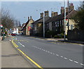
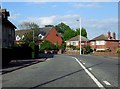
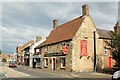
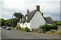
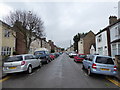
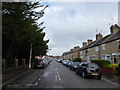
Photos of PE2 9LS

Area Information
Living in PE2 9LS means residing within a specific residential cluster defined by postcode PE2 9LS in England. This small area forms part of the wider Peterborough region, offering a settled environment for those seeking a defined locality. The population stands at 2,624 people, creating a compact community where neighbours tend to know one another. Daily life here revolves around the practicalities of a tight-knit neighbourhood where distances to key services remain manageable for local residents. The area is characterised by its residential focus, providing a stable home for families and individuals who value a consistent address. As a distinct postcode sector, PE2 9LS offers a specific slice of the city that balances local amenities with the quiet of a housing cluster. You will find that living here provides a straightforward introduction to suburban life without the noise or congestion often found in denser city centres. The population size suggests a neighbourhood that maintains a sense of scale while still accessing the broader infrastructure of the surrounding Peterborough area. For anyone considering PE2 9LS, the area presents a clear picture of established housing. The setting is defined by its residential nature, meaning your daily routine will centre on local streets and nearby facilities. This postcode covers a small footprint, which can make commuting to work, school, or shops a matter of short journeys. You can expect a typical English suburb where the focus is on home life and local community interaction rather than urban excitement. The area remains a functional part of the greater Peterborough market, offering homes that suit those who prioritise stability and a defined residential zone.
- Area Type
- Postcode
- Area Size
- Not available
- Population
- 2624
- Population Density
- 4527 people/km²
The property market in PE2 9LS is characterised by a strong presence of houses, which form the primary accommodation type for residents in this postcode. With 43 per cent of the population owning their homes, the area reflects a significant proportion of owner-occupiers rather than a rental-dominated zone. This statistic suggests that buying into PE2 9LS aligns with the aspirations of many locals who have chosen to settle permanently. The housing stock is composed mainly of houses, offering buyers a selection of single-family properties rather than flats or apartments. For those looking to purchase, the high ownership rate indicates that properties in PE2 9LS often have a history of tenure and maintenance. Buyers can expect to find homes that suit families looking for detached or semi-detached living arrangements. The residential nature of the postcode means that the market is driven by households seeking stability and space. This contrasts with city centre areas where rented apartments might dominate the listings. Instead, PE2 9LS offers a market defined by permanence and individual household needs. The mix of owner-occupied homes and the prevalence of houses create a specific type of buyer environment. Individuals moving to PE2 9LS are likely looking for a traditional house layout rather than an apartment block. The 43 per cent ownership figure is substantial, showing that investment homeowners are a key part of the local landscape. When searching for homes in PE2 9LS, you are entering a market where long-term residents have shaped the value and character of the streets. This environment is ideal for those who want to invest in a house rather than chase a short-term rental yield.
House Prices in PE2 9LS
No properties found in this postcode.
Energy Efficiency in PE2 9LS
Residents of PE2 9LS benefit from a range of amenities within practical reach, ensuring daily needs are met without excessive travel. The area has access to five major retail venues, including Tesco Peterborough, Lidl Peterborough, and Budgens Fletton. You can purchase groceries, household essentials, and general merchandise at these well-known supermarkets. The presence of these three specific chains guarantees that fresh food and convenient shopping are just a short trip away. This retail density supports a lifestyle where daily errands are simple and time-efficient. Transport links complement the retail options, with four metro stops providing access to Peterborough, Orton Mere, and Ferry Meadows. These hubs connect you to wider transport networks for jobs or leisure. Furthermore, two railway stations, Peterborough Railway Station and Whittlesea Railway Station, facilitate rail travel to distant destinations. This mix of metro and rail infrastructure means you can choose between driving and public transport depending on the day or preference. While PE2 9LS itself is a residential cluster, the surrounding town offers a variety of leisure and dining spots. You are situated near enough to pick up weekly shop with ease while retaining the peace of a neighbourhood focused on living. The specific proximity to Budgens Fletton and the main Peterborough stores ensures you never lack for basic necessities. This balance between a quiet home life and accessible commercial zones defines the practical appeal of the postcode. You enjoy a settled routine while remaining close to the conveniences of larger retail and transport centres.
Amenities
Schools
Families living in PE2 9LS have access to two primary schools within the immediate vicinity, providing options for early education. Brewster Avenue Infant School operates as a primary institution and holds a good Ofsted rating, ensuring a standard of education that meets regulatory requirements. Parents can choose this school for their younger children who typically attend infant stages of primary education. The good rating indicates that the academy meets expected standards for teaching and student outcomes. The second option is St Augustine's CofE (Voluntary Aided) Junior School, also noted as a primary school with a good Ofsted rating. This institution caters to the later stages of primary education, offering a faith-based curriculum for pupils preparing for secondary school. The presence of both infant and junior schools nearby means parents can access educational provision without travelling extensively outside the postcode area. Having two primary schools with good ratings strengthens the desirability of the location for those with school-aged children. The availability of these specific schools reflects the planning of the area to support the demographic needs of families in PE2 9LS. Neither school is listed as outstanding, but both satisfy the requirement of being rated good, which provides a reliable baseline for educational quality. Living in PE2 9LS gives you the chance to send your children to one of these established institutions. The fact that both are primary schools highlights that secondary education options would require commuting to further locations not listed in this dataset. For residents, the proximity of these specific named schools is a key practical advantage when evaluating the area for family growth.
| Rank | School | Type | Entry gender | Ages |
|---|
Explore more schools in this area
Go to Schools tabDemographics
The community in PE2 9LS reflects a mature population with a median age of 47 years. Most residents fall into the adult age range between 30 and 64 years, indicating a neighbourhood where working-age adults form the backbone of society. This demographic profile suggests a stable environment where families and professionals have established roots in the locality. Half of the population consists of adults who are likely juggling careers and domestic responsibilities within PE2 9LS. Household composition in PE2 9LS shows significant ownership, with 43 per cent of residents owning their homes outright or with a mortgage. This figure highlights a strong incentive among locals to build equity rather than rent. The remaining households likely comprise social tenants or private renters, contributing to a typical mix found in English residential clusters. Accommodation in the area is dominated by houses, distinguishing it from an area dominated by flats or high-rise developments. This housing style supports families who prefer single-family dwellings with individual gardens or defined outdoor spaces. Ethnic diversity in PE2 9LS is predominantly White, mirroring the broader statistical trends for many suburban areas in the region. The demographic data paints a picture of a traditional neighbourhood where long-standing residents contribute to the social fabric. With a median age of 47, the area attracts those who have already secured their footing in the property market. This age group often correlates with higher home ownership rates, further reinforcing the stability seen in the area. The population structure supports a community that is likely focused on practical living arrangements rather than transient housing needs.
Household Size
Accommodation Type
Tenure
Ethnic Group
Religion
Household Composition
Age
Household Deprivation
NS-SEC
Explore more demographic insights in this area
Go to Demographics tabPlanning
Planning Constraints
- Flood RiskPremium
- Ramsar Wetland SitesPremium
- Area of Outstanding Natural BeautyPremium
- Protected Nature ReservePremium
- Protected WoodlandPremium