Area Overview for PE2 9HD
Photos of PE2 9HD


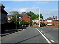
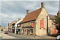
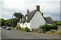
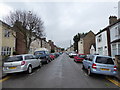
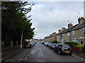
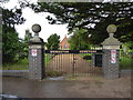
90 photos from this area
Area Information
Key information about the PE2 9HD including its size, population, and administrative classification.
- Area Type
- Postcode
- Area Size
- 1.6 hectares
- Population
- 1586
- Population Density
- 7170 people/km²
House Prices in PE2 9HD
33
Properties
£128,200
Average Sold Price
£58,000
Lowest Price
£192,000
Highest Price
Showing 33 properties
| Address | Type | Beds | Baths | Last Sale Price | Last Sale Date | |
|---|---|---|---|---|---|---|
| 57 New Road, Woodston, Peterborough, PE2 9HD | Terraced | 2 | 1 | £110,000 | Jul 2024 | |
| 29 New Road, Woodston, Peterborough, PE2 9HD | Retail | 3 | 1 | £180,000 | Aug 2022 | |
| 5 New Road, Woodston, Peterborough, PE2 9HD | house | - | - | £192,000 | Jul 2021 | |
| 61 New Road, Woodston, Peterborough, PE2 9HD | house | 2 | - | £151,000 | May 2021 | |
| 37 New Road, Woodston, Peterborough, PE2 9HD | Detached | 3 | 1 | £172,000 | Nov 2019 | |
| 27 New Road, Woodston, Peterborough, PE2 9HD | Semi-detached | 3 | 2 | £163,000 | Nov 2018 | |
| 69 New Road, Woodston, Peterborough, PE2 9HD | Bungalow | 2 | 1 | £145,000 | Nov 2016 | |
| 59 New Road, Woodston, Peterborough, PE2 9HD | Terraced | 3 | 1 | £112,000 | May 2015 | |
| 53 New Road, Woodston, Peterborough, PE2 9HD | house | - | - | £118,000 | Nov 2013 | |
| 25 New Road, Woodston, Peterborough, PE2 9HD | Semi-detached | 3 | 2 | £95,000 | May 2011 |
Page 1 of 4
Energy Efficiency in PE2 9HD
Amenities
Schools
| Rank | School | Type | Entry gender | Ages |
|---|
Explore more schools in this area
Go to Schools tabDemographics
Household Size
Family (3-5 people)
most common
Accommodation Type
Houses
most common
Tenure
40
majority
Ethnic Group
White
most common
Religion
N/A
most common
Household Composition
N/A
most common
Age
47
median
Adults (30-64 years)
most common
Household Deprivation
N/A
with no deprivation
NS-SEC
19
in Lower managerial occupations
Explore more demographic insights in this area
Go to Demographics tabPlanning
Planning Constraints
- Flood RiskPremium
- Ramsar Wetland SitesPremium
- Area of Outstanding Natural BeautyPremium
- Protected Nature ReservePremium
- Protected WoodlandPremium