Area Overview for PE2 9DE
Photos of PE2 9DE
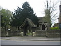
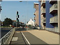
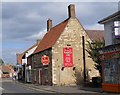
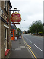

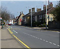
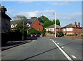
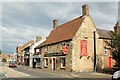
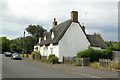
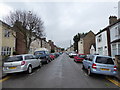
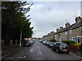

90 photos from this area
Area Information
Key information about the PE2 9DE including its size, population, and administrative classification.
- Area Type
- Postcode
- Area Size
- 1.3 hectares
- Population
- 1719
- Population Density
- 6098 people/km²
House Prices in PE2 9DE
46
Properties
£147,370
Average Sold Price
£33,000
Lowest Price
£495,000
Highest Price
Showing 46 properties
| Address | Type | Beds | Baths | Last Sale Price | Last Sale Date | |
|---|---|---|---|---|---|---|
| 133 Palmerston Road, Woodston, Peterborough, PE2 9DE | Flat | 3 | 1 | £205,000 | Oct 2024 | |
| 145 Palmerston Road, Woodston, Peterborough, PE2 9DE | Terraced | 3 | 1 | £173,000 | Mar 2024 | |
| 125B Palmerston Road, Woodston, Peterborough, PE2 9DE | Flat | 2 | 1 | £81,500 | Jul 2023 | |
| 141 Palmerston Road, Woodston, Peterborough, PE2 9DE | Retail | 2 | 1 | £170,000 | Oct 2022 | |
| 113 Palmerston Road, Woodston, Peterborough, PE2 9DE | house | - | - | £199,995 | Jun 2021 | |
| 153 Palmerston Road, Woodston, Peterborough, PE2 9DE | Terraced | 3 | - | £185,000 | Mar 2021 | |
| 159 Palmerston Road, Woodston, Peterborough, PE2 9DE | Semi-detached | 5 | 3 | £495,000 | Oct 2020 | |
| 85 Palmerston Road, Woodston, Peterborough, PE2 9DE | Terraced | 2 | 1 | £154,000 | Aug 2020 | |
| 79A Palmerston Road, Woodston, Peterborough, PE2 9DE | Terraced | 3 | 1 | £190,000 | Dec 2018 | |
| 157 Palmerston Road, Woodston, Peterborough, PE2 9DE | Terraced | 4 | 1 | £265,000 | Jun 2018 |
Page 1 of 5
Energy Efficiency in PE2 9DE
Amenities
Schools
| Rank | School | Type | Entry gender | Ages |
|---|
Explore more schools in this area
Go to Schools tabDemographics
Household Size
Family (3-5 people)
most common
Accommodation Type
Houses
most common
Tenure
57
majority
Ethnic Group
White
most common
Religion
N/A
most common
Household Composition
N/A
most common
Age
47
median
Adults (30-64 years)
most common
Household Deprivation
N/A
with no deprivation
NS-SEC
27
in Lower managerial occupations
Explore more demographic insights in this area
Go to Demographics tabPlanning
Planning Constraints
- Flood RiskPremium
- Ramsar Wetland SitesPremium
- Area of Outstanding Natural BeautyPremium
- Protected Nature ReservePremium
- Protected WoodlandPremium