Area Overview for PE2 8XP
Photos of PE2 8XP
Area Information
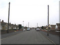
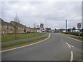
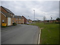
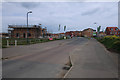
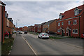
Living in PE2 8XP means residing in a very tightly knit residential cluster where property and proximity are closely linked. This specific postcode covers just over nine thousand square metres, yet it serves a population of 1,613 people. That density creates a compact environment where neighbours are invariably nearby. The area lies within the wider Peterborough context, offering a chapter of English life defined by local familiarity rather than urban sprawl. Residents here enjoy a consistent pace of daily life supported by immediate access to settled housing. The small footprint of this pocket means that what defines the neighbourhood is the immediate built environment and the specific streets that make up the cluster. You move through an area where the scale is human and the community interconnects naturally. This is a place for those who prefer a predictable routine and want to know exactly where their home sits in relation to their daily necessities. The sheer concentration of homes in such a small space suggests a planned or evolved settlement designed for close living. You will find that life here revolves around the practicalities of a well-defined residential zone rather than the expanses of larger towns.
- Area Type
- Postcode
- Area Size
- 9071 m²
- Population
- 1613
- Population Density
- 2773 people/km²
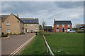
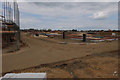
The property market in PE2 8XP is almost exclusively an owner-occupied sector. With 84 percent of homes owned by residents, the area functions as a stable long-term housing zone rather than a transient rental hub. Houses form the core of the accommodation stock, reflecting a preference for traditional family living over flats or apartments. This high ownership rate implies that buyers here are looking for places to stay comfortably for years, not short-term lets. The small total size of 9,071 square metres means the stock is finite and local. Potential buyers must act quickly as opportunities in such a compact postcode are rare and may disappear quickly. The nature of the housing as predominantly houses suggests lower demand from those seeking high-rise accommodation or city-centre conversions. For anyone considering buying homes in the surrounding stretching areas, understanding that this specific spot is owner-led is crucial. The market is driven by residents upgrading within the type or relocating to this established cluster from further afield. There is little evidence of large-scale development or speculative investment here; the character is set by the existing homeowners.
House Prices in PE2 8XP
Showing 35 properties
| Address | Type | Beds | Baths | Last Sale Price | Last Sale Date | |
|---|---|---|---|---|---|---|
| 10 Penelope Grove, Stanground South, Peterborough, PE2 8XP | house | - | - | £240,000 | Nov 2025 | |
| 18 Penelope Grove, Stanground South, Peterborough, PE2 8XP | Semi-detached | 3 | 2 | £235,000 | Nov 2024 | |
| 15 Penelope Grove, Stanground South, Peterborough, PE2 8XP | Detached | 3 | 2 | £280,000 | Jul 2024 | |
| 50 Penelope Grove, Stanground South, Peterborough, PE2 8XP | Terraced | 3 | 2 | £250,000 | Feb 2023 | |
| 19 Penelope Grove, Stanground South, Peterborough, PE2 8XP | house | - | - | £260,000 | Dec 2021 | |
| 21 Penelope Grove, Stanground South, Peterborough, PE2 8XP | house | - | - | £226,000 | Nov 2021 | |
| 34 Penelope Grove, Stanground South, Peterborough, PE2 8XP | house | - | - | £142,000 | Oct 2021 | |
| 30 Penelope Grove, Stanground South, Peterborough, PE2 8XP | Terraced | 1 | 1 | £140,000 | Sep 2021 | |
| 32 Penelope Grove, Stanground South, Peterborough, PE2 8XP | house | - | - | £142,000 | Sep 2021 | |
| 1 Penelope Grove, Stanground South, Peterborough, PE2 8XP | house | - | - | £245,000 | Sep 2021 |
Energy Efficiency in PE2 8XP
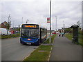
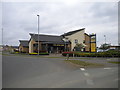
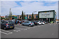
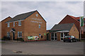
Your daily lifestyle in PE2 8XP is supported by a practical immediate range of amenities. Retail options are well covered with five notable shops within reach, including Morrisons Stanground, Tesco Stanground, and Aldi Stanground. These supermarkets provide full grocery needs without requiring a long drive into the town centre. For rail transport, you are close to Peterborough Railway Station and Whittlesea Railway Station, facilitating easy travel to a wider region. Three metro-style stations serve the area, including Peterborough, Orton Mere, and Ferry Meadows, offering broad connectivity options. The proximity to Peterborough Business Airport adds a layer of convenience for frequent flyers or those in relevant industries. While the postcode itself is small, the reach of these services makes the location highly accessible. You can shop for essentials, travel by train, or catch a flight without leaving the immediate vicinity of Stanground. This blend of local retail and regional transport nodes creates a convenient economic hub for residents. The lifestyle here is practical, efficient, and tightly integrated with the wider county network.
Amenities
Schools
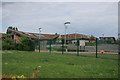
Families living in PE2 8XP have access to specific primary education options nearby. Saint Michael CofE Primary School (Voluntary Aided) operates as a key local institution for early education in the vicinity. Another option is Saint Michael CofE Primary School, which provides similar primary education services for children in the catchment. Both institutions are of the Church of England tradition, offering a consistent religious and educational philosophy. The presence of two primary schools indicates a dedicated educational infrastructure for local children. There are no secondary schools listed immediately adjacent to this specific postcode, suggesting residents may travel to larger town centres for older children. For those prioritising early years education, these named schools offer a recognised foundation. The availability of Voluntary Aided status implies a combination of church governance and maintained school funding, which can influence the approach to curriculum and values within the classroom. Families must research catchment boundaries carefully, as these primary schools serve defined zones. The focus on primary education highlights the importance of the early years in the local lifestyle.
| Rank | School | Type | Entry gender | Ages |
|---|
Explore more schools in this area
Go to Schools tabDemographics
The community in PE2 8XP is distinctly dominated by long-term residents who have chosen to settle down. Home ownership stands at an impressive 84 percent, indicating that most people live in these homes for many years. This high level of stability is typical of an established area where families build roots over time. The predominant accommodation type consists of houses, which aligns with the need for space and the preference for ownership. While the median age of the population sits at 22, the most common age range for residents is actually adults between 30 and 64 years. This suggests that while young people may reside here, the demographic heart is composed of established families and individuals. The area is predominantly White, reflecting a traditional demographic makeup common in many parts of England. Such a community profile supports a quiet, consistent atmosphere where residents know one another well. The fact that most households own their property points to a market where investment and security are paramount. You are looking at an area where the social fabric is woven from decades of occupation rather than transient living.
Household Size
Accommodation Type
Tenure
Ethnic Group
Religion
Household Composition
Age
Household Deprivation
NS-SEC
Explore more demographic insights in this area
Go to Demographics tabPlanning
Planning Constraints
- Flood RiskPremium
- Ramsar Wetland SitesPremium
- Area of Outstanding Natural BeautyPremium
- Protected Nature ReservePremium
- Protected WoodlandPremium