Area Overview for PE2 8UR
Photos of PE2 8UR
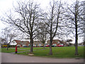
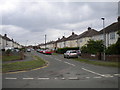
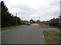
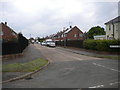
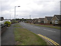
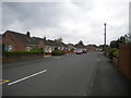
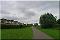

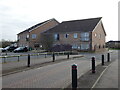
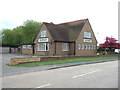
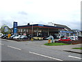
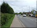
15 photos from this area
Area Information
Key information about the PE2 8UR including its size, population, and administrative classification.
- Area Type
- Postcode
- Area Size
- 3.3 hectares
- Population
- 1513
- Population Density
- 1596 people/km²
House Prices in PE2 8UR
70
Properties
£178,476
Average Sold Price
£67,995
Lowest Price
£390,000
Highest Price
Showing 70 properties
| Address | Type | Beds | Baths | Last Sale Price | Last Sale Date | |
|---|---|---|---|---|---|---|
| 1 Houghton Avenue, Park Farm, Peterborough, PE2 8UR | Detached | 4 | 2 | £365,000 | Jan 2025 | |
| 23 Houghton Avenue, Park Farm, Peterborough, PE2 8UR | Detached | 3 | 1 | £270,000 | Dec 2024 | |
| 61 Houghton Avenue, Park Farm, Peterborough, PE2 8UR | Detached | 4 | 1 | £310,000 | Nov 2024 | |
| 9 Houghton Avenue, Park Farm, Peterborough, PE2 8UR | Detached | 4 | 2 | £340,000 | Jul 2024 | |
| 31 Houghton Avenue, Park Farm, Peterborough, PE2 8UR | Detached | 4 | 2 | £390,000 | Nov 2023 | |
| 11 Houghton Avenue, Park Farm, Peterborough, PE2 8UR | Detached | 4 | 2 | £373,000 | Apr 2023 | |
| 46 Houghton Avenue, Park Farm, Peterborough, PE2 8UR | Detached | 4 | 3 | £380,000 | Feb 2023 | |
| 34 Houghton Avenue, Park Farm, Peterborough, PE2 8UR | Retail | 4 | 1 | £343,000 | Nov 2022 | |
| 40 Houghton Avenue, Park Farm, Peterborough, PE2 8UR | Detached | 3 | - | £265,000 | Nov 2022 | |
| 58 Houghton Avenue, Park Farm, Peterborough, PE2 8UR | Retail | 4 | 2 | £352,000 | May 2022 |
Page 1 of 7
Energy Efficiency in PE2 8UR
Amenities
Schools
| Rank | School | Type | Entry gender | Ages |
|---|
Explore more schools in this area
Go to Schools tabDemographics
Household Size
Two person
most common
Accommodation Type
Houses
most common
Tenure
79
majority
Ethnic Group
White
most common
Religion
N/A
most common
Household Composition
N/A
most common
Age
47
median
Adults (30-64 years)
most common
Household Deprivation
N/A
with no deprivation
NS-SEC
32
in Lower managerial occupations
Explore more demographic insights in this area
Go to Demographics tabPlanning
Planning Constraints
- Flood RiskPremium
- Ramsar Wetland SitesPremium
- Area of Outstanding Natural BeautyPremium
- Protected Nature ReservePremium
- Protected WoodlandPremium