Area Overview for PE2 8GP
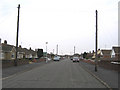
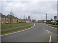
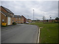
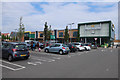
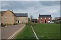
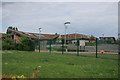
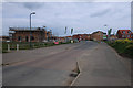
Photos of PE2 8GP
Area Information
Living in PE2 8GP offers a distinct experience due to its unique scale and location. This postcode covers a specific residential cluster spanning just 5.2 hectares. Within this compact footprint, approximately 1,541 people call the neighbourhood home. The area presents a concentrated living environment where local facilities are within easy reach of every resident. You will find accommodation primarily consisting of houses rather than flats or apartments. The community reflects a majority white population with a median age of 22. This youngmedian demographic suggests a dynamic local scene where families and young professionals often mix. House ownership stands at 57%, indicating that a significant portion of residents secure their own doors rather than renting long-term. The high population density of 29,749 people per square kilometre creates a sense of lively neighbourhood without the sprawl of larger towns. Daily life here revolves around immediate communities and accessible transport links. You can rely on strong digital connectivity to support remote working or leisure activities. The area serves as a practical base for accessing wider regional amenities through rail and road networks. This small residential pocket offers a focused lifestyle embedded within the broader Peterborough region.
- Area Type
- Postcode
- Area Size
- 5.2 hectares
- Population
- 1541
- Population Density
- 3166 people/km²
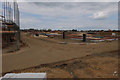
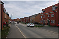
The property market in PE2 8GP is defined by a strong preference for traditional housing stock. Houses constitute the primary accommodation type, offering families and individuals standard residential living spaces. Approximately 57% of residents own their homes, creating a robust owner-occupied sector rather than a rental-heavy zone. This majority ownership typically implies established relationships between neighbours and a desire for long-term stability. Buyers looking at homes in this postcode should expect mostly detached or semi-detached structures suitable for typical family needs. The small geographical size of this cluster means housing stock is limited and competition can be sharp for available properties. With a population of 1,541 residents confined to 5.2 hectares, the Hounges are tightly packed compared to rural villas. The high population density of nearly 30,000 people per square kilometre further signals efficient use of existing housing. Given the 57% ownership rate, new buyers often face competition from existing homeowners seeking to upgrade. Those considering purchasing homes in PE2 8GP will find a market characterised by local ownership rather than transient tenancy. This structure supports a community where property values and maintenance standards tend to remain consistent over time.
House Prices in PE2 8GP
Showing 2 properties
| Address | Type | Beds | Baths | Last Sale Price | Last Sale Date | |
|---|---|---|---|---|---|---|
| Flat At The Applecart, Bellona Drive, Stanground South, Peterborough, PE2 8GP | Terraced | 3 | - | - | - | |
| Inpost Electronic Delivery Lockers, Bellona Drive, Stanground South, Peterborough, PE2 8GP | Retail | - | - | - | - |
Energy Efficiency in PE2 8GP
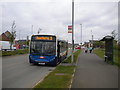
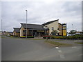
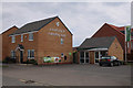
Your daily life in PE2 8GP revolves around accessible retail and transport hubs within practical reach. Three supermarkets serve local shopping needs, including Morrisons Stanground, Tesco Stanground, and Aldi Stanground. These venues provide everything from groceries to household essentials without requiring long commutes. Retail infrastructure supports a self-sufficient lifestyle where most daily purchases are local. Transport links extend your range across the region through major stations near Peterborough, Orton Mere, and Ferry Meadows. You can reach Peterborough Railway Station and Whittlesea Railway Station for wider travel connections. The Peterborough Business Airport sits nearby, offering unique access for business purposes. This mix of retail convenience and transport infrastructure creates a balanced environment for working parents or commuters. You do not need to travel far for your weekly food shop or your morning coffee break. The presence of key retailers and transit points ensures that living in PE2 8GP remains practical and convenient. Amenities are positioned to minimise travel time while maximising your choice of shopping options.
Amenities
Schools
| Rank | School | Type | Entry gender | Ages |
|---|
Explore more schools in this area
Go to Schools tabDemographics
The community in PE2 8GP reflects a young and established population structure. The median age sits at 22 years, placing the neighbourhood well below the national average. Most residents fall into the adult bracket between 30 and 64 years, suggesting many households are established rather than transient students. Home ownership rates reach 57%, meaning a clear majority of locals secure their properties outright or via mortgage. The remaining residents rent, contributing to a balanced but mixed market. Houses form the predominant accommodation type, with very few flats or bungalows recorded in this postcode. The area maintains a predominantly white ethnic composition, reflecting its long-standing local character. Avoidance of vague generalisations highlights that this is a specific residential zone with defined demographics. These figures indicate a relatively stable community where long-term residents coexist with younger families entering the market. Safety scores suggest standard precautions are necessary due to medium crime levels. The combination of high ownership and young age points to a neighbourhood where residents often build lasting ties with their neighbours. This profile appeals to buyers seeking a settled, owner-occupied environment with a youthful energy.
Household Size
Accommodation Type
Tenure
Ethnic Group
Religion
Household Composition
Age
Household Deprivation
NS-SEC
Explore more demographic insights in this area
Go to Demographics tabPlanning
Planning Constraints
- Flood RiskPremium
- Ramsar Wetland SitesPremium
- Area of Outstanding Natural BeautyPremium
- Protected Nature ReservePremium
- Protected WoodlandPremium