Area Overview for PE2 8BT
Photos of PE2 8BT
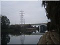
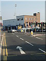
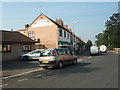
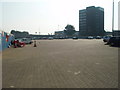

100 photos from this area
Area Information
Key information about the PE2 8BT including its size, population, and administrative classification.
- Area Type
- Postcode
- Area Size
- 5184 m²
- Population
- 1636
- Population Density
- 4475 people/km²
House Prices in PE2 8BT
11
Properties
£203,125
Average Sold Price
£40,500
Lowest Price
£300,000
Highest Price
Showing 11 properties
| Address | Type | Beds | Baths | Last Sale Price | Last Sale Date | |
|---|---|---|---|---|---|---|
| 120 Fletton Avenue, Fletton, Peterborough, PE2 8BT | Semi-detached | 4 | 1 | £300,000 | Oct 2022 | |
| 112 Fletton Avenue, Fletton, Peterborough, PE2 8BT | house | - | - | £290,000 | Apr 2022 | |
| 128 Fletton Avenue, Fletton, Peterborough, PE2 8BT | house | 3 | 1 | £229,000 | Jul 2020 | |
| 108 Fletton Avenue, Fletton, Peterborough, PE2 8BT | Semi-detached | 3 | 1 | £220,000 | Jun 2020 | |
| 116 Fletton Avenue, Fletton, Peterborough, PE2 8BT | Semi-detached | 3 | 2 | £175,000 | Apr 2017 | |
| 122 Fletton Avenue, Fletton, Peterborough, PE2 8BT | Semi-detached | 4 | 1 | £212,500 | Feb 2017 | |
| 124 Fletton Avenue, Fletton, Peterborough, PE2 8BT | Terraced | 4 | - | £158,000 | Jul 2014 | |
| 126 Fletton Avenue, Fletton, Peterborough, PE2 8BT | Terraced | - | - | £40,500 | Apr 1996 | |
| 114 Fletton Avenue, Fletton, Peterborough, PE2 8BT | house | - | - | - | - | |
| 110 Fletton Avenue, Fletton, Peterborough, PE2 8BT | house | - | - | - | - |
Page 1 of 2
Energy Efficiency in PE2 8BT
Amenities
Schools
| Rank | School | Type | Entry gender | Ages |
|---|
Explore more schools in this area
Go to Schools tabDemographics
Household Size
Family (3-5 people)
most common
Accommodation Type
Houses
most common
Tenure
54
majority
Ethnic Group
White
most common
Religion
N/A
most common
Household Composition
N/A
most common
Age
47
median
Adults (30-64 years)
most common
Household Deprivation
N/A
with no deprivation
NS-SEC
28
in Lower managerial occupations
Explore more demographic insights in this area
Go to Demographics tabPlanning
Planning Constraints
- Flood RiskPremium
- Ramsar Wetland SitesPremium
- Area of Outstanding Natural BeautyPremium
- Protected Nature ReservePremium
- Protected WoodlandPremium