Area Overview for PE19 6UF
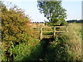
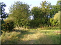
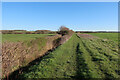
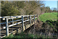
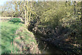
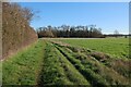
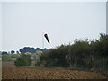
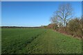
Photos of PE19 6UF
Area Information
Living in PE19 6UF defines a distinctly quiet residential experience centred on a compact cluster of homes. This specific postcode covers just 42.7 hectares, creating an intimate environment where neighbours are naturally close. You will find a small community of 1,685 people spread across the area, resulting in a low density of 48 people per square kilometre. This scale ensures a peaceful atmosphere without the congestion of larger urban settlements. The locality sits within the broader PE19 postcode district, maintaining a rural feel while keeping essential services within practical reach. Daily life here is characterised by space and tranquility, ideal for those seeking a slower pace away from city centres. The layout supports a calm existence where the immediate surroundings offer a clear view over fields or gardens rather than city skylines. Families and individuals value this sense of open space, making it a popular choice for commuters who prefer a low-density setting. You do not face the crowds or noise typical of denser metropolitan zones. Instead, you enjoy the benefits of a tightly knit neighbourhood where the built environment remains modest and uncluttered. This balance of space and community connection makes PE19 6UF a practical choice for residents who prioritise air and distance between properties.
- Area Type
- Postcode
- Area Size
- 42.7 hectares
- Population
- 1685
- Population Density
- 48 people/km²
The property market in PE19 6UF is dominated by owner-occupiers, distinguishing it sharply from rental-heavy town centres or student hubs. With 84% of residents owning their homes, the area functions primarily as a location for people buying to live and stay, rather than investors seeking short-term lets. This high ownership rate correlates directly with the fact that all accommodation consists of houses. You will not encounter flats or shared housing options in this specific postcode. The housing stock is therefore built for families and individuals seeking privacy and space. This dynamic creates a stable market where families move based on life changes, such as raising children or retiring, rather than job rotations alone. The 42.7 hectares of land accommodate these homes with ample space, ensuring no overcrowding among properties. Buyers looking at houses here should expect a scene defined by permanence and stability. The low density of 48 people per square kilometre means properties have generous boundaries and likely significant outdoor areas. This makes the area attractive for those who value garden space and silence. While the total population is small at 1,685, the concentration of owners ensures a consistent demand for maintained, single-family dwellings. You are buying into a community where the majority have a vested interest in property values and neighbourhood upkeep.
House Prices in PE19 6UF
Showing 13 properties
| Address | Type | Beds | Baths | Last Sale Price | Last Sale Date | |
|---|---|---|---|---|---|---|
| 14 Harbins Lane, Abbotsley, PE19 6UF | Terraced | 3 | 1 | £412,000 | Jul 2022 | |
| 5 Harbins Lane, Abbotsley, PE19 6UF | Detached | - | - | £474,500 | Mar 2016 | |
| 10 Harbins Lane, Abbotsley, PE19 6UF | Terraced | - | - | £249,500 | Sep 2007 | |
| 12 Harbins Lane, Abbotsley, PE19 6UF | Terraced | - | - | £115,500 | Feb 2000 | |
| 3 Harbins Lane, Abbotsley, PE19 6UF | Detached | - | - | £160,000 | Feb 1997 | |
| 2 Harbins Lane, Abbotsley, PE19 6UF | Detached | 2 | 2 | - | - | |
| Harper House, 9 Harbins Lane, Abbotsley, PE19 6UF | Detached | 2 | 1 | - | - | |
| Agricultural Building, Harbins Farm, Harbins Lane, Abbotsley, PE19 6UF | Farm | - | - | - | - | |
| 16 Harbins Lane, Abbotsley, PE19 6UF | Detached | 4 | 2 | - | - | |
| 11 Harbins Lane, Abbotsley, PE19 6UF | Detached | - | - | - | - |
Energy Efficiency in PE19 6UF
Your lifestyle in PE19 6UF revolves around convenience and local amenities that are within easy reach. Retail options are well represented by five notable shops, including Morrisons Daily St., Tesco St Neots, and Spar. These supermarkets ensure you can purchase groceries and daily essentials without travelling far. For rail services, St Neots Railway Station and Sandy Railway Station are your primary links to the wider network. These stations offer scheduled connections that integrate smoothly into your weekly routine. You do not need long commutes to access shops or train tickets, as these facilities are situated nearby. This proximity means errands take minutes rather than hours. The area supports a self-sufficient daily life where basic needs are met locally. You enjoy the quiet of a 48 people per square kilometre environment while having major supermarkets and stations close at hand. This mix of rural calm and accessible infrastructure defines the living experience. You can prepare fresh meals at home using supplies from Morrisons or Spar, then commute via train when necessary. The lifestyle is practical, efficient, and free from unnecessary travel time. Services are curated for the residents of this specific postcode, ensuring you never feel isolated from the wider world.
Amenities
Schools
Families with children in PE19 6UF have access to high-quality local education, anchored by a single nearby institution. Barnabas Oley CofE Primary School stands out as the nearest educational provider for the area. This primary school holds an outstanding Ofsted rating, a top-tier designation that signals exceptional standards in teaching and student care. Living in PE19 6UF means your children are close to a school with proven success in its educational outcomes. As this is the only school listed for the immediate vicinity, there is no mix of primary and secondary options within walking distance. Parents must consider transportation for older students, as the data does not list secondary schools near the postcode. However, the presence of an outstanding-rated primary school provides a strong foundation for early education. You can rely on a school that meets the highest government standards. The distance remains practical, fitting easily into daily routines for families. This educational asset adds significant value to the residential appeal of the location. You do not need to commute far to secure a top-tier primary education for your children. The school environment supports the stable, family-oriented nature of the 84% home ownership rate in the area.
| Rank | School | Type | Entry gender | Ages |
|---|
Explore more schools in this area
Go to Schools tabDemographics
The community in PE19 6UF reflects a mature demographic with a stable social fabric. The median age stands at 47 years, meaning the population skews significantly towards older adults rather than young singles or families with young children. Adults aged between 30 and 64 years constitute the most common age range, suggesting a neighbourhood filled with established households and empty-nesters. This age profile indicates a shift away from new families constantly moving in and out, creating a settled population. Home ownership is exceptionally high at 84%, which points to deep local roots and long-term residency. Very few residents rent their properties, reinforcing the idea that this is an area for those who have chosen to put down permanent roots. All accommodation in this zone takes the form of houses; you will not find any apartments or high-rise flats. The predominant ethnic group is White, aligning with the broader regional trends of the surrounding countryside. Deprivation levels are low, supported by the high ownership rate and stable age profile. This translates to a quality of life where residents benefit from lower community stress and resource abundance. You live among people who have chosen to stay, fostering a dependable social network within the 1,685 residents.
Household Size
Accommodation Type
Tenure
Ethnic Group
Religion
Household Composition
Age
Household Deprivation
NS-SEC
Explore more demographic insights in this area
Go to Demographics tabPlanning
Planning Constraints
- Flood RiskPremium
- Ramsar Wetland SitesPremium
- Area of Outstanding Natural BeautyPremium
- Protected Nature ReservePremium
- Protected WoodlandPremium