Area Overview for PE19 6SX
Photos of PE19 6SX
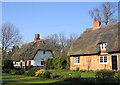
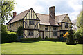
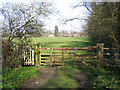
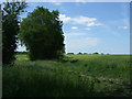
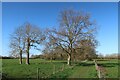
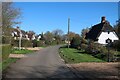
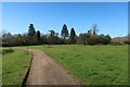
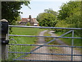
21 photos from this area
Area Information
Key information about the PE19 6SX including its size, population, and administrative classification.
- Area Type
- Postcode
- Area Size
- 53.7 hectares
- Population
- 1504
- Population Density
- 72 people/km²
House Prices in PE19 6SX
34
Properties
£660,385
Average Sold Price
£305,000
Lowest Price
£1,400,000
Highest Price
Showing 34 properties
| Address | Type | Beds | Baths | Last Sale Price | Last Sale Date | |
|---|---|---|---|---|---|---|
| 13A High Street, Croxton, PE19 6SX | Detached | 4 | 2 | £960,000 | Feb 2025 | |
| 12 High Street, Croxton, PE19 6SX | Cottage | 4 | 3 | £720,000 | Jul 2024 | |
| 4 High Street, Croxton, PE19 6SX | Semi-detached | 5 | 3 | £975,000 | Nov 2022 | |
| 29 High Street, Croxton, PE19 6SX | Retail | 2 | 3 | £620,000 | Sep 2022 | |
| 31 High Street, Croxton, PE19 6SX | Detached | - | - | £305,000 | Jan 2021 | |
| 26 High Street, Croxton, PE19 6SX | Detached | 4 | 2 | £600,000 | Feb 2018 | |
| 11 High Street, Croxton, PE19 6SX | Detached | 5 | 2 | £550,000 | Nov 2015 | |
| 20 High Street, Croxton, PE19 6SX | house | 3 | 1 | £315,000 | May 2015 | |
| 28 High Street, Croxton, PE19 6SX | Detached | 4 | - | £705,000 | Jan 2015 | |
| 13 High Street, Croxton, PE19 6SX | Detached | 3 | 3 | £457,500 | Jan 2010 |
Page 1 of 4
Energy Efficiency in PE19 6SX
Amenities
Schools
| Rank | School | Type | Entry gender | Ages |
|---|
Explore more schools in this area
Go to Schools tabDemographics
Household Size
Family (3-5 people)
most common
Accommodation Type
Houses
most common
Tenure
72
majority
Ethnic Group
White
most common
Religion
N/A
most common
Household Composition
N/A
most common
Age
47
median
Adults (30-64 years)
most common
Household Deprivation
N/A
with no deprivation
NS-SEC
49
in Lower managerial occupations
Explore more demographic insights in this area
Go to Demographics tabPlanning
Planning Constraints
- Flood RiskPremium
- Ramsar Wetland SitesPremium
- Area of Outstanding Natural BeautyPremium
- Protected Nature ReservePremium
- Protected WoodlandPremium