Area Overview for PE19 6RF
Photos of PE19 6RF
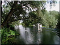
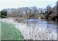
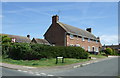
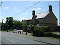
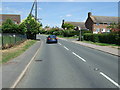
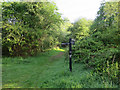
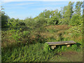
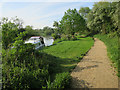
30 photos from this area
Area Information
Key information about the PE19 6RF including its size, population, and administrative classification.
- Area Type
- Postcode
- Area Size
- 10.1 hectares
- Population
- 1733
- Population Density
- 96 people/km²
House Prices in PE19 6RF
56
Properties
£341,544
Average Sold Price
£141,500
Lowest Price
£810,000
Highest Price
Showing 56 properties
| Address | Type | Beds | Baths | Last Sale Price | Last Sale Date | |
|---|---|---|---|---|---|---|
| 42 High Street, Great Paxton, PE19 6RF | Detached | 2 | 2 | £330,000 | Dec 2025 | |
| 59 High Street, Great Paxton, PE19 6RF | Detached | 6 | 5 | £810,000 | Mar 2025 | |
| 20 High Street, Great Paxton, PE19 6RF | house | 3 | 2 | £480,000 | Sep 2024 | |
| 34 High Street, Great Paxton, PE19 6RF | Terraced | 2 | 1 | £284,200 | Jun 2023 | |
| 7 High Street, Great Paxton, PE19 6RF | Terraced | 3 | 1 | £345,000 | Dec 2022 | |
| 61 High Street, Great Paxton, PE19 6RF | house | 4 | - | £490,000 | Jan 2022 | |
| 31 High Street, Great Paxton, PE19 6RF | Cottage | 3 | 1 | £450,000 | Sep 2021 | |
| 73 High Street, Great Paxton, PE19 6RF | Detached | 5 | - | £550,000 | Aug 2021 | |
| 78 High Street, Great Paxton, PE19 6RF | Semi-detached | 3 | 1 | £250,000 | May 2021 | |
| 1 High Street, Great Paxton, PE19 6RF | Terraced | 4 | 2 | £350,000 | Feb 2021 |
Page 1 of 6
Energy Efficiency in PE19 6RF
Amenities
Schools
| Rank | School | Type | Entry gender | Ages |
|---|
Explore more schools in this area
Go to Schools tabDemographics
Household Size
Family (3-5 people)
most common
Accommodation Type
Houses
most common
Tenure
83
majority
Ethnic Group
White
most common
Religion
N/A
most common
Household Composition
N/A
most common
Age
47
median
Adults (30-64 years)
most common
Household Deprivation
N/A
with no deprivation
NS-SEC
52
in Lower managerial occupations
Explore more demographic insights in this area
Go to Demographics tabPlanning
Planning Constraints
- Flood RiskPremium
- Ramsar Wetland SitesPremium
- Area of Outstanding Natural BeautyPremium
- Protected Nature ReservePremium
- Protected WoodlandPremium