Area Overview for PE19 5EG
Photos of PE19 5EG
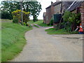
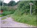
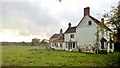
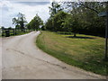
7 photos from this area
Area Information
Key information about the PE19 5EG including its size, population, and administrative classification.
- Area Type
- Postcode
- Area Size
- 53.1 hectares
- Population
- 1722
- Population Density
- 53 people/km²
House Prices in PE19 5EG
47
Properties
£572,594
Average Sold Price
£180,000
Lowest Price
£1,500,000
Highest Price
Showing 47 properties
| Address | Type | Beds | Baths | Last Sale Price | Last Sale Date | |
|---|---|---|---|---|---|---|
| 42 Hatchet Lane, Stonely, PE19 5EG | house | - | - | £596,500 | Feb 2025 | |
| Stonely Hall Cottage, 20 Hatchet Lane, Stonely, PE19 5EG | Detached | 3 | 2 | £455,000 | Mar 2024 | |
| 6A Hatchet Lane, Stonely, PE19 5EG | Detached | 3 | - | £760,000 | Sep 2021 | |
| 34 Hatchet Lane, Stonely, PE19 5EG | Detached | 5 | 3 | £950,000 | Jun 2021 | |
| 25 Hatchet Lane, Stonely, PE19 5EG | house | - | - | £365,000 | Jun 2021 | |
| 23 Hatchet Lane, Stonely, PE19 5EG | house | - | - | £520,000 | Feb 2021 | |
| 2A Hatchet Lane, Stonely, PE19 5EG | house | - | - | £800,000 | Dec 2018 | |
| 5 Hatchet Lane, Stonely, PE19 5EG | Bungalow | 5 | 6 | £1,275,000 | Apr 2018 | |
| 45 Hatchet Lane, Stonely, PE19 5EG | Detached | 5 | - | £840,000 | Nov 2016 | |
| 31 Hatchet Lane, Stonely, PE19 5EG | house | - | - | £675,000 | Nov 2015 |
Page 1 of 5
Energy Efficiency in PE19 5EG
Amenities
Schools
| Rank | School | Type | Entry gender | Ages |
|---|
Explore more schools in this area
Go to Schools tabDemographics
Household Size
Two person
most common
Accommodation Type
Houses
most common
Tenure
77
majority
Ethnic Group
White
most common
Religion
N/A
most common
Household Composition
N/A
most common
Age
47
median
Adults (30-64 years)
most common
Household Deprivation
N/A
with no deprivation
NS-SEC
48
in Lower managerial occupations
Explore more demographic insights in this area
Go to Demographics tabPlanning
Planning Constraints
- Flood RiskPremium
- Ramsar Wetland SitesPremium
- Area of Outstanding Natural BeautyPremium
- Protected Nature ReservePremium
- Protected WoodlandPremium