Area Overview for PE19 4PQ
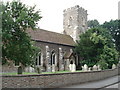
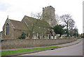
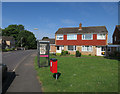
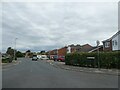
Photos of PE19 4PQ


Area Information
PE19 4PQ is a specific postcode area covering a small residential cluster in England. With a population of 2,471, this location offers a compact living environment. The area features a population density of 844 people per square kilometre, which indicates a moderately contained settlement without the sprawl of larger urban zones. Residents here enjoy a straightforward daily life defined by proximity to essential services rather than extended commutes into city centres. The small scale of the postcodes suggests a neighbourhood where travel distances to key amenities are managed easily. You can expect a community where local routes connect directly to major shopping and transport hubs. This setting avoids the congestion often found in denser urban districts. The layout supports a lifestyle focused on practical access to nearby towns while maintaining a distinct residential character. Living in PE19 4PQ means choosing an area where the scale of the settlement matches a desire for a quieter, more controlled environment. The community is centred around this specific cluster, making it easy to navigate the immediate surroundings.
- Area Type
- Postcode
- Area Size
- Not available
- Population
- 2471
- Population Density
- 844 people/km²
The property market in PE19 4PQ is defined by high owner occupation and traditional housing stock. With 72% of residents owning their homes, the area is firmly established as a private purchase market. You will find that rental accommodation represents a minority of the housing supply here. The predominant accommodation type consists of Houses, meaning buyers will primarily examine detached or semi-detached properties rather than flats or maisonettes. This stock configuration is typical for established suburban clusters in the region. A prospective homebuyer should understand that this is not a market driven by new-build conversions or urban centre apartments. The high ownership percentage indicates that most transactions involve trades between existing owners rather than landlords allocating units. This environment suits buyers seeking a permanent residence with established tenure. The housing mix reflects the demographic reality where adults in their 30s and 40s have settled down to live in house-style accommodation close to their workplaces and schools.
House Prices in PE19 4PQ
No properties found in this postcode.
Energy Efficiency in PE19 4PQ
Residents of PE19 4PQ benefit from a range of amenities located within practical reach. For daily shopping needs, you can access five notable retail outlets including Co-op Little, Tesco St Neots, and M&S St Neots SF. These stores provide comprehensive coverage for groceries, general household items, and fashion requirements. The area also features strong rail connectivity with one major station at St Neots Railway Station. This station offers direct rail access for commuters travelling further afield. The combination of local supermarkets and a mainline railway station creates a convenient lifestyle hub. You will not need to travel far to complete standard errands or plan weekend trips. Shopping trips can be easily managed locally, while rail travel provides the option to extend leisure time to distant destinations. This mix of retail convenience and transport links defines the practical lifestyle for those choosing this postcode.
Amenities
Schools
Families looking at PE19 4PQ have access to specific educational institutions within their immediate vicinity. Little Paxton Primary School serves as the designated primary education option nearby. The school holds an Ofsted rating of Good, which provides a clear measure of educational quality for parents. As a primary facility, it caters to children from the earliest years of their schooling until they reach secondary age. The presence of a single named primary school suggests that the local catchment is dedicated to this institution. There are no secondary schools or further education colleges listed in the immediate data for this postcode. This means that older children will likely need to travel to other settlements for secondary education. For families moving into PE19 4PQ, the proximity to Little Paxton Primary School is the primary educational advantage. The Good rating assures residents that children will receive a standard of education recognised by the state inspection framework.
| Rank | School | Type | Entry gender | Ages |
|---|
Explore more schools in this area
Go to Schools tabDemographics
The demographic profile of PE19 4PQ reveals a stable community dominated by adults. The most common age range for residents falls between 30 and 64 years. This indicates a workforce-oriented population with family units and established households. The median age is 47 years, which further confirms that the neighbourhood appeals to those beyond the prime property buying years of younger adulthood. Home ownership stands at 72%, demonstrating that the majority of people living here have purchased their properties. This high rate suggests a settled population who view the area as a long-term home base rather than a transient rental market. The predominant ethnic group within the postcode is White, reflecting the broader regional composition of this part of England. Accommodation in PE19 4PQ consists primarily of Houses, aligning with the preference for detached or semi-detached properties over apartments. The combination of a median age of 47 and a high home ownership rate paints a picture of economic stability within the local cluster.
Household Size
Accommodation Type
Tenure
Ethnic Group
Religion
Household Composition
Age
Household Deprivation
NS-SEC
Explore more demographic insights in this area
Go to Demographics tabPlanning
Planning Constraints
- Flood RiskPremium
- Ramsar Wetland SitesPremium
- Area of Outstanding Natural BeautyPremium
- Protected Nature ReservePremium
- Protected WoodlandPremium