Area Overview for PE19 1SG
Photos of PE19 1SG
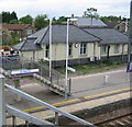
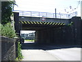
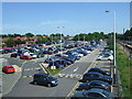

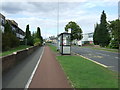
84 photos from this area
Area Information
Key information about the PE19 1SG including its size, population, and administrative classification.
- Area Type
- Postcode
- Area Size
- 1.0 hectares
- Population
- 1424
- Population Density
- 2763 people/km²
House Prices in PE19 1SG
26
Properties
£204,250
Average Sold Price
£49,000
Lowest Price
£375,000
Highest Price
Showing 26 properties
| Address | Type | Beds | Baths | Last Sale Price | Last Sale Date | |
|---|---|---|---|---|---|---|
| 11 Princes Drive, St Neots, PE19 1SG | Semi-detached | 3 | 1 | £375,000 | Jun 2022 | |
| 6 Princes Drive, St Neots, PE19 1SG | house | - | - | £319,500 | Sep 2021 | |
| 19 Princes Drive, St Neots, PE19 1SG | Semi-detached | 3 | 2 | £252,500 | Jun 2021 | |
| 25 Princes Drive, St Neots, PE19 1SG | Bungalow | - | - | £207,500 | Mar 2021 | |
| 14 Princes Drive, St Neots, PE19 1SG | house | - | - | £295,000 | Mar 2021 | |
| 18 Princes Drive, St Neots, PE19 1SG | Semi-detached | 4 | - | £325,000 | Jun 2018 | |
| 16 Princes Drive, St Neots, PE19 1SG | house | - | - | £229,000 | Jul 2015 | |
| 1 Princes Drive, St Neots, PE19 1SG | Semi-detached | 3 | 3 | £248,000 | Jul 2015 | |
| 15 Princes Drive, St Neots, PE19 1SG | Semi-detached | 3 | 1 | £230,000 | Jun 2015 | |
| 21 Princes Drive, St Neots, PE19 1SG | Bungalow | - | - | £210,000 | Jan 2012 |
Page 1 of 3
Energy Efficiency in PE19 1SG
Amenities
Schools
| Rank | School | Type | Entry gender | Ages |
|---|
Explore more schools in this area
Go to Schools tabDemographics
Household Size
Two person
most common
Accommodation Type
Houses
most common
Tenure
66
majority
Ethnic Group
White
most common
Religion
N/A
most common
Household Composition
N/A
most common
Age
47
median
Adults (30-64 years)
most common
Household Deprivation
N/A
with no deprivation
NS-SEC
33
in Lower managerial occupations
Explore more demographic insights in this area
Go to Demographics tabPlanning
Planning Constraints
- Flood RiskPremium
- Ramsar Wetland SitesPremium
- Area of Outstanding Natural BeautyPremium
- Protected Nature ReservePremium
- Protected WoodlandPremium