Area Overview for PE19 1QW
Photos of PE19 1QW


Area Information
This specific postcode, PE19 1QW, covers a tightly clustered residential zone spanning just 1.3 hectares. Within this confined footprint, approximately 1,397 people live and work, creating a neighbourhood defined by its compact scale and high population density of 105,898 people per square kilometre. Living in this area means experiencing a close-knit environment where households are situated in close proximity to one another. The community is firmly established in Cambridgeshire, operating as a distinct residential pocket rather than a sprawling development. Daily life here is shaped by these boundaries. Residents navigate a small urban or suburban setting where space is at a premium yet community interaction is likely frequent due to the concentration of homes. The area functions as a self-contained cluster, relying heavily on the immediate vicinity for daily needs. You will find yourself surrounded by neighbours rather than vast open fields or detached estates. This density suggests a lively local atmosphere where the immediate surroundings form the primary context for everyday living. Understanding the physical limits of this 1.3-hectare zone is essential when imagining your future life here, as the street layout and neighbourhood feel are dictated by these strict spatial parameters.
- Area Type
- Postcode
- Area Size
- 1.3 hectares
- Population
- 1397
- Population Density
- 4235 people/km²
The housing landscape in PE19 1QW is defined by a predominantly owner-occupied market. With 55% of properties owned by their occupants, the area functions more as a long-term home base than a transient rental zone. This high ownership percentage suggests that sellers in the neighbourhood are likely motivated by lifestyle changes or market movements rather than financial extraction from tenants. The accommodation type is exclusively houses, meaning you will encounter detached, semi-detached, or terraced family homes rather than flats or studio apartments. For buyers viewing homes in PE19 1QW, the stock is tailored to those seeking traditional domestic living. The absence of rental-focused housing indicates a stable community where properties are often inherited or passed down, reinforcing the sense of permanence. When appraising values, the small 1.3-hectare footprint implies that supply may be limited compared to larger neighbourhoods. This scarcity can influence pricing dynamics within the immediate cluster. You are looking at a market where sentiment and ownership history play a significant role. The houses here cater to families and individuals who value privacy and established credentials over the convenience of flat living. Understanding this ownership structure helps you gauge the likelihood of whole-sale sales versus transfers within the current household base.
House Prices in PE19 1QW
No properties found in this postcode.
Energy Efficiency in PE19 1QW
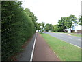
Daily life in PE19 1QW revolves around a compact network of practical amenities within easy reach. Residents benefit from five retail outlets, including Spar and Lidl St, ensuring access to essentials like groceries and household basics. These shops cater to immediate daily needs without requiring long journeys to larger commercial centres. Commuting is facilitated by one major railway hub, St Neots Railway Station, which provides regular passenger services to wider destinations. The combination of local shops and rail access creates a lifestyle centred on convenience and efficiency. You will find that routine errands such as collecting milk or picking up dinner are handled quickly with the Spar and Lidl St nearby. The proximity to the station means you can commute into regional hubs easily when necessary. There are no large leisure complexes or major parks listed in the immediate data, so your leisure time may involve walking routes or visiting nearby towns. This straightforward arrangement suits residents who prioritise practicality over extensive entertainment options. The high density of the area means neighbours and shops are rarely far apart, fostering a lifestyle where daily tasks are managed close to home.
Amenities
Schools
Families considering PE19 1QW have access to primary education options directly nearby. St Mary's CofE VA Primary School operates within the immediate catchment area, providing education for younger children in this village cluster. Nearby residents also utilise St Mary's Church of England Primary School St Neots, which holds an Ofsted rating of good. This rating confirms a standard of education that meets national expectations and offers reassurance regarding academic quality. The presence of two primary schools suggests a focus on early years education within the community. There are no secondary schools listed in the immediate data for this specific postcode, meaning older children likely commute to larger towns. This dual-primary setup indicates a strong local provision for infants and children up to age 11. For parents, the choice between the local CofE VA institution and the slightly larger St Neots campus offers a familiar starting point for their children's education. You can expect a curriculum delivered under recognised good standards, ensuring the foundational years are covered with support from experienced staff. These schools form the backbone of family life in this residential cluster.
| Rank | School | Type | Entry gender | Ages |
|---|
Explore more schools in this area
Go to Schools tabDemographics
The community in PE19 1QW reflects a largely mature demographic profile. The median age stands at 47, indicating a population dominated by adults between the ages of 30 and 64. This aligns with the finding that the most common age range falls squarely within these working and retirement-transition years. You are likely to meet residents who have established careers or are enjoying stable family life rather than the transient mix typical of student quarters. Home ownership characterises the area, with 55% of residents owning their homes outright. This majority ownership rate suggests financial stability and a vested long-term interest in the local estate. The accommodation type consists primarily of houses, distinguishing this cluster from high-rise apartments or scattered terraced units. While White residents form the predominant ethnic group, the demographic data paints a picture of a settled, conventional household structure. There is no indication of significant youth infilling or elderly care dominance. Instead, the area embodies a standard family-and-empty-nester community where property tenure and stability are the norm. This demographic mix supports a quiet, established neighbourhood vibe where locals tend to stay put and invest in their surroundings.
Household Size
Accommodation Type
Tenure
Ethnic Group
Religion
Household Composition
Age
Household Deprivation
NS-SEC
Explore more demographic insights in this area
Go to Demographics tabPlanning
Planning Constraints
- Flood RiskPremium
- Ramsar Wetland SitesPremium
- Area of Outstanding Natural BeautyPremium
- Protected Nature ReservePremium
- Protected WoodlandPremium