Area Overview for PE19 1ET
Photos of PE19 1ET


Area Information
Living in PE19 1ET places you within a compact residential cluster defined by a precise postcode footprint. This specific area covers an area size of 7193 square metres, making it a small, contained environment rather than a sprawling suburb. The population stands at 1565 residents, which creates an immediate sense of closeness among neighbours. Density here reaches 217564 people per square kilometre, a figure that highlights how tightly packed the housing stock is within these boundaries. You are not looking for a large village or urban sprawl; you are buying into a specific, manageable patch of the St Neots landscape. Daily life in PE19 1ET revolves around immediate proximity rather than long commutes to local facilities. The area functions as a distinct residential pocket where the built environment is dense and the community footprint is clearly defined. Prospective buyers should view this postcode as a specific slice of property market that demands physical closeness rather than architectural grandeur or expansive green spaces. The character of the area is formed by this high density and small total population, creating a neighbourhood that feels intimately known by its inhabitants.
- Area Type
- Postcode
- Area Size
- 7193 m²
- Population
- 1565
- Population Density
- 2764 people/km²
The property market in PE19 1ET is dominated by residential houses, with the accommodation type listed explicitly as Houses for this postcode. This classification distinguishes the area from urban centres where flats or apartments might dominate the skyline. With 69% of residents being home owners, the market is fundamentally skewed towards owner-occupied properties rather than a high rental yield zone. For a buyer seeking a standalone dwelling with private space, PE19 1ET offers a clear profile of traditional housing stock. The small total population of 1565 confines the pool of available sales to a very limited number of transactions at any given time. This scarcity means that every house listed for sale carries significant weight in determining local market trends. You are unlikely to find chains of multiple buyers flipping properties rapidly within this cluster. Instead, the market operates on the foundation of existing homeowners looking to downsize or move, or established owners seeking to trade up. The high density per square kilometre ensures that land values are significant, as the total area size of only 7193 square metres limits the total number of buildable plots available in this specific cluster.
House Prices in PE19 1ET
Showing 24 properties
| Address | Type | Beds | Baths | Last Sale Price | Last Sale Date | |
|---|---|---|---|---|---|---|
| 20 Leys Road, St Neots, PE19 1ET | house | - | - | £275,000 | May 2022 | |
| 2 Leys Road, St Neots, PE19 1ET | Terraced | 4 | 2 | £325,000 | Dec 2018 | |
| 12 Leys Road, St Neots, PE19 1ET | house | - | - | £230,000 | Jun 2018 | |
| 22 Leys Road, St Neots, PE19 1ET | Terraced | 3 | - | £150,000 | Jun 2013 | |
| 6 Leys Road, St Neots, PE19 1ET | house | - | - | £130,000 | Mar 2009 | |
| 24 Leys Road, St Neots, PE19 1ET | Terraced | - | - | £175,000 | Feb 2009 | |
| 8 Leys Road, St Neots, PE19 1ET | house | - | - | £170,000 | Nov 2006 | |
| 14 Leys Road, St Neots, PE19 1ET | Semi-detached | - | - | £110,000 | Jul 2006 | |
| 15 Leys Road, St Neots, PE19 1ET | Semi-detached | - | - | £173,000 | Dec 2005 | |
| 11 Leys Road, St Neots, PE19 1ET | Semi-detached | - | - | £147,500 | Nov 2003 |
Energy Efficiency in PE19 1ET
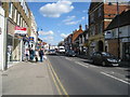
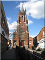
Your daily life in PE19 1ET is supported by a set of accessible amenities located within practical reach of the residential cluster. Retail options include M&S St Neots SF, Morrisons Daily St, and Waitrose St, providing a complete range from daily essentials to quality grocery shopping. With five notable retail venues listed in the immediate proximity, you will not need to travel far for essential household items or convenience. For travel needs, St Neots Railway Station serves as the key transport hub, facilitating connections to surrounding regions. The 7193 square metre footprint of the area means these amenities are likely a short drive or walk away, fitting easily into your daily routine. You will find that the local high street offers sufficient variety for a resident community of 1565 people. Dining and leisure options are implied by the presence of major supermarkets and a railway station, which often act as focal points for local gathering. The lifestyle here is defined by convenience and direct access to established national retail chains rather than niche local boutiques.
Amenities
Schools
For parents considering PE19 1ET, the most significant educational institution listed nearby is Riverside Meadows Academy. This venue operates as a special school, indicating that the local provision includes facilities for students with specific educational needs. There is no data provided in the section regarding other mainstream primary or secondary schools within the immediate vicinity of this postcode, so you must rely on this single named entity for local school information. The presence of a special academy suggests the area may cater to a specific demographic of students requiring tailored learning environments. When evaluating PE19 1ET for your children, you would need to look beyond this single data point to confirm options for standard state education. The mix of school types in this narrow data set points to a utilitarian approach to local infrastructure, where specific needs are met by dedicated facilities rather than a broad spectrum of schools. Families should verify the exact catchment areas for other institutions outside this specific list before making a final decision on schooling arrangements for PE19 1ET residents.
| Rank | School | Type | Entry gender | Ages |
|---|
Explore more schools in this area
Go to Schools tabDemographics
The community in PE19 1ET reflects a relatively mature household profile with a median age of 47 years. You will find that the most common age range consists of adults between 30 and 64 years, indicating a population established rather than family-focused or retirement centric. Home ownership stands at 69%, which means nearly seven out of ten residents own their property outright. This high ownership rate suggests stability and a lack of transient renting pressure within the immediate postcode. The predominant ethnic group is White, meaning the area maintains a traditional demographic composition. Regarding accommodation types, the section lists Houses as the primary form of dwelling, suggesting a departure from urban flats. You should expect a landscape defined by freehold or leasehold properties attached to land rather than block living. The demographic data paints a picture of a settled, adult community where property values and lifestyle choices likely align with long-term residency. This age structure means local events and community governance are likely controlled by middle-aged decision-makers who have deep roots in the St Neots region.
Household Size
Accommodation Type
Tenure
Ethnic Group
Religion
Household Composition
Age
Household Deprivation
NS-SEC
Explore more demographic insights in this area
Go to Demographics tabPlanning
Planning Constraints
- Flood RiskPremium
- Ramsar Wetland SitesPremium
- Area of Outstanding Natural BeautyPremium
- Protected Nature ReservePremium
- Protected WoodlandPremium