Area Overview for PE15 0YY
Photos of PE15 0YY
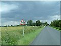
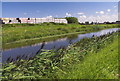
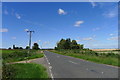
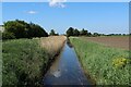
10 photos from this area
Area Information
Key information about the PE15 0YY including its size, population, and administrative classification.
- Area Type
- Postcode
- Area Size
- 72.4 hectares
- Population
- 2102
- Population Density
- 71 people/km²
House Prices in PE15 0YY
8
Properties
£205,000
Average Sold Price
£110,000
Lowest Price
£315,000
Highest Price
Showing 8 properties
| Address | Type | Beds | Baths | Last Sale Price | Last Sale Date | |
|---|---|---|---|---|---|---|
| Gaul Road Farm, Gaul Road, March, PE15 0YY | Detached | 4 | 1 | £190,000 | May 2006 | |
| York Lodge, Gaul Road, March, PE15 0YY | Bungalow | - | - | £315,000 | Nov 2004 | |
| Highfield, Gaul Road, March, PE15 0YY | Detached | 4 | 2 | £110,000 | Jul 1998 | |
| 6, Gaul Farm Industrial Units, Gaul Road, March, PE15 0YY | warehouse | - | - | - | - | |
| Graham Garage Ltd, 12, Gaul Farm Industrial Units, Gaul Road, March, PE15 0YY | Industrial | - | - | - | - | |
| Jack Ross & Craig Bowers, 13, Gaul Farm Industrial Units, Gaul Road, March, PE15 0YY | Industrial | - | - | - | - | |
| Specialised Bags Ltd, 14, Gaul Farm Industrial Units, Gaul Road, March, PE15 0YY | Industrial | - | - | - | - | |
| Rges International Ltd, 11, Gaul Farm Industrial Units, Gaul Road, March, PE15 0YY | general_industrial | - | - | - | - |
Energy Efficiency in PE15 0YY
Amenities
Schools
| Rank | School | Type | Entry gender | Ages |
|---|
Explore more schools in this area
Go to Schools tabDemographics
Household Size
Two person
most common
Accommodation Type
Houses
most common
Tenure
62
majority
Ethnic Group
White
most common
Religion
N/A
most common
Household Composition
N/A
most common
Age
47
median
Adults (30-64 years)
most common
Household Deprivation
N/A
with no deprivation
NS-SEC
22
in Lower managerial occupations
Explore more demographic insights in this area
Go to Demographics tabPlanning
Planning Constraints
- Flood RiskPremium
- Ramsar Wetland SitesPremium
- Area of Outstanding Natural BeautyPremium
- Protected Nature ReservePremium
- Protected WoodlandPremium