Area Overview for PE14 9PL
Photos of PE14 9PL
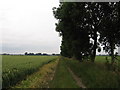

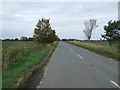
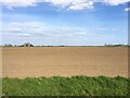
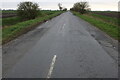
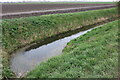
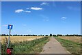
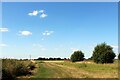
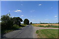
15 photos from this area
Area Information
Key information about the PE14 9PL including its size, population, and administrative classification.
- Area Type
- Postcode
- Area Size
- 92.9 hectares
- Population
- 1571
- Population Density
- 21 people/km²
House Prices in PE14 9PL
14
Properties
£345,800
Average Sold Price
£59,000
Lowest Price
£830,000
Highest Price
Showing 14 properties
| Address | Type | Beds | Baths | Last Sale Price | Last Sale Date | |
|---|---|---|---|---|---|---|
| Bracken House, Padgetts Road, Christchurch, PE14 9PL | Bungalow | 4 | 1 | £405,000 | Sep 2025 | |
| Aisling Acres, Padgetts Road, Christchurch, PE14 9PL | house | 3 | - | £475,000 | Aug 2023 | |
| Peartree Farm, Padgetts Road, Christchurch, PE14 9PL | Retail | 4 | 2 | £830,000 | May 2022 | |
| Holme Farm, Padgetts Road, Christchurch, PE14 9PL | house | - | - | £675,000 | Nov 2021 | |
| Annies Cottage, Padgetts Road, Christchurch, PE14 9PL | Bungalow | 2 | 1 | £265,000 | Jun 2017 | |
| Poplar House, Padgetts Road, Christchurch, PE14 9PL | Bungalow | 4 | 2 | £200,000 | Sep 2016 | |
| Peartree Cottage, Padgetts Road, Christchurch, PE14 9PL | Semi-detached | 3 | - | £164,000 | Aug 2015 | |
| The Ferns, Padgetts Road, Christchurch, PE14 9PL | Bungalow | 3 | - | £165,000 | Dec 2013 | |
| Home Acre, Padgetts Road, Christchurch, PE14 9PL | house | 5 | - | £220,000 | Jan 2012 | |
| Hackney Cottage, Padgetts Road, Christchurch, PE14 9PL | Detached | 2 | 1 | £59,000 | Jul 1998 |
Page 1 of 2
Energy Efficiency in PE14 9PL
Amenities
Schools
| Rank | School | Type | Entry gender | Ages |
|---|
Explore more schools in this area
Go to Schools tabDemographics
Household Size
Two person
most common
Accommodation Type
Houses
most common
Tenure
71
majority
Ethnic Group
White
most common
Religion
N/A
most common
Household Composition
N/A
most common
Age
47
median
Adults (30-64 years)
most common
Household Deprivation
N/A
with no deprivation
NS-SEC
25
in Lower managerial occupations
Explore more demographic insights in this area
Go to Demographics tabPlanning
Planning Constraints
- Flood RiskPremium
- Ramsar Wetland SitesPremium
- Area of Outstanding Natural BeautyPremium
- Protected Nature ReservePremium
- Protected WoodlandPremium