Area Overview for PE14 9JU
Photos of PE14 9JU
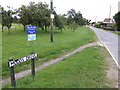
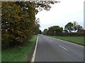
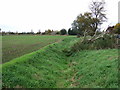
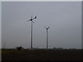
6 photos from this area
Area Information
Key information about the PE14 9JU including its size, population, and administrative classification.
- Area Type
- Postcode
- Area Size
- 1.2 km²
- Population
- 1976
- Population Density
- 45 people/km²
House Prices in PE14 9JU
15
Properties
£336,099
Average Sold Price
£109,995
Lowest Price
£560,000
Highest Price
Showing 15 properties
| Address | Type | Beds | Baths | Last Sale Price | Last Sale Date | |
|---|---|---|---|---|---|---|
| Russets, Mudds Drove, Three Holes, PE14 9JU | Detached | 4 | 1 | £560,000 | Dec 2020 | |
| Roses In The Wind, Mudds Drove, Three Holes, PE14 9JU | house | 2 | 1 | £238,000 | Jun 2018 | |
| Orchard View, Mudds Drove, Three Holes, PE14 9JU | Semi-detached | 2 | - | £109,995 | Apr 2014 | |
| The Mill, Mudds Drove, Three Holes, PE14 9JU | Flat | 2 | 1 | £215,000 | Mar 2008 | |
| Mudds Old Farm, Mudds Drove, Three Holes, PE14 9JU | house | - | - | £557,500 | Oct 2007 | |
| Walnut House, Mudds Drove, Three Holes, PE14 9JU | Detached | 4 | - | - | - | |
| 2, Mudds Cottages, Mudds Drove, Three Holes, PE14 9JU | Detached | - | - | - | - | |
| 1, Mudds Cottages, Mudds Drove, Three Holes, PE14 9JU | Detached | - | - | - | - | |
| Bramley House Cattery, Mudds Drove, Three Holes, PE14 9JU | commercial | - | - | - | - | |
| Dwelling, Mudds Drove, Three Holes, PE14 9JU | undefined | - | - | - | - |
Page 1 of 2
Energy Efficiency in PE14 9JU
Amenities
Schools
| Rank | School | Type | Entry gender | Ages |
|---|
Explore more schools in this area
Go to Schools tabDemographics
Household Size
Two person
most common
Accommodation Type
Houses
most common
Tenure
74
majority
Ethnic Group
White
most common
Religion
N/A
most common
Household Composition
N/A
most common
Age
47
median
Adults (30-64 years)
most common
Household Deprivation
N/A
with no deprivation
NS-SEC
25
in Lower managerial occupations
Explore more demographic insights in this area
Go to Demographics tabPlanning
Planning Constraints
- Flood RiskPremium
- Ramsar Wetland SitesPremium
- Area of Outstanding Natural BeautyPremium
- Protected Nature ReservePremium
- Protected WoodlandPremium