Area Overview for PE14 8PF
Photos of PE14 8PF
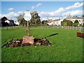
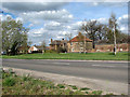
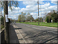
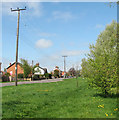
23 photos from this area
Area Information
Key information about the PE14 8PF including its size, population, and administrative classification.
- Area Type
- Postcode
- Area Size
- 7.3 hectares
- Population
- 1678
- Population Density
- 155 people/km²
House Prices in PE14 8PF
39
Properties
£195,594
Average Sold Price
£17,250
Lowest Price
£512,500
Highest Price
Showing 39 properties
| Address | Type | Beds | Baths | Last Sale Price | Last Sale Date | |
|---|---|---|---|---|---|---|
| 80 Wisbech Road, Outwell, PE14 8PF | Terraced | 3 | 1 | £130,000 | Jul 2020 | |
| 84 Wisbech Road, Outwell, PE14 8PF | Bungalow | 3 | - | £512,500 | Sep 2019 | |
| 138 Wisbech Road, Outwell, PE14 8PF | Bungalow | 2 | 1 | £130,000 | Apr 2018 | |
| 116 Wisbech Road, Outwell, PE14 8PF | Bungalow | 5 | - | £240,000 | Nov 2015 | |
| 120A Wisbech Road, Outwell, PE14 8PF | Bungalow | - | - | £180,000 | Sep 2015 | |
| 88B Wisbech Road, Outwell, PE14 8PF | house | - | - | £90,000 | Dec 2014 | |
| Beaupre Hall Farm, 98 Wisbech Road, Outwell, PE14 8PF | Unknown | - | - | £265,000 | Jul 2005 | |
| 76 Wisbech Road, Outwell, PE14 8PF | house | - | - | £17,250 | Jun 1997 | |
| 132 Wisbech Road, Outwell, PE14 8PF | Detached | 4 | 2 | - | - | |
| Manilla House, 82 Wisbech Road, Outwell, PE14 8PF | Terraced | 4 | 1 | - | - |
Page 1 of 4
Energy Efficiency in PE14 8PF
Amenities
Schools
| Rank | School | Type | Entry gender | Ages |
|---|
Explore more schools in this area
Go to Schools tabDemographics
Household Size
Two person
most common
Accommodation Type
Houses
most common
Tenure
82
majority
Ethnic Group
White
most common
Religion
N/A
most common
Household Composition
N/A
most common
Age
47
median
Adults (30-64 years)
most common
Household Deprivation
N/A
with no deprivation
NS-SEC
23
in Lower managerial occupations
Explore more demographic insights in this area
Go to Demographics tabPlanning
Planning Constraints
- Flood RiskPremium
- Ramsar Wetland SitesPremium
- Area of Outstanding Natural BeautyPremium
- Protected Nature ReservePremium
- Protected WoodlandPremium