Area Overview for PE14 0EA
Photos of PE14 0EA
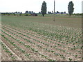
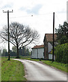
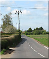
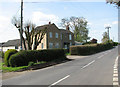

42 photos from this area
Area Information
Key information about the PE14 0EA including its size, population, and administrative classification.
- Area Type
- Postcode
- Area Size
- 9.5 hectares
- Population
- 1678
- Population Density
- 155 people/km²
House Prices in PE14 0EA
8
Properties
£311,667
Average Sold Price
£75,000
Lowest Price
£605,000
Highest Price
Showing 8 properties
| Address | Type | Beds | Baths | Last Sale Price | Last Sale Date | |
|---|---|---|---|---|---|---|
| 111 Outwell Road, Emneth, PE14 0EA | Detached | 4 | 2 | £605,000 | Feb 2024 | |
| Shesez, 103 Outwell Road, Emneth, PE14 0EA | Detached | 3 | - | £255,000 | May 2015 | |
| Ivy Cottage, 90 Outwell Road, Emneth, PE14 0EA | Detached | - | - | £75,000 | Mar 2002 | |
| Inglethorpe House, 80 Outwell Road, Emneth, PE14 0EA | Detached | 5 | 3 | - | - | |
| Palma, 82 Outwell Road, Emneth, PE14 0EA | Detached | - | - | - | - | |
| 95 Outwell Road, Emneth, PE14 0EA | Detached | - | - | - | - | |
| Dog Grooming At, Shesez, 103 Outwell Road, Emneth, PE14 0EA | Retail | - | - | - | - | |
| Stables South Of 70-72, Outwell Road, Emneth, PE14 0EA | Equestrian | - | - | - | - |
Energy Efficiency in PE14 0EA
Amenities
Schools
| Rank | School | Type | Entry gender | Ages |
|---|
Explore more schools in this area
Go to Schools tabDemographics
Household Size
Two person
most common
Accommodation Type
Houses
most common
Tenure
82
majority
Ethnic Group
White
most common
Religion
N/A
most common
Household Composition
N/A
most common
Age
47
median
Adults (30-64 years)
most common
Household Deprivation
N/A
with no deprivation
NS-SEC
23
in Lower managerial occupations
Explore more demographic insights in this area
Go to Demographics tabPlanning
Planning Constraints
- Flood RiskPremium
- Ramsar Wetland SitesPremium
- Area of Outstanding Natural BeautyPremium
- Protected Nature ReservePremium
- Protected WoodlandPremium