Area Overview for PE13 5JD
Photos of PE13 5JD
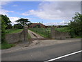

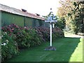
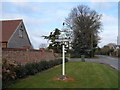


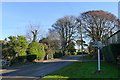
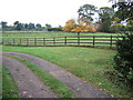
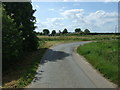
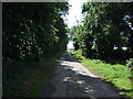
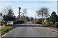
12 photos from this area
Area Information
Key information about the PE13 5JD including its size, population, and administrative classification.
- Area Type
- Postcode
- Area Size
- 2.5 hectares
- Population
- 1723
- Population Density
- 91 people/km²
House Prices in PE13 5JD
15
Properties
£187,611
Average Sold Price
£68,500
Lowest Price
£330,000
Highest Price
Showing 15 properties
| Address | Type | Beds | Baths | Last Sale Price | Last Sale Date | |
|---|---|---|---|---|---|---|
| 10, Karrow Meadows, Goodens Lane, Newton In The Isle, PE13 5JD | Bungalow | 3 | 1 | £315,000 | Dec 2021 | |
| 12, Karrow Meadows, Goodens Lane, Newton In The Isle, PE13 5JD | Detached | 4 | 2 | £330,000 | Aug 2021 | |
| 3, Karrow Meadows, Goodens Lane, Newton In The Isle, PE13 5JD | Bungalow | - | - | £195,000 | Sep 2016 | |
| 11, Karrow Meadows, Goodens Lane, Newton In The Isle, PE13 5JD | Bungalow | 3 | - | £164,000 | Jul 2013 | |
| 9 Goodens Lane, Newton In The Isle, PE13 5JD | Semi-detached | - | - | £179,000 | Aug 2007 | |
| 13, Karrow Meadows, Goodens Lane, Newton In The Isle, PE13 5JD | Detached | - | - | £220,000 | Apr 2007 | |
| 8, Karrow Meadows, Goodens Lane, Newton In The Isle, PE13 5JD | Bungalow | 4 | 2 | £125,000 | Jan 2002 | |
| 1, Karrow Meadows, Goodens Lane, Newton In The Isle, PE13 5JD | Detached | - | - | £92,000 | Sep 1998 | |
| 14, Karrow Meadows, Goodens Lane, Newton In The Isle, PE13 5JD | Bungalow | - | - | £68,500 | Feb 1998 | |
| 4 Karrow Meadows, Newton In The Isle, PE13 5JD | Bungalow | 4 | 2 | - | - |
Page 1 of 2
Energy Efficiency in PE13 5JD
Amenities
Schools
| Rank | School | Type | Entry gender | Ages |
|---|
Explore more schools in this area
Go to Schools tabDemographics
Household Size
Two person
most common
Accommodation Type
Houses
most common
Tenure
84
majority
Ethnic Group
White
most common
Religion
N/A
most common
Household Composition
N/A
most common
Age
47
median
Adults (30-64 years)
most common
Household Deprivation
N/A
with no deprivation
NS-SEC
27
in Lower managerial occupations
Explore more demographic insights in this area
Go to Demographics tabPlanning
Planning Constraints
- Flood RiskPremium
- Ramsar Wetland SitesPremium
- Area of Outstanding Natural BeautyPremium
- Protected Nature ReservePremium
- Protected WoodlandPremium