Area Overview for PE13 5AS
Photos of PE13 5AS
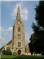
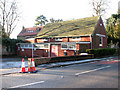

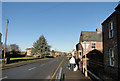

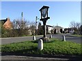
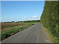
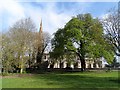

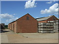
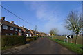
45 photos from this area
Area Information
Key information about the PE13 5AS including its size, population, and administrative classification.
- Area Type
- Postcode
- Area Size
- 1.8 hectares
- Population
- 1860
- Population Density
- 1018 people/km²
House Prices in PE13 5AS
18
Properties
£185,444
Average Sold Price
£56,000
Lowest Price
£430,000
Highest Price
Showing 18 properties
| Address | Type | Beds | Baths | Last Sale Price | Last Sale Date | |
|---|---|---|---|---|---|---|
| Wisbury, 34 Gorefield Road, Leverington, PE13 5AS | house | - | - | £236,000 | Sep 2024 | |
| Wolhara, 32 Gorefield Road, Leverington, PE13 5AS | Detached | 3 | 1 | £235,000 | Nov 2022 | |
| Appledore, 44 Gorefield Road, Leverington, PE13 5AS | Detached | 4 | 2 | £430,000 | Aug 2022 | |
| Rose Cottage, 45 Gorefield Road, Leverington, PE13 5AS | Semi-detached | 2 | - | £182,000 | May 2022 | |
| 45A Gorefield Road, Leverington, PE13 5AS | Detached | 3 | - | £180,000 | Mar 2021 | |
| Wilrose, 40 Gorefield Road, Leverington, PE13 5AS | house | - | - | £115,000 | Jul 2019 | |
| Starkholme, 36 Gorefield Road, Leverington, PE13 5AS | Semi-detached | 3 | - | £142,000 | May 2014 | |
| The Cottage, 43 Gorefield Road, Leverington, PE13 5AS | Detached | 2 | 1 | £93,000 | Nov 2003 | |
| Denloris, 38 Gorefield Road, Leverington, PE13 5AS | Semi-detached | - | - | £56,000 | Jul 2001 | |
| LIVING ACCOMODATION, THE SIX RINGERS PUBLIC HOUSE, 47 GOREFIELD ROAD, Leverington, PE13 5AS | Flat | - | - | - | - |
Page 1 of 2
Energy Efficiency in PE13 5AS
Amenities
Schools
| Rank | School | Type | Entry gender | Ages |
|---|
Explore more schools in this area
Go to Schools tabDemographics
Household Size
Two person
most common
Accommodation Type
Houses
most common
Tenure
72
majority
Ethnic Group
White
most common
Religion
N/A
most common
Household Composition
N/A
most common
Age
47
median
Adults (30-64 years)
most common
Household Deprivation
N/A
with no deprivation
NS-SEC
24
in Lower managerial occupations
Explore more demographic insights in this area
Go to Demographics tabPlanning
Planning Constraints
- Flood RiskPremium
- Ramsar Wetland SitesPremium
- Area of Outstanding Natural BeautyPremium
- Protected Nature ReservePremium
- Protected WoodlandPremium