Area Overview for PE13 4JA
Photos of PE13 4JA
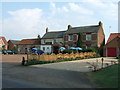

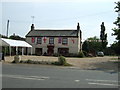
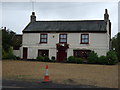
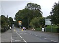


9 photos from this area
Area Information
Key information about the PE13 4JA including its size, population, and administrative classification.
- Area Type
- Postcode
- Area Size
- 13.7 hectares
- Population
- 2030
- Population Density
- 91 people/km²
House Prices in PE13 4JA
46
Properties
£203,573
Average Sold Price
£5,000
Lowest Price
£435,000
Highest Price
Showing 46 properties
| Address | Type | Beds | Baths | Last Sale Price | Last Sale Date | |
|---|---|---|---|---|---|---|
| The Cedars, 30 Main Road, Parson Drove, PE13 4JA | Bungalow | 2 | - | £240,000 | Sep 2020 | |
| Valentine House, 8 Main Road, Parson Drove, PE13 4JA | house | - | - | £100,000 | Jul 2020 | |
| Lemon Tree House, 7 Main Road, Parson Drove, PE13 4JA | house | - | - | £230,000 | Dec 2019 | |
| The Old Farmhouse, 27 Main Road, Parson Drove, PE13 4JA | house | - | - | £435,000 | Nov 2019 | |
| The Old Store, 21 Main Road, Parson Drove, PE13 4JA | house | - | - | £300,000 | Nov 2018 | |
| April Cottage, 28 Main Road, Parson Drove, PE13 4JA | Bungalow | - | - | £257,500 | Dec 2017 | |
| Sudbrooke, 47 Main Road, Parson Drove, PE13 4JA | Detached | 4 | 2 | £305,000 | Mar 2017 | |
| Ingham Hall Lodge, 32 Main Road, Parson Drove, PE13 4JA | Bungalow | 3 | - | £235,000 | Mar 2016 | |
| Beech House, 48 Main Road, Parson Drove, PE13 4JA | Detached | 5 | 4 | £208,000 | Sep 2014 | |
| New Trafford, 38 Main Road, Parson Drove, PE13 4JA | Bungalow | - | - | £247,500 | Dec 2009 |
Page 1 of 5
Energy Efficiency in PE13 4JA
Amenities
Schools
| Rank | School | Type | Entry gender | Ages |
|---|
Explore more schools in this area
Go to Schools tabDemographics
Household Size
Two person
most common
Accommodation Type
Houses
most common
Tenure
78
majority
Ethnic Group
White
most common
Religion
N/A
most common
Household Composition
N/A
most common
Age
47
median
Adults (30-64 years)
most common
Household Deprivation
N/A
with no deprivation
NS-SEC
25
in Lower managerial occupations
Explore more demographic insights in this area
Go to Demographics tabPlanning
Planning Constraints
- Flood RiskPremium
- Ramsar Wetland SitesPremium
- Area of Outstanding Natural BeautyPremium
- Protected Nature ReservePremium
- Protected WoodlandPremium