Area Overview for PE1 5HL
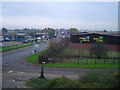
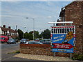
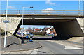
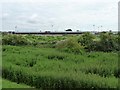
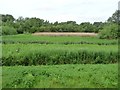
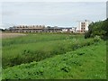
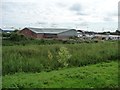
Photos of PE1 5HL


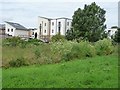
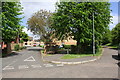
Area Information
Living in PE1 5HL offers a specific residential experience defined by its small scale and location within England. This postcode covers a compact cluster measuring just 1163 m², housing a population of 2519 people. The density here is considerable, creating a tight-knit environment where neighbours are close by. Daily life revolves around a small, concentrated community rather than sprawling suburbs. You will find that the area functions as a distinct pocket within the wider Peterborough region. While the physical footprint is tiny, the presence of 2519 residents ensures there is a sense of local presence and activity. The area serves as a stable residential zone for families and individuals seeking proximity to urban amenities without the sprawl of a larger city district. Understanding this small geographic boundary helps you appreciate the specific character of living in PE1 5HL. It is a place where the local infrastructure is built to serve a defined group rather than a vast metropolis. The distinctiveness of the area lies in this concentration, offering a focused living environment for those considering homes in this specific postcode.
- Area Type
- Postcode
- Area Size
- 1163 m²
- Population
- 2519
- Population Density
- 7323 people/km²
The housing landscape in PE1 5HL is characterised by a significant rental component, with home ownership sitting at just 38%. This means the majority of homes in this specific postcode are likely let properties. You will predominantly find houses rather than flats or apartments, which suits the demographic skew towards adults aged 30 to 64. A 38% ownership rate suggests that nearly 62% of the 2519 residents rent their accommodation. For buyers looking at homes in PE1 5HL, this indicates a market where tenure might be fluid, with a constant turnover of tenants alongside long-term owners. The accommodation type is explicitly listed as houses, confirming the physical nature of the housing stock in this 1163 m² zone. This is not a high-rise district but a cluster of traditional housing. When evaluating property here, consider that the low ownership percentage could reflect market conditions outside the immediate vicinity or a strong presence of professionals living in rented houses. Understanding this split is crucial for anyone considering purchasing property in this small, specific location.
House Prices in PE1 5HL
Showing 8 properties
| Address | Type | Beds | Baths | Last Sale Price | Last Sale Date | |
|---|---|---|---|---|---|---|
| 70 Star Road, Eastgate, Peterborough, PE1 5HL | Terraced | 2 | 1 | £145,000 | Nov 2021 | |
| 72 Star Road, Eastgate, Peterborough, PE1 5HL | Terraced | 2 | - | £129,995 | Feb 2021 | |
| 74 Star Road, Eastgate, Peterborough, PE1 5HL | house | 2 | 1 | £105,000 | Apr 2007 | |
| 66 Star Road, Eastgate, Peterborough, PE1 5HL | house | - | - | £18,000 | Apr 1999 | |
| 76 Star Road, Eastgate, Peterborough, PE1 5HL | Retail | 3 | 1 | - | - | |
| 62 Star Road, Eastgate, Peterborough, PE1 5HL | Terraced | - | - | - | - | |
| 64 Star Road, Eastgate, Peterborough, PE1 5HL | Semi-detached | - | - | - | - | |
| 68 Star Road, Eastgate, Peterborough, PE1 5HL | Terraced | - | - | - | - |
Energy Efficiency in PE1 5HL
Residents of PE1 5HL have access to a range of amenities within practical reach. Your local retail options include a Spar, Tesco Peterborough, and Asda Peterborough, ensuring you can find groceries and daily necessities nearby. Transport links are supported by two railway stations: Peterborough Railway Station and Whittlesea Railway Station. You can also use three metro-style stops at Peterborough, Orton Mere, and Ferry Meadows. This network makes commuting to wider city centres feasible. The area allows you to keep your essential shopping close while maintaining easy rail access. Living in PE1 5HL means you benefit from the facilities in Peterborough without needing to travel far for basic retail. The proximity to these named venues like Asda Peterborough and Peterborough Railway Station integrates this small postcode into the wider suburban fabric. You will find the necessary services for a comfortable daily routine just outside the immediate residential cluster.
Amenities
Schools
| Rank | School | Type | Entry gender | Ages |
|---|
Explore more schools in this area
Go to Schools tabDemographics
The community within PE1 5HL is dominated by adults between the ages of 30 and 64 years old. The median age for residents is 47, indicating a mature population. These age ranges suggest the area attracts families and individuals who have moved beyond their twenties. Home ownership stands at 38%, meaning roughly two out of every three residents in this cluster rent their homes. This is a notable figure for a residential area and suggests a dynamic mix of owner-occupiers and landlords. The predominant ethnic group is White, reflecting the broader demographic trends of the region. Accommodation types are primarily houses, which aligns with the age profile of the residents who often prefer detached or semi-detached living. The population density of 2166481 people per km² is a statistical anomaly derived from the tiny area size but points to high intensity of use within the 1163 m² boundary. Living in PE1 5HL means sharing a neighbourhood with a stable, middle-aged demographic. Homes in this area are likely settled into the long term, driven by the high proportion of adults established in their careers and lives.
Household Size
Accommodation Type
Tenure
Ethnic Group
Religion
Household Composition
Age
Household Deprivation
NS-SEC
Explore more demographic insights in this area
Go to Demographics tabPlanning
Planning Constraints
- Flood RiskPremium
- Ramsar Wetland SitesPremium
- Area of Outstanding Natural BeautyPremium
- Protected Nature ReservePremium
- Protected WoodlandPremium