Area Overview for PE1 4TQ
Photos of PE1 4TQ

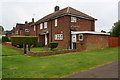
21 photos from this area
Area Information
Key information about the PE1 4TQ including its size, population, and administrative classification.
- Area Type
- Postcode
- Area Size
- 9199 m²
- Population
- 1901
- Population Density
- 8048 people/km²
House Prices in PE1 4TQ
28
Properties
£88,688
Average Sold Price
£20,000
Lowest Price
£175,000
Highest Price
Showing 28 properties
| Address | Type | Beds | Baths | Last Sale Price | Last Sale Date | |
|---|---|---|---|---|---|---|
| 72 Belvoir Way, Welland, Peterborough, PE1 4TQ | Terraced | 3 | 1 | £175,000 | Sep 2023 | |
| 94 Belvoir Way, Welland, Peterborough, PE1 4TQ | Terraced | 2 | 1 | £140,000 | Sep 2020 | |
| 98 Belvoir Way, Welland, Peterborough, PE1 4TQ | Terraced | 2 | 2 | £105,000 | Feb 2017 | |
| 92 Belvoir Way, Welland, Peterborough, PE1 4TQ | house | - | - | £103,000 | Dec 2008 | |
| 88 Belvoir Way, Welland, Peterborough, PE1 4TQ | house | - | - | £104,000 | May 2008 | |
| 120 Belvoir Way, Welland, Peterborough, PE1 4TQ | Semi-detached | - | - | £29,000 | Jul 1998 | |
| 116 Belvoir Way, Welland, Peterborough, PE1 4TQ | house | - | - | £33,500 | Nov 1995 | |
| 84 Belvoir Way, Welland, Peterborough, PE1 4TQ | Semi-detached | 3 | - | £20,000 | Nov 1995 | |
| 80 Belvoir Way, Welland, Peterborough, PE1 4TQ | Semi-detached | - | - | - | - | |
| 104 Belvoir Way, Welland, Peterborough, PE1 4TQ | house | - | - | - | - |
Page 1 of 3
Energy Efficiency in PE1 4TQ
Amenities
Schools
| Rank | School | Type | Entry gender | Ages |
|---|
Explore more schools in this area
Go to Schools tabDemographics
Household Size
Family (3-5 people)
most common
Accommodation Type
Houses
most common
Tenure
23
majority
Ethnic Group
White
most common
Religion
N/A
most common
Household Composition
N/A
most common
Age
22
median
Adults (30-64 years)
most common
Household Deprivation
N/A
with no deprivation
NS-SEC
10
in Lower managerial occupations
Explore more demographic insights in this area
Go to Demographics tabPlanning
Planning Constraints
- Flood RiskPremium
- Ramsar Wetland SitesPremium
- Area of Outstanding Natural BeautyPremium
- Protected Nature ReservePremium
- Protected WoodlandPremium