Area Overview for PE1 4HU
Photos of PE1 4HU
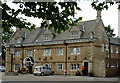
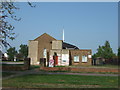
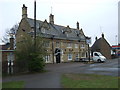
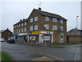

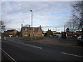
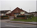
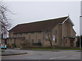
34 photos from this area
Area Information
Key information about the PE1 4HU including its size, population, and administrative classification.
- Area Type
- Postcode
- Area Size
- 1.7 hectares
- Population
- 1754
- Population Density
- 5400 people/km²
House Prices in PE1 4HU
43
Properties
£220,044
Average Sold Price
£39,000
Lowest Price
£1,527,500
Highest Price
Showing 43 properties
| Address | Type | Beds | Baths | Last Sale Price | Last Sale Date | |
|---|---|---|---|---|---|---|
| 77 Western Avenue, Dogsthorpe, Peterborough, PE1 4HU | Terraced | 2 | 1 | £185,000 | Mar 2025 | |
| 151 Western Avenue, Dogsthorpe, Peterborough, PE1 4HU | Semi-detached | 3 | 1 | £210,000 | Feb 2025 | |
| 113 Western Avenue, Dogsthorpe, Peterborough, PE1 4HU | Retail | 5 | 1 | £167,500 | Jan 2024 | |
| 121 Western Avenue, Dogsthorpe, Peterborough, PE1 4HU | Terraced | 3 | 1 | £200,000 | May 2023 | |
| 147 Western Avenue, Dogsthorpe, Peterborough, PE1 4HU | house | - | - | £175,000 | Feb 2022 | |
| 81 Western Avenue, Dogsthorpe, Peterborough, PE1 4HU | Semi-detached | 3 | 1 | £1,527,500 | Jul 2021 | |
| 139 Western Avenue, Dogsthorpe, Peterborough, PE1 4HU | Semi-detached | 2 | 1 | £144,100 | Jan 2019 | |
| 87 Western Avenue, Dogsthorpe, Peterborough, PE1 4HU | Semi-detached | 3 | 1 | £170,000 | Oct 2017 | |
| 89 Western Avenue, Dogsthorpe, Peterborough, PE1 4HU | Detached | 3 | 1 | £145,000 | Aug 2016 | |
| 155 Western Avenue, Dogsthorpe, Peterborough, PE1 4HU | house | 2 | - | £101,000 | Mar 2014 |
Page 1 of 5
Energy Efficiency in PE1 4HU
Amenities
Schools
| Rank | School | Type | Entry gender | Ages |
|---|
Explore more schools in this area
Go to Schools tabDemographics
Household Size
Family (3-5 people)
most common
Accommodation Type
Houses
most common
Tenure
54
majority
Ethnic Group
White
most common
Religion
N/A
most common
Household Composition
N/A
most common
Age
47
median
Adults (30-64 years)
most common
Household Deprivation
N/A
with no deprivation
NS-SEC
17
in Lower managerial occupations
Explore more demographic insights in this area
Go to Demographics tabPlanning
Planning Constraints
- Flood RiskPremium
- Ramsar Wetland SitesPremium
- Area of Outstanding Natural BeautyPremium
- Protected Nature ReservePremium
- Protected WoodlandPremium