Area Overview for PE1 3BS
Photos of PE1 3BS

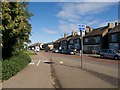

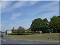
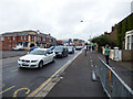

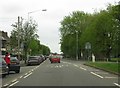
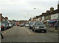


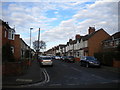
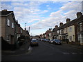
100 photos from this area
Area Information
Key information about the PE1 3BS including its size, population, and administrative classification.
- Area Type
- Postcode
- Area Size
- 1.5 hectares
- Population
- 2532
- Population Density
- 4025 people/km²
House Prices in PE1 3BS
65
Properties
£128,422
Average Sold Price
£31,500
Lowest Price
£395,000
Highest Price
Showing 65 properties
| Address | Type | Beds | Baths | Last Sale Price | Last Sale Date | |
|---|---|---|---|---|---|---|
| 54 Gilpin Street, New England, Peterborough, PE1 3BS | Terraced | 3 | 1 | £160,000 | Mar 2025 | |
| 43 Gilpin Street, New England, Peterborough, PE1 3BS | Detached | 4 | 1 | £300,000 | Jan 2025 | |
| 12 Gilpin Street, New England, Peterborough, PE1 3BS | Detached | 3 | 1 | £176,000 | Dec 2024 | |
| 9 Gilpin Street, New England, Peterborough, PE1 3BS | Semi-detached | 3 | 1 | £224,210 | Jul 2023 | |
| 17 Gilpin Street, New England, Peterborough, PE1 3BS | Semi-detached | 3 | 1 | £182,000 | Nov 2022 | |
| 45 Gilpin Street, New England, Peterborough, PE1 3BS | Retail | 2 | 1 | £238,000 | Aug 2022 | |
| 44 Gilpin Street, New England, Peterborough, PE1 3BS | Retail | 3 | 1 | £163,500 | May 2022 | |
| 29 Gilpin Street, New England, Peterborough, PE1 3BS | house | 3 | 1 | £182,000 | May 2022 | |
| 8 Gilpin Street, New England, Peterborough, PE1 3BS | house | - | - | £156,100 | Dec 2021 | |
| 76 Gilpin Street, New England, Peterborough, PE1 3BS | Terraced | 3 | 1 | £395,000 | Feb 2020 |
Page 1 of 7
Energy Efficiency in PE1 3BS
Amenities
Schools
| Rank | School | Type | Entry gender | Ages |
|---|
Explore more schools in this area
Go to Schools tabDemographics
Household Size
Family (3-5 people)
most common
Accommodation Type
Houses
most common
Tenure
36
majority
Ethnic Group
White
most common
Religion
N/A
most common
Household Composition
N/A
most common
Age
47
median
Adults (30-64 years)
most common
Household Deprivation
N/A
with no deprivation
NS-SEC
10
in Lower managerial occupations
Explore more demographic insights in this area
Go to Demographics tabPlanning
Planning Constraints
- Flood RiskPremium
- Ramsar Wetland SitesPremium
- Area of Outstanding Natural BeautyPremium
- Protected Nature ReservePremium
- Protected WoodlandPremium