Area Overview for Paston & Walton Ward
Photos of Paston & Walton Ward
Area Information
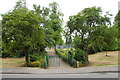
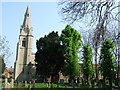
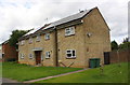
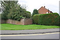
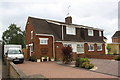
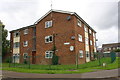
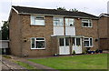
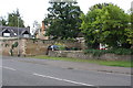
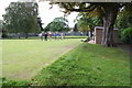
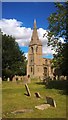
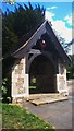
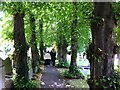
Paston & Walton Ward sits inside Peterborough, covering just 2.4 square kilometres. The residential core developed mainly in the 1970s and 1980s after the development corporation acquired Paston Ridings common land in 1974. Long before this modern expansion, the civil parish of Paston held a population of 182 in 1921 before merging into the city in 1929. Today, the ward contains the twin villages of Paston and Walton, anchored by the parish church of All Saints. This Grade I listed building features fragments from the 11th century, a north chapel from 1220, and a tower from the early 14th century. Residents live close to Paston Ridings County Primary School, which opened in 1994, and the Caverstede Early Years Centre. Living in Paston & Walton Ward means accessing a district with deep historical roots alongside modern housing. You are steps away from the Caverstede Valley, a local nature reserve, which offers a green space within easy reach of the homes. This ward blends 700 years of parish history with twentieth-century community planning.
- Area Type
- District Borough Unitary Ward
- Area Size
- 2.4 km²
- Population
- Not available
- Population Density
- Not available
Demographics
The community in Paston & Walton Ward skews heavily towards older residents. The median age stands at 70 years, placing this ward among the oldest in the country. While specific age breakdowns are not further detailed in the available records, the predominant age grouping is simply described as Total, indicating a concentration in the upper end of the scale. You will find a more senior demographic rather than young families or students in this neighbourhood. Home ownership rates sit at exactly 50 per cent, meaning half the residents own their homes outright or with a mortgage. The remaining half likely rents, though specific rental market data is not provided. Household composition and predominant ethnic group data appear in the records but lack detailed breakdown figures. Without specific numbers on household size or working-age populations, the dominant picture is one of settled, older living. This demographic profile suggests a quiet, stable environment where retirees and long-term residents make up the majority.
Household Size
Accommodation Type
Tenure
Ethnic Group
Religion
Household Composition
Age
Household Deprivation
NS-SEC
Explore more demographic insights in this area
Go to Demographics tabPlanning
Planning Constraints
- Flood RiskPremium
- Ramsar Wetland SitesPremium
- Area of Outstanding Natural BeautyPremium
- Protected Nature ReservePremium
- Protected WoodlandPremium
- Crime RiskPremium