Area Overview for Paston
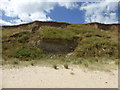
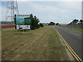
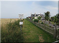
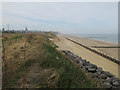
Photos of Paston

Area Information
Living in Paston offers a distinct blend of compact urban living and practical accessibility. Covering 78.1 hectares, this built-up area in England is characterised by its mature demographic profile, with a median age of 70, suggesting a community of long-term residents. The area is home to 76% owner-occupiers, reflecting a stable housing market where many properties are held by those who have lived there for years. Daily life in Paston is shaped by its proximity to essential services and transport links. Residents benefit from nearby retail options, including major chains like Tesco Mundesley and Sainsburys North, ensuring convenience for shopping and daily errands. While the area’s size is modest, its strategic location near multiple railway stations—North Walsham, Gunton, and Worstead—provides reliable connections to surrounding towns and cities. Paston’s character is defined by its balance of local amenities and broader connectivity, making it a viable choice for those seeking a settled, low-maintenance lifestyle without sacrificing access to key services.
- Area Type
- Built Up Area 250
- Area Size
- 78.1 hectares
- Population
- Not available
- Population Density
- Not available
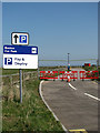
Residents of Paston have access to a range of essential amenities within practical reach. The area is served by five retail outlets, including major chains like Tesco Mundesley, Sainsburys North, and Morrisons Daily North, ensuring convenience for shopping and daily errands. These stores cater to a variety of needs, from groceries to household supplies, supporting a self-sufficient lifestyle. The presence of three railway stations—North Walsham, Gunton, and Worstead—provides reliable access to broader regional networks, facilitating travel to nearby towns and cities. While the data does not mention parks or leisure facilities, the proximity to retail and transport hubs suggests a focus on practicality over expansive recreational spaces. For those valuing ease of access to services and efficient travel, Paston’s amenities align with a lifestyle that prioritises convenience and connectivity over sprawling urban or rural amenities.
Amenities
Schools
| Rank | School | Type | Entry gender | Ages |
|---|
Explore more schools in this area
Go to Schools tabDemographics
Paston’s population is predominantly older, with a median age of 70, indicating a community where retirement or long-term residency is common. The data shows that 76% of homes are owner-occupied, a figure that underscores the area’s stability and suggests a preference for long-term investment in property. While the dataset does not specify household composition or ethnic diversity, the high home ownership rate implies a settled demographic with fewer transient residents. The absence of detailed information on household types or accommodation mix means the area’s social fabric remains largely uncharacterised by data, though the age profile points to a population that may prioritise ease of access to services over dynamic urban amenities. For buyers, this demographic profile may align with those seeking a quiet, established neighbourhood with minimal turnover, though the lack of specific diversity metrics leaves room for further inquiry into the community’s broader makeup.
Household Size
Accommodation Type
Tenure
Ethnic Group
Religion
Household Composition
Age
Household Deprivation
NS-SEC
Explore more demographic insights in this area
Go to Demographics tabPlanning
Planning Constraints
- Crime RiskPremium