Area Overview for Paslow Wood Common
Photos of Paslow Wood Common


Area Information
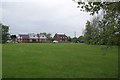
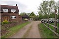
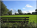
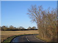
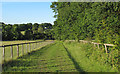
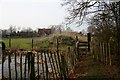
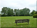
Paslow Wood Common is a compact built-up area in England, spanning 32 hectares. It is a place where older residents form the majority, with a median age of 70, suggesting a community shaped by long-term residency and stability. The area’s proximity to key transport hubs, including Ingatestone, Shenfield, and Brentwood railway stations, ensures easy access to nearby towns and cities. For daily life, residents benefit from nearby retail options such as Tesco Doddinghurst, Sainsburys Chipping, and the Chelmsford Star Co-operative Society, offering convenience for shopping and errands. The area’s safety score of 75 indicates a relatively low crime risk, contributing to a sense of security. While the population data does not specify household types or diversity, the high home ownership rate of 76% suggests a community of established residents. Living in Paslow Wood Common means balancing a quieter, older demographic with practical connectivity to essential services and transport links.
- Area Type
- Built Up Area 250
- Area Size
- 32.0 hectares
- Population
- Not available
- Population Density
- Not available
Living in Paslow Wood Common offers access to a range of amenities within easy reach. The area is served by five retail outlets, including the Chelmsford Star Co-operative Society, Tesco Doddinghurst, and Sainsburys Chipping, providing options for grocery shopping and daily essentials. Three railway stations—Ingatestone, Shenfield, and Brentwood—offer direct links to nearby towns, supporting both commuting and leisure travel. While the data does not mention parks or recreational spaces, the presence of retail and transport hubs suggests a practical, service-oriented lifestyle. Residents can enjoy a mix of convenience and connectivity, with local shops and rail links shaping a routine that balances independence with accessibility.
Amenities
Schools
| Rank | School | Type | Entry gender | Ages |
|---|
Explore more schools in this area
Go to Schools tabDemographics
The population of Paslow Wood Common has a median age of 70, with the most common age range encompassing all age groups. This suggests a community where older residents are well-represented, though specific data on household composition, accommodation types, or ethnic diversity is not available. The home ownership rate stands at 76%, indicating that the majority of residents live in properties they own rather than rent. This figure, combined with the absence of detailed breakdowns on household structures, implies a stable, long-term resident base. However, without information on deprivation levels or specific religious or ethnic demographics, it is difficult to assess the full range of social characteristics. The area’s data reflects a snapshot of a mature population with strong ties to their homes, but further details on community dynamics remain unexplored.
Household Size
Accommodation Type
Tenure
Ethnic Group
Religion
Household Composition
Age
Household Deprivation
NS-SEC
Explore more demographic insights in this area
Go to Demographics tabPlanning
Planning Constraints
- Crime RiskPremium