Area Overview for Park Street and Frogmore
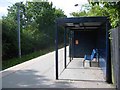
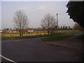
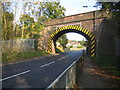
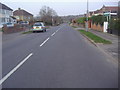
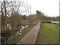
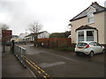
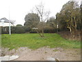
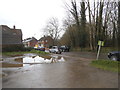
Photos of Park Street and Frogmore
Area Information
Living in Park Street and Frogmore offers a blend of practicality and accessibility. Covering 63.8 hectares, this built-up area in England is compact yet well-served by infrastructure. The community, with a median age of 70, reflects a mature demographic, suggesting a settled population. Daily life here is shaped by proximity to transport networks and essential services. The area’s broadband score of 99 ensures near-excellent internet connectivity, while mobile coverage of 85 is good, supporting both remote work and everyday digital needs. Residents benefit from five nearby rail stations, including Park Street and How Wood, and a metro link at Watford Underground Station, offering seamless access to surrounding towns. While the area’s character is defined by its practical amenities, its appeal lies in its balance of convenience and a relatively low crime risk, though standard security measures remain advisable.
- Area Type
- Built Up Area 250
- Area Size
- 63.8 hectares
- Population
- Not available
- Population Density
- Not available
The lifestyle in Park Street and Frogmore is shaped by its proximity to essential amenities. Retail options include Co-op St, M&S St Albans Mount BP, and Co-op Watford, offering convenience for shopping and daily errands. The five rail stations provide easy access to surrounding areas, enhancing mobility for commuters and visitors. While the data does not specify parks or leisure facilities, the area’s compact size suggests a focus on practical living rather than expansive recreational spaces. The availability of nearby shops and transport links contributes to a convenient, efficient lifestyle, ideal for those prioritising accessibility over large-scale leisure opportunities.
Amenities
Schools
The nearest school to Park Street and Frogmore is the Park Street Church of England Voluntary Aided Primary School, which serves the area’s younger residents. This primary school holds an Ofsted rating of ‘good’, indicating a satisfactory standard of education. While the data does not list secondary schools, the presence of a well-rated primary school suggests families may find it adequate for early education. However, the absence of additional schools in the data means parents should explore further options beyond the immediate vicinity. The single school listed highlights the need for families to consider broader educational networks when settling in the area.
| Rank | School | Type | Entry gender | Ages |
|---|
Explore more schools in this area
Go to Schools tabDemographics
The population of Park Street and Frogmore has a median age of 70, indicating a community skewed towards older residents. Home ownership stands at 71%, reflecting a predominantly owner-occupied area with fewer rental properties. This suggests a stable, long-term resident base. The data does not specify household composition or ethnic diversity, but the high home ownership rate implies a focus on family homes and established living arrangements. The accommodation types are not detailed, but the area’s built-up nature likely includes a mix of terraced and semi-detached housing. With no deprivation data provided, the quality of life here appears tied to the availability of essential services and transport links, which are well-established.