Area Overview for Park Street Ward
Photos of Park Street Ward


Area Information
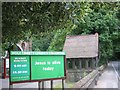
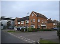
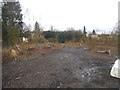
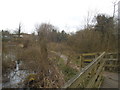
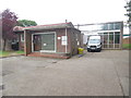
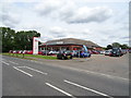
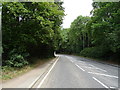
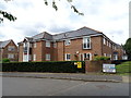
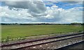
Living in Park Street Ward offers a quiet suburban experience located in Hertfordshire, just over two miles from St Albans city centre. This area covers 12.4 km² and sits within the St Albans City and District Council region. The ward functions as a small village with a distinct suburban feel, positioned on the southern outskirts of the city. A green buffer separates the settlement from St Albans, while the Metropolitan Green Belt encircles it. The main artery, Watling Street, runs through the heart of the village as Pen Road and the A5183, serving as a historic trunk route dating back to Saxon and Norman times. You will find a contemporary community where residents are predominantly employed in nearby urban centres rather than within the village itself. Local amenities include a petrol station, automotive services, and two public houses. The economy relies heavily on the proximity to major business hubs, with a substantial business centre and light industrial estate located in the adjacent area of Frogmore. To the south-east, the disused Handley Page aerodrome marks the boundary of this historic landscape. The village maintains a low-density character despite being accessible to London and other cities via key road links like the A405 and the North Orbital. This blend of rural charm and commuter convenience defines daily life in Park Street Ward.
- Area Type
- District Borough Unitary Ward
- Area Size
- 12.4 km²
- Population
- Not available
- Population Density
- Not available
Demographics
The community profile of Park Street Ward reflects a mature and established population. The median age is 70, confirming that the area is heavily dominated by older residents. This demographic skew aligns with the high rate of home ownership, which stands at 75%. Three-quarters of households within this 12.4 km² ward own their homes outright or with a mortgage, indicating significant stability compared to typical commuter villages. Household composition data confirms the predominance of established families or single-occupancy households typical of retirement communities. The population statistics show that the total age range forms the core of the demographic, with no specific younger working-age clusters highlighted in the available figures. This age profile suggests a slower pace of life where residents have likely lived in their properties for decades. The high ownership rate means you are more likely to find settled families than transient renters. With a majority of the population aged towards or past retirement, the local culture centres around stability and long-term residency. The absence of significant data on ethnic diversity or religious composition does not change the fundamental picture of an elderly, homeownership-heavy district. You will encounter a homogeneous group of people who have invested deeply in their local environment.
Household Size
Accommodation Type
Tenure
Ethnic Group
Religion
Household Composition
Age
Household Deprivation
NS-SEC
Explore more demographic insights in this area
Go to Demographics tabPlanning
Planning Constraints
- Flood RiskPremium
- Ramsar Wetland SitesPremium
- Area of Outstanding Natural BeautyPremium
- Protected Nature ReservePremium
- Protected WoodlandPremium
- Crime RiskPremium