Area Overview for Panshanger Ward
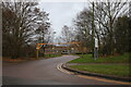
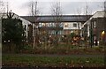
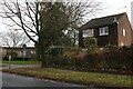
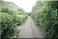
Photos of Panshanger Ward

Area Information
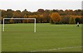
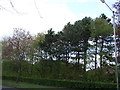
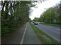
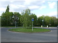
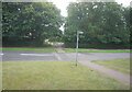
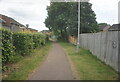
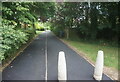
Living in Panshanger Ward offers a distinct residential experience centred around the historic Panshanger estate. Situated within the unitary authority of Welwyn Hatfield in Hertfordshire, this suburban district spans just 1.9 km². The area occupies the northeastern outskirts of Welwyn Garden City, positioned near the former Panshanger estate between the towns of Hertford and Welwyn Garden City. The core residential zone clusters around the postcode AL7 2WA, at coordinates 51.797088, -0.166638. The neighbourhood developed significantly from the 1960s onwards, constructed on former farmland that once included Grubs Barn hamlet and Attimore Hall Farm. This post-war evolution transformed the landscape into a structured housing estate through three development phases. You will find housing from Phase One, completed between 1964 and 1967 across areas like Daniells, yielding 490 homes. Phase Two arrived in 1968 along Herns Lane, followed by Phase Three between 1970 and 1972. This layered history creates a community where modern suburban living sits adjacent to significant heritage sites, including Grade II* listed Panshanger Park. The park features the River Mimram and grounds designed by Capability Brown and Humphrey Repton. Daily life here balances proximity to the bustling development of Welwyn Garden City with the quiet of its own history. Former merle use and subsequent mineral extraction since 1959 have altered parts of the landscape, with the former Panshanger Aerodrome site lying along the northern edge. Understanding these boundaries helps you grasp the physical character of the ward. You access a settled environment born from the visionary planning of Ebenezer Howard, who purchased 1,458 acres in 1919.
- Area Type
- District Borough Unitary Ward
- Area Size
- 1.9 km²
- Population
- Not available
- Population Density
- Not available
Demographics
The community profile of Panshanger Ward is defined by an unusually high proportion of older residents. The median age here stands at 70, creating a neighbourhood where the most common age range is still listed simply as "Total" in broad summaries. This demographic skew suggests a population that values stability over rapid change. Consequently, the area functions as a retired-area or retirement community, appealing to those seeking a quieter life. Home ownership represents the dominant housing tenure type. Sixty-four percent of households reside in their own property, indicating a strong sense of permanence and attachment to the homes in Panshanger Ward. The remaining households likely maintain stable living arrangements consistent with an older local population. While the data does not specify ethnic groups or religious breakdowns, the dominance of home ownership points towards a traditional community structure. You will find that the household composition is not driven by large families or frequent turnover. The current setup supports a lifestyle where residents know their neighbours and local services by name. The high ownership rate at 64% means that decisions about community improvements often rely on owner-occupier input rather than tenant dynamics. This context is vital for anyone considering homes in Panshanger Ward, as the fabric of the area is shaped by long-term residents. The ward does not cater to a transient population but rather supports those seeking a settled, owner-led environment near the historic heart of Hertfordshire.
Household Size
Accommodation Type
Tenure
Ethnic Group
Religion
Household Composition
Age
Household Deprivation
NS-SEC
Explore more demographic insights in this area
Go to Demographics tabPlanning
Planning Constraints
- Flood RiskPremium
- Ramsar Wetland SitesPremium
- Area of Outstanding Natural BeautyPremium
- Protected Nature ReservePremium
- Protected WoodlandPremium