Area Overview for Panfield
Photos of Panfield


Area Information
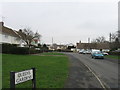
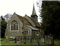
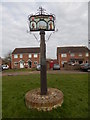
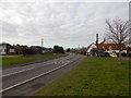
Panfield is a compact built-up area in England, spanning 30.5 hectares. Its population profile suggests a mature community, with a median age of 70, reflecting a demographic skewed towards older residents. This area is characterised by a mix of residential properties, with 76% of homes owned by their occupants, indicating a stable housing market. Daily life in Panfield is shaped by its proximity to essential services and transport links. The area’s small size means amenities and workplaces are within practical reach, though it lacks the density of larger urban centres. Panfield’s appeal lies in its quiet, established character, with a focus on local connectivity. Residents benefit from nearby retail options, including supermarkets and co-operatives, and multiple rail stations within walking distance. While the area may not cater to young families or commuters seeking high-density living, it offers a tranquil environment for those prioritising convenience and a slower pace of life. For buyers seeking a home with a strong sense of community and accessible infrastructure, Panfield provides a distinct alternative to more sprawling developments.
- Area Type
- Built Up Area 250
- Area Size
- 30.5 hectares
- Population
- Not available
- Population Density
- Not available
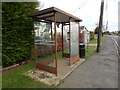
Living in Panfield offers access to a range of nearby amenities, including five retail outlets such as Chelmsford Star Co-operative Society Co, Morrisons Daily, and Lidl Braintree. These shops provide everyday essentials, ensuring convenience for residents. The area’s transport links enhance its accessibility, with a bus interchange and four rail stations within walking distance. While the data does not specify parks or leisure facilities, the presence of multiple retail and transport options suggests a practical, community-focused lifestyle. The compact nature of Panfield means daily errands and social activities are easily managed without long commutes. For those valuing proximity to services and a settled environment, the area’s amenities contribute to a functional, low-stress routine. However, buyers should consider whether the lack of detailed information on leisure or recreational spaces aligns with their preferences for outdoor or cultural activities.
Amenities
Schools
| Rank | School | Type | Entry gender | Ages |
|---|
Explore more schools in this area
Go to Schools tabDemographics
Panfield’s population has a median age of 70, with the most common age range encompassing all demographics. This suggests a community dominated by older adults, which influences local services and social dynamics. Home ownership is high, with 76% of properties owned by residents, indicating a long-term presence of households. The data does not specify household composition or accommodation types, but the overall figures suggest a settled population with established living arrangements. The area’s predominant ethnic group and religious composition are not detailed, but the absence of specific data implies a homogeneous profile. For buyers, this demographic structure may translate to a stable market with fewer fluctuations in property values. However, the lack of younger residents could affect the demand for schools and family-oriented amenities. Those considering Panfield should weigh its mature demographic against their personal needs, particularly if they require a more diverse age range or community vibrancy.
Household Size
Accommodation Type
Tenure
Ethnic Group
Religion
Household Composition
Age
Household Deprivation
NS-SEC
Explore more demographic insights in this area
Go to Demographics tabPlanning
Planning Constraints
- Crime RiskPremium