Area Overview for Pampisford
Photos of Pampisford

Area Information
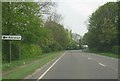
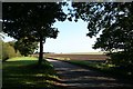
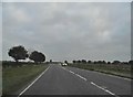
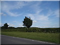
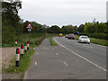
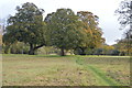
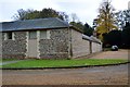
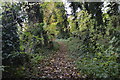
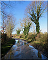
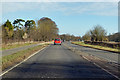
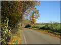
Pampisford is a small village and civil parish located in Cambridgeshire, covering an area of 6.5 square kilometres. The community sits approximately eight miles south of Cambridge, accessible primarily via the A505 road near Sawston. This settlement maintains a distinctly rural character defined by its history and quiet surroundings. Historical records first mention the location as "Pampeswurde" in the Domesday Book of 1086, noting a population of just 25 inhabitants. While the village has grown, it retains historic elements such as Brent Ditch, a surviving section of an ancient defensive earthwork. Residents live in an environment shaped by notable landmarks including Pampisford Hall, a Grade II listed Victorian country mansion featuring an arboretum and pleasure grounds. St Mary's Church stands as a central feature, housing a 650-year-old tower and chest tombs for historical figures like Dr Robert Gell. You will find yourself living in a space that balances modern connectivity with deep historical roots. The proximity to a major university city offers access to broader opportunities while the local streets provide a slower pace. This setting suits those seeking a home near Cambridge without the immediate urban density.
- Area Type
- Parish
- Area Size
- 6.5 km²
- Population
- Not available
- Population Density
- Not available
Demographics
The community in Pampisford reflects a stable, settled population with distinct demographic traits. The median age of residents is 70 years, indicating that the area is home to many older adults and retirees. This age profile contrasts sharply with younger metropolitan centres. Data shows that 64% of households own their homes, a figure significantly higher than the national average for comparable villages. This high ownership rate suggests a community built on long-term residence rather than transient renting or student living. Housing diversity supports various family structures, though the overall household composition data indicates a standard mix typical of rural parishes. The ethnic makeup follows broader national trends without significant local anomalies. You do not encounter unusual segregation here; the diversity aligns with the general Cambridgeshire context. Because the population is relatively small, with estimates around 1,279 people, daily interactions can be personal yet respectful of privacy. The area does not experience the pressures of rapid migration or fluctuating population numbers. Living in Pampisford means joining a quiet neighbourhood where demographics favour stability and continuity over rapid change.
Household Size
Accommodation Type
Tenure
Ethnic Group
Religion
Household Composition
Age
Household Deprivation
NS-SEC
Explore more demographic insights in this area
Go to Demographics tabPlanning
Planning Constraints
- Flood RiskPremium
- Ramsar Wetland SitesPremium
- Area of Outstanding Natural BeautyPremium
- Protected Nature ReservePremium
- Protected WoodlandPremium
- Crime RiskPremium