Area Overview for Palgrave
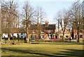
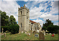
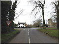
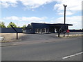
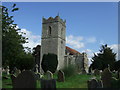
Photos of Palgrave


Area Information
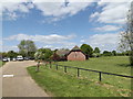
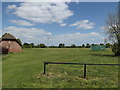
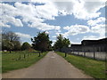
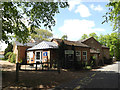
Palgrave is a small built-up area in England, spanning 42.7 hectares. It is characterised by a mature population, with a median age of 70, suggesting a community rooted in long-term residency. The area is predominantly owner-occupied, with 81% of homes owned by their occupants, reflecting a stable residential base. Daily life in Palgrave is shaped by its proximity to essential services, including two primary schools and a railway station at Diss. The area’s safety score of 85/100 indicates a low crime risk, offering reassurance to residents. While compact, Palgrave provides access to retail options such as Tesco, Morrisons, and Aldi in nearby Diss. Its blend of practical amenities and quiet living makes it an appealing choice for those seeking a settled, low-maintenance environment.
- Area Type
- Built Up Area 250
- Area Size
- 42.7 hectares
- Population
- Not available
- Population Density
- Not available
Palgrave’s lifestyle is shaped by its proximity to Diss, which offers five retail outlets, including major chains like Tesco, Morrisons, and Aldi. The Diss Railway Station provides direct access to regional transport networks, enhancing connectivity. While the area itself is small, its integration with Diss ensures residents have access to shopping, dining, and leisure options. The absence of specific parks or recreational facilities in the data means the area’s character is defined by its practical amenities and quiet, community-focused atmosphere.
Amenities
Schools
Palgrave is served by two primary schools: Palgrave Church of England Voluntary Controlled Primary School and Palgrave Church of England Primary School, the latter of which holds an Ofsted rating of ‘good’. Both institutions cater to younger families, though no secondary schools are listed in the data. The presence of two primary schools suggests a focus on early education, with the ‘good’ rating at one school offering a benchmark for quality. Families with young children may find the options sufficient, but those requiring secondary education would need to look beyond Palgrave.
| Rank | School | Type | Entry gender | Ages |
|---|
Explore more schools in this area
Go to Schools tabDemographics
The population of Palgrave has a median age of 70, with the most common age range encompassing all demographics. This suggests a community where older residents form a significant proportion, likely due to long-term residency or limited recent growth. Home ownership is high at 81%, indicating a stable housing market with few rental properties. The data does not specify household composition or ethnic diversity, but the figures imply a cohesive, possibly family-oriented community. The absence of detailed deprivation metrics means the area’s quality of life is inferred from its safety and connectivity, rather than socioeconomic challenges.