Area Overview for Paglesham
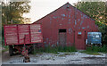
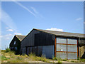
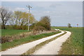
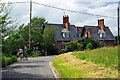
Photos of Paglesham
Area Information
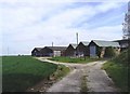
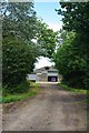
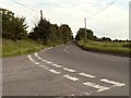
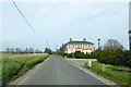
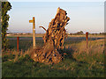
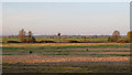
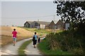
Living in Paglesham offers a distinct experience within this civil parish of Manwood. You are entering an 8.3 km² settlement that operates closely with the surrounding countryside. The area is defined by a quiet pace of life rather than urban bustle. This is a place where residents navigate a specific set of structural constraints along with daily routines. The environment presents clear planning limitations regarding natural wetlands and protected nature reserves. These geographical features form the physical backbone of the local landscape. You should understand that the parish contains Ramsar wetland sites and designated protected nature reserves. These protected areas dictate how the land is managed and what development occurs. Safety remains a priority for residents, with crime risk scoring well below average. The neighbourhood benefits from a safety score of 80 out of 100. This indicates a secure environment for families and individuals. While digital connectivity is strong, environmental assessments reveal significant flood risk coverage. This is a critical factor to consider when viewing homes. The area has no designated Area of Outstanding Natural Beauty coverage. It also lacks protected woodland within its current boundaries. You will find a community where home ownership drives the local economy and social fabric.
- Area Type
- Parish
- Area Size
- 8.3 km²
- Population
- Not available
- Population Density
- Not available
Demographics
The community in Paglesham reflects a mature population profile. The median age stands at 70, confirming this is a retirement-dominant area. You will find that the vast majority of residents fall into the older age brackets. House ownership defines the social structure, with 73% of households being owner-occupied. This high percentage suggests a settled population with deep local roots. The remaining 27% consists of renters or those in other tenure types. Most people live here rather than pass through transiently. The area does not show data for predominant ethnic groups or specific religious affiliations in the provided records. This implies the population may be largely traditional in composition. Deprivation statistics are not included in the current dataset, so you cannot evaluate economic inequality directly. You must rely on the age profile and ownership rates as your primary indicators of community stability. The absence of young families or single-person households skews the social landscape towards settled older demographics. Primary schools near Paglesham likely cater to any remaining younger residents or staff families. The local social life revolves around residential stability rather than a shifting workforce.
Household Size
Accommodation Type
Tenure
Ethnic Group
Religion
Household Composition
Age
Household Deprivation
NS-SEC
Explore more demographic insights in this area
Go to Demographics tabPlanning
Planning Constraints
- Flood RiskPremium
- Ramsar Wetland SitesPremium
- Area of Outstanding Natural BeautyPremium
- Protected Nature ReservePremium
- Protected WoodlandPremium
- Crime RiskPremium