Area Overview for Oulton
Photos of Oulton

Area Information
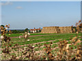
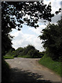
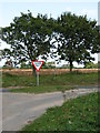
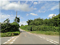
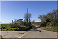
Living in Oulton offers a quiet life within a defined county electoral division of England. This area covers exactly 10.6 square kilometres, creating a compact neighbourhood where daily routines are straightforward. You will find a residential setting that prioritises stability over rapid change. The environment is characterised by a lack of major planning constraints, meaning new development faces fewer restrictions from protected sites. You can walk through the estate knowing there are no Ramsar wetland sites or Areas of Outstanding Natural Beauty directly overlaying your potential future home. The only environmental regulation you must consider relates to a specific presence of protected woodland within the boundary. This location appeals to those who value a settled community free from the immediate pressure of strict conservation designations. Your days here will not be disrupted by the complexities of navigating complex environmental planning rules. It is a place where the physical layout supports a calm existence, distinct from the busier corridors of larger urban developments.
- Area Type
- County Electoral Division
- Area Size
- 10.6 km²
- Population
- Not available
- Population Density
- Not available
Demographics
The community in Oulton presents a clear demographic profile that defines its character. The median age resident here is seventy years, indicating an area populated predominantly by older generations. Most households consist of individuals or couples rather than families with young children. This age structure suggests a mature social fabric where neighbours tend to know one another well. Over 69 per cent of residents own their homes, confirming a strong sense of tenure and local investment. The remaining residents likely allocate space to those seeking flexibility on the rental market, though the majority remain settled. You will not find significant statistical variation regarding ethnicity or religious composition within the provided data, suggesting a homogenous population. This lack of diversity figures in the dataset points to a historically established community with long-term roots. When you consider living in Oulton, you are entering a space where the social composition is stable and predictable. The high home ownership rate reinforces the idea that this is a destination for those building a permanent home rather than seeking a transient lifestyle.
Household Size
Accommodation Type
Tenure
Ethnic Group
Religion
Household Composition
Age
Household Deprivation
NS-SEC
Explore more demographic insights in this area
Go to Demographics tabPlanning
Planning Constraints
- Flood RiskPremium
- Ramsar Wetland SitesPremium
- Area of Outstanding Natural BeautyPremium
- Protected Nature ReservePremium
- Protected WoodlandPremium
- Crime RiskPremium