Area Overview for Otley Bottom
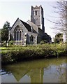
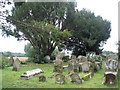
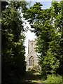
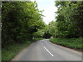
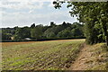
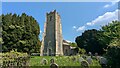
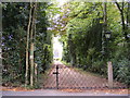
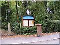
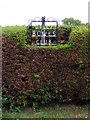
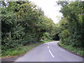
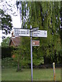
Photos of Otley Bottom

Area Information
Living in Otley Bottom offers a distinct blend of compact urban living and practical accessibility. Covering 34.2 hectares, this built-up area in England is home to a population with a median age of 70, reflecting a community that leans towards older residents. The area’s compact size means amenities and services are within easy reach, supporting a lifestyle that prioritises convenience. Safety is a key feature, with a crime risk score of 91, indicating below-average crime rates and a secure environment for residents. Otley Bottom’s proximity to retail hubs, rail networks, and educational institutions makes it appealing for those seeking a balanced mix of daily essentials and connectivity. While the area is small, it is well-served by nearby schools, including Otley College of Agriculture and Horticulture, and multiple railway stations within practical reach. This combination of safety, accessibility, and essential services makes Otley Bottom a viable choice for those looking for a settled, low-maintenance lifestyle in a well-connected part of England.
- Area Type
- Built Up Area 250
- Area Size
- 34.2 hectares
- Population
- Not available
- Population Density
- Not available
Otley Bottom’s lifestyle is shaped by its proximity to essential amenities. Retail options include five nearby venues, such as Waitrose Little and East of England Co-operative Co, offering a range of shopping and grocery needs. The area’s rail connections, including Entrance2 and Woodbridge stations, provide easy access to local and regional destinations, enhancing mobility for residents. While the data does not detail parks or leisure facilities, the presence of multiple retail and transport hubs suggests a community focused on practicality and convenience. The compact layout ensures daily errands and social activities are accessible without the need for long commutes, supporting a lifestyle that balances simplicity with connectivity.
Amenities
Schools
The nearest educational institution to Otley Bottom is Otley College of Agriculture and Horticulture, a sixth-form college offering post-16 education. While no primary or secondary schools are listed in the data, the presence of a sixth-form college may be particularly relevant for families with teenagers seeking advanced academic or vocational training. This suggests the area is more suited to those with older children or students pursuing higher education, rather than families requiring early-years schooling. The limited school options highlight the need for residents to consider proximity to other educational facilities outside the immediate area.
| Rank | School | Type | Entry gender | Ages |
|---|
Explore more schools in this area
Go to Schools tabDemographics
The community in Otley Bottom is characterised by a median age of 70, with the most common age range encompassing the total population. Home ownership is high, with 80% of residents owning their homes, suggesting a stable, long-term demographic. The data does not specify household composition or accommodation types, but the overall profile indicates a mature population with established living arrangements. The absence of detailed diversity metrics means broader demographic trends are not quantified here, though the high home ownership rate implies a community where residents are likely to have settled in the area for extended periods. This stability contributes to a neighbourhood with a consistent character, where daily life is shaped by the needs and routines of an older demographic.
Household Size
Accommodation Type
Tenure
Ethnic Group
Religion
Household Composition
Age
Household Deprivation
NS-SEC
Explore more demographic insights in this area
Go to Demographics tabPlanning
Planning Constraints
- Crime RiskPremium