Area Overview for Orwell & Villages Ward
Photos of Orwell & Villages Ward


Area Information
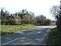
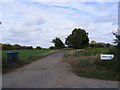
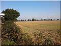
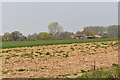
Living in Orwell & Villages Ward offers a distinctly rural experience within the East Suffolk district unitary authority. This electoral ward encompasses approximately 71.4 km² of land in the southern part of East Suffolk, situated near the Orwell Estuary. The area is defined by its village-based layout rather than a compact urban centre, spread across a landscape that residents describe as part of an Area of Outstanding Natural Beauty. You are looking at a very small community with a total population of 1,676 people. This low population count against a spread of over 71 square kilometres means the area emphasises privacy and space over urban convenience. The geographical coordinates place you centrally around 52.011159, 1.294267, which anchors the ward within the broader East of England region. Daily life here revolves around local village interactions rather than city commuting. Because the ward includes multiple villages within the same administrative boundary, your sense of community depends heavily on which specific settlement you choose. The sheer scale of the territory relative to its human population suggests a quiet, rural lifestyle where neighbours may be separated by significant distances. This environment suits those who prioritise tranquillity and proximity to nature above access to major employment hubs or rapid public transport links.
- Area Type
- District Borough Unitary Ward
- Area Size
- 71.4 km²
- Population
- 1676
- Population Density
- 719 people/km²
Demographics
The community profile in Orwell & Villages Ward is heavily skewed towards older residents. The median age for the population is 70 years old, which indicates a demographic comprised primarily of retirees or older adults. This age distribution suggests a neighbourhood where young families are less common than empty nesters or pensioners. Home ownership is exceptionally high at 78% of total households. This figure confirms that the area is not a rental market but rather a legacy community established by long-term owners who have likely lived here for decades. You will find very few private landlords or temporary tenants in this ward. The high rate of ownership often correlates with older accommodation stock that has been passed down through generations rather than modern developments built for investment. While the data does not specify ethnic breakdowns or religious affiliations, the demographic structure points to a homogenous, traditionally British village community. Residents here are likely established locals rather than recent migrants seeking new opportunities. The lack of young families also influences the energy and pace of daily life. Expect a slow, settled rhythm rather than the bustle typical of areas with a younger demographic. The 70-year-old median age is the defining statistic for this ward, shaping everything from school attendance to local shop trading patterns.
Household Size
Accommodation Type
Tenure
Ethnic Group
Religion
Household Composition
Age
Household Deprivation
NS-SEC
Explore more demographic insights in this area
Go to Demographics tabPlanning
Planning Constraints
- Flood RiskPremium
- Ramsar Wetland SitesPremium
- Area of Outstanding Natural BeautyPremium
- Protected Nature ReservePremium
- Protected WoodlandPremium
- Crime RiskPremium