Area Overview for Old Heath & The Hythe Ward
Photos of Old Heath & The Hythe Ward


Area Information
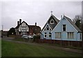
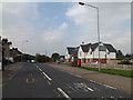
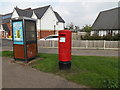
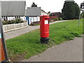
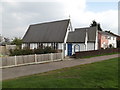
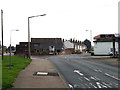
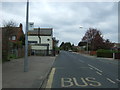
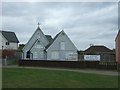
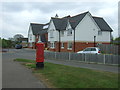
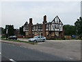
Old Heath & The Hythe Ward occupies a distinctive position southeast of Colchester in Essex, offering a compact community for those seeking a defined local identity. The area spans 8.8 km², a limited footprint that fosters a close-knit environment while remaining only about 2 miles from Colchester town centre. Its history dates back to Saxon times as the original river port for the region, a legacy preserved in active quaysides at King Edward Quay and Haven Quay. While the modern landscape reflects its evolution from 'Old Hythe' to a residential parish, the connection to maritime heritage remains visible in local symbols and structures. You will find the ward situated near St. Giles and adjacent to settlements like Donyland and East Donyland, forming part of a continuous rural-urban fringe. This location provides easy access to the wider Colchester area without the density of the immediate town centre. Living here means inhabiting a space where historical significance meets contemporary quietude. The population of 1,295 residents ensures that everyday noise levels remain low compared to larger borough towns. You are entering a neighbourhood defined by its historical roots and its functional proximity to the county town, offering a serene setting for daily life.
- Area Type
- District Borough Unitary Ward
- Area Size
- 8.8 km²
- Population
- 1295
- Population Density
- 147 people/km²
Demographics
The community profile of Old Heath & The Hythe Ward is defined by an older resident base, making it a suburb often appealing to retirees or established families. The median age here is 70, indicating that the majority of the population falls within older age brackets. This demographic skew suggests a neighbourhood where local service needs may prioritise healthcare and leisure activities suitable for seniors rather than youth entertainment. Exactly 55% of residents own their homes, placing Old Heath & The Hythe Ward in the middle ground between a wholly tenure-bound estate and a fully private market. This ownership rate reflects a stable, long-term resident base who have likely lived in the area for decades. Accommodation types are not explicitly detailed in the raw figures, but the high home ownership percentage strongly implies a prevalence of detached or semi-detached houses rather than high-density flats or student housing. The small population of 1,295 across 147 people per km² ensures a very low population density, meaning you will rarely encounter large crowds on high streets or crowded public parks. While the specific ethnic and religious composition is not itemised in the available statistics, the homogeneity often found in such rural parishes suggests a traditionally established community. For anyone considering homes in Old Heath & The Hythe Ward, this data points to a quiet, settled environment rather than a transient or rapidly changing district.
Household Size
Accommodation Type
Tenure
Ethnic Group
Religion
Household Composition
Age
Household Deprivation
NS-SEC
Explore more demographic insights in this area
Go to Demographics tabPlanning
Planning Constraints
- Flood RiskPremium
- Ramsar Wetland SitesPremium
- Area of Outstanding Natural BeautyPremium
- Protected Nature ReservePremium
- Protected WoodlandPremium
- Crime RiskPremium