Area Overview for Old Costessey Ward
Photos of Old Costessey Ward
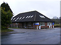
Area Information
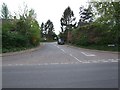
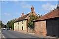
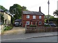
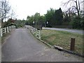
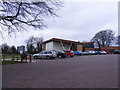
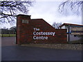
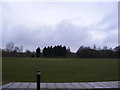
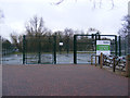
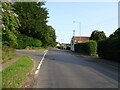
Living in Old Costessey Ward offers a quiet existence within the South Norfolk district, approximately four miles north-west of Norwich. The ward spans 11.0 km² and houses a small population of 1,517 residents. This location sits in the valleys of the rivers Wensum and Tud, placing it within easy reach of the larger Costessey community while retaining a distinct residential character. The area contains notable landmarks including Costessey Park Golf Course and the Marriott's Way footpath, which cross the northern parish boundaries. You will find pockets of old woodland at East Hills and Gunton Lane, alongside the remains of the ivy-clad belfry tower from Costessey Hall at the golf course. Daily life here revolves around accessible local amenities such as the Roundwell Medical Centre and the Costessey Centre. Superstores and a Park and Ride site are situated nearby to the west. This ward represents a balance between historical significance, visible in the area's Anglo-Saxon roots, and modern convenience. The low population density means you likely enjoy a neighbourly environment without the congestion of Norwich city centre. Whether you value proximity to the Norfolk Showground on the western border or a short distance to regional hubs, this ward provides a settled pace of living defined by its riverside setting and thoughtful mix of green spaces and built environment.
- Area Type
- District Borough Unitary Ward
- Area Size
- 11.0 km²
- Population
- 1517
- Population Density
- 138 people/km²
Demographics
The community within Old Costessey Ward is defined by a notably mature population. The median age stands at 70 years, indicating that senior residents form the core of the demographic profile. While specific data on household composition and predominant ethnic groups is not detailed in current records, the age statistic alone suggests a quieter, more settled neighbourhood compared to national averages. Home ownership remains a defining feature of this ward, with 67% of residents owning their homes outright or with a mortgage. This high ownership rate typically correlates with stronger community stability and long-term settlement patterns among the local population. Accommodation types and religion data are represented as totals in the available overview, without a breakdown of specific categories. The lack of detailed variance in household composition implies a stable social fabric where long-term residents reside alongside one another. For those considering homes in this area, the demographic reality is one of an established community rather than a transient population. The age profile suggests shopping and services cater well to older adults, though the presence of a medical centre nearby supports the needs of this specific age bracket. You are entering an area where a significant majority of neighbours have likely called this ward home for decades.
Household Size
Accommodation Type
Tenure
Ethnic Group
Religion
Household Composition
Age
Household Deprivation
NS-SEC
Explore more demographic insights in this area
Go to Demographics tabPlanning
Planning Constraints
- Flood RiskPremium
- Ramsar Wetland SitesPremium
- Area of Outstanding Natural BeautyPremium
- Protected Nature ReservePremium
- Protected WoodlandPremium
- Crime RiskPremium