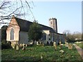
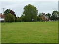
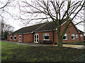
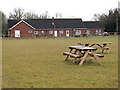
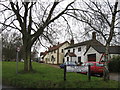
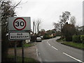
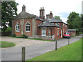
Area Overview for Old Buckenham
Photos of Old Buckenham
Area Information
Old Buckenham stands as a distinct built-up area within Norfolk, covering eighty point two hectares. The town represents a settled community with a clear residential focus rather than a sprawling metropolitan sprawl. Living in Old Buckenham means experiencing a locality where residents know their surroundings intimately. The area balances quiet residential streets with essential services that are within practical reach. You will find the town caters to those who value stability and familiarity over constant change. The character of Old Buckenham is defined by long-term inhabitants who have put down roots for generations. This creates an environment where daily life centers on community routines rather than transient populations. Homes in Old Buckenham reflect this permanence, with most properties owned by those who reside there. The town does not suffer from the anonymity of larger cities. Instead, it offers a contained space where neighbours often know one another by sight. Prospective buyers looking for Old Buckenham enter a setting that prioritizes pace over pace. The layout supports a lifestyle where retail parks and railway stations sit close enough to reduce travel time but distant enough to maintain suburban privacy. You do not find the congestion typical of major urban centres here. The area provides a straightforward living situation where the essentials are accessible without dominating the landscape. This makes Old Buckenham suitable for those seeking a property market that does not fluctuate wildly with national trends.
- Area Type
- Built Up Area 250
- Area Size
- 80.2 hectares
- Population
- Not available
- Population Density
- Not available
Living in Old Buckenham offers convenient access to retail and dining. Five major supermarkets serve the immediate area, ensuring you can find groceries without traveling far. Sainsburys Attleborough, Lidl Attleborough and Asda Snetterton act as the backbone of local provision. These locations allow residents to pick up essentials, bulk shop or grab fresh produce without needing a specific journey plan. You will also find smaller convenience stores within the town limits. The rail network further enhances the lifestyle by linking Old Buckenham to broader commercial centres. Four railway stations are nearby, meaning you can access dining and leisure venues in Attleborough or beyond. You do not spend your week commuting to and from distant large towns for basic needs. The presence of these amenities defines the practical character of daily life. Residents walk to local cups of tea rather than drive across the region. The balance between local sufficiency and regional access creates a comfortable rhythm. You find what you need quickly. The area supports a lifestyle where errands are completed efficiently. Whether you choose homes in Old Buckenham are motivated by proximity to Sainsburys or Lidl does not matter less than the ease of access. The retail footprint is sufficient for independent living. You do not feel isolated from modern consumer choice. The combination of local shops and nearby rail logistics ensures you can maintain employment outside the town while keeping daily life grounded here.
Amenities
Schools
Families accessing schools near Old Buckenham benefit from a choice of local institutions. Old Buckenham Community Primary School serves as one of the designated primary options. Another key option is Old Buckenham High School, which operates as a primary institution within the local catchment area. Residents also have access to Old Buckenham Primary School and Nursery, which holds a good Ofsted rating. This specific accreditation provides a verified benchmark for educational quality in the immediate vicinity. Beyond the standard primary education options, there is a special school provision nearby. Chapel Green School offers specialist education, adding a layer of comprehensive care for children with additional needs. Another entry on the roll list is Old Buckenham High School, which functions as an academy. This designation allows the school to operate independently while following the national curriculum. The mix of school types means that primary education is largely handled locally. Families do not always need to travel far for foundational learning. The presence of an academy and a special school indicates that Old Buckenham supports a range of educational requirements without relying entirely on transport to neighbouring towns. If you choose homes in Old Buckenham, you are placing your children within a five-mile radius of multiple educational facilities. The proximity of Old Buckenham Primary School and Nursery ensures early years care remains accessible.
| Rank | School | Type | Entry gender | Ages |
|---|
Explore more schools in this area
Go to Schools tabDemographics
The community in Old Buckenham reflects a settled population with a median age of seventy. This figure indicates that the town houses a significant number of older residents compared to the national average. Most commonly, the population falls into age brackets typical of retirement or late mid-life stages. This demographic profile shapes the social fabric and local needs of Old Buckenham. Home ownership levels stand at seventy seven per cent. This high statistic demonstrates that the majority of households in Old Buckenham own their homes outright or have substantial equity. Consequently, the rental market plays a minor role in the local economy. You will find fewer transient households compared to areas with lower ownership rates. The prevalence of owner-occupiers suggests stability in neighbourhood composition over time. Household composition and ethnic diversity data are not explicitly detailed in the local breakdown provided. However, the high ownership rate of seventy seven per cent strongly implies a community structure based on family units or partners staying together for long periods. There is no evidence of significant population churn. Residents in Old Buckenham tend to remain in their properties for decades. This consistency means the area lacks the rapid demographic shifts seen in commuter towns. The social environment remains predictable, which appeals to buyers who dislike uncertainty in their living situation.
Household Size
Accommodation Type
Tenure
Ethnic Group
Religion
Household Composition
Age
Household Deprivation
NS-SEC
Explore more demographic insights in this area
Go to Demographics tabPlanning
Planning Constraints
- Crime RiskPremium