Area Overview for Occold
Photos of Occold


Area Information
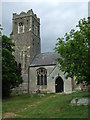
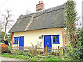
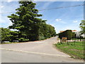
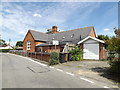
Occold is a small built-up area in England, covering 25.1 hectares. It is home to a population with a median age of 70, reflecting a community predominantly composed of older residents. The area’s compact size means amenities and services are closely clustered, making daily life practical for residents. Occold’s proximity to Diss Railway Station offers straightforward access to regional transport networks, while nearby retail options such as Co-op Eye provide essential shopping. The presence of Occold Primary School underscores the area’s focus on local education. With a low crime risk score of 92, Occold offers a secure environment, ideal for those prioritising safety and stability. Its character is defined by a mature demographic, a strong sense of community, and a reliance on local infrastructure. For buyers, Occold represents a blend of simplicity and accessibility, with housing stock primarily owner-occupied and a mix of accommodation types. The area’s charm lies in its quiet, well-established nature, appealing to those seeking a slower pace of life without sacrificing convenience.
- Area Type
- Built Up Area 250
- Area Size
- 25.1 hectares
- Population
- Not available
- Population Density
- Not available
Occold’s lifestyle is shaped by its proximity to retail and transport hubs. Five notable retail venues, including Co-op Eye and East of England Co-operative Co, provide essential shopping options within walking distance. The Diss Railway Station enhances mobility, allowing residents to travel further afield for work, leisure, or services. While the area lacks detailed data on parks or leisure facilities, the presence of local shops and transport links suggests a practical, community-focused lifestyle. The compact nature of Occold means amenities are accessible without long commutes, supporting a low-stress daily routine. The combination of retail convenience and transport access makes it suitable for those valuing simplicity and self-sufficiency.
Amenities
Schools
Occold Primary School is the only educational institution explicitly listed near the area. The data does not include Ofsted ratings or secondary school options, but the presence of a primary school suggests that families with young children can access local education. The lack of secondary school data means parents may need to consider commuting to nearby towns for higher education. The single primary school may indicate a smaller student population, which could affect resources and extracurricular opportunities. For families prioritising proximity to schools, Occold’s primary education is a key asset, though further research would be needed to assess its quality.
| Rank | School | Type | Entry gender | Ages |
|---|
Explore more schools in this area
Go to Schools tabDemographics
Occold’s population has a median age of 70, indicating a community skewed towards older adults. Home ownership is high at 82%, suggesting a stable, long-term resident base. The data does not specify household composition or accommodation types, but the overall demographic profile points to a mature population with established routines. The area’s predominant ethnic group and religious composition are not detailed, but the figures provided reflect the total population. This demographic structure may influence local services, with a focus on healthcare and retirement amenities. The high home ownership rate implies a community with a strong sense of place, where residents are likely to have lived for many years. For prospective buyers, this suggests a neighbourhood with a consistent character, though it may lack the diversity of younger, growing areas.
Household Size
Accommodation Type
Tenure
Ethnic Group
Religion
Household Composition
Age
Household Deprivation
NS-SEC
Explore more demographic insights in this area
Go to Demographics tabPlanning
Planning Constraints
- Crime RiskPremium