Area Overview for Oakington and Westwick
Photos of Oakington and Westwick


Area Information
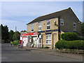
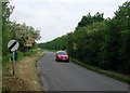
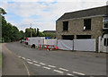
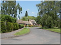
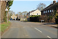
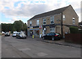
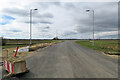
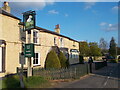
Oakington and Westwick is a small rural civil parish in South Cambridgeshire, extending over an area of 7.4 km². Located approximately seven miles north-west of Cambridge, the parish was formed in 1985 by merging the former separate settlements of Oakington and Westwick. Today, the combined population stands at approximately 1,400 residents. You will find a community with deep historical roots, where archaeological evidence suggests possible settlement during the Palaeolithic era, and Roman pottery shards indicate habitation from the 2nd to the 4th century AD. The parish retains significant historical structures, including the 12th-century church that served as the focal point of early Oakington and Westwick Hall, built by the Linton family in the 1850s and 1860s. The Queens Way recreation ground marks the site of an early Anglo-Saxon graveyard discovered in 1938. Beck Brook crosses the landscape, spanned by Westwick Bridge, which has seen various reconstructions since its first recorded mention in 1279. Northstowe now borders the parish, having received land transferred from Oakington and Westwick to enable its formation as a new town in 2021. Living in Oakington and Westwick means inhabiting a place where history, nature, and modern development intersect. The parish offers quiet country living close to Cambridge, situated alongside former railway lines now converted into a guided bus and cycleway. This connectivity provides access to the wider region while maintaining a distinct rural character.
- Area Type
- Parish
- Area Size
- 7.4 km²
- Population
- Not available
- Population Density
- Not available
Demographics
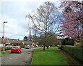
The community in Oakington and Westwick is characterised by an older demographic profile. The median age for residents is 70, indicating a significant presence of older adults within the neighbourhood. While specific data on the most common age range is not detailed beyond the median figure, the high median age suggests families with young children are fewer in number compared to older households. Approximately 77 per cent of all residents own their homes, reflecting a settlement where property ownership is the norm rather than the exception. This high ownership rate implies a stable resident base who have put down roots over many years. The parish functions as a close-knit community where long-term occupation is evident in the housing stock. Accommodation types and household composition figures are available only as aggregate categories in the data, pointing to a traditional rural living arrangement. You will find that the local environment supports an older lifestyle, with the presence of historic buildings like Westwick Hall and conservation areas contributing to the setting. The low crime risk further supports a peaceful life for retirees and elderly residents. With a population of around 1,400, the parish offers a small, manageable environment where neighbours know each other. The demographic reality means you should expect a quieter, less transient atmosphere compared to larger towns or growing cities nearby.
Household Size
Accommodation Type
Tenure
Ethnic Group
Religion
Household Composition
Age
Household Deprivation
NS-SEC
Explore more demographic insights in this area
Go to Demographics tabPlanning
Planning Constraints
- Flood RiskPremium
- Ramsar Wetland SitesPremium
- Area of Outstanding Natural BeautyPremium
- Protected Nature ReservePremium
- Protected WoodlandPremium
- Crime RiskPremium