Area Overview for Nuthampstead
Photos of Nuthampstead
Area Information
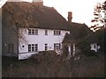
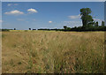
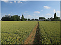
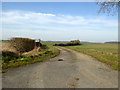
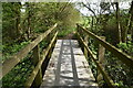
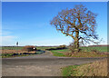
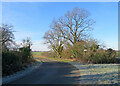
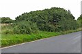
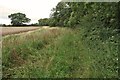
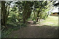
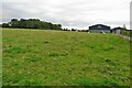
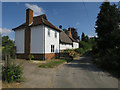
Nuthampstead is a small civil parish located in the North Hertfordshire district of Hertfordshire. It sits at the far eastern end of the district and forms the only parish in this area that borders Essex. You will find the village approximately five miles south-east of Royston on chalk uplands. The territory covers an area size of 7.9 km², offering a quiet and tiered setting for residents. Historically, this hamlet first appeared indirectly in the Domesday Book in 1086 as a manor held by Hugh from Geoffrey de Mandeville. The site was assessed at £6 tax on three hides, implying a taxable population of around 269 people at that time. Today, the 2021 census records a population of 141, reflecting its status as a compact community. The location shares characteristics with north-east Essex and south Cambridgeshire, placing it off the beaten track. Key landmarks include the Church of St George, The Woodman Inn, and The Town House. Archaeological traces such as moats, ridge-and-furrow lines, and a former brickworks quarry dot the landscape. Living in Nuthampstead means embracing a rural lifestyle defined by steep hills, open skies, and a deep connection to the local countryside. The community in Nuthampstead displays a distinct demographic profile shaped by its rural nature. The median age for the population stands at 70, indicating a senior demographic dominates the area. Most households consist of older residents rather than young families. Home ownership is exceptionally high, with figures showing that 78% of households own their homes. This statistic suggests that renting accommodation is uncommon within the village boundaries. The data does not specify breakdowns by ethnicity or religion, but the small population size of 141 creates an intimate social environment. Because the area is defined as a hamlet, you will likely find a close-knit group of neighbours. The household composition data indicates a total snapshot of the local families, though specific parent-child ratios are not detailed in the available records. Given the high percentage of owner-occupiers, most people in Nuthampstead have lived there for a long time. This stability contrasts sharply with urban centres where moves happen frequently. If you are considering buying here, expect to engage with a community where generations have deep roots. The older age profile means services cater primarily to mature residents, such as large family homes adapted for older occupants rather than starter flats. Understanding the housing stock in Nuthampstead is essential for any prospective buyer. The area functions almost entirely as a home ownership market rather than a rental hub. Data confirms that 78% of people own their homes, which leaves just 22% of households in rented accommodation. This ratio indicates that buying is the standard route to living in Nuthampstead. The small total population of 141 suggests a limited supply of properties on the market at any given time. You will typically find traditional brick homes, barn conversions, and older cottages rather than modern developments. The predominant accommodation type reflects the rural character of the 7.9 km² parish. Historical elements like the medieval Scales Park and WWII base housing influence the architectural style of existing streets. There are no large estates or purpose-built complexes in the current housing landscape. Buyers looking at Nuthampstead should treat this as an established neighbourhood where properties have remained in family hands for decades. The low density means you will see more open land and fewer neighbours than in towns. If you desire a detached house with significant garden space, this location will suit your needs. However, limited inventory means competition for available listings may be intense. Digital connectivity in Nuthampstead varies between fixed and mobile networks. Mobile coverage scores an 84 out of 100, representing good signal quality. You can expect reliable reception for travelers and those relying on phones for daily communication. Fixed broadband quality, however, scores 58 out of 100, which falls into the fair rather than excellent category. This score indicates that internet speeds may fluctuate compared to urban centres with superior fibre infrastructure. For residents working from home, this scorebook suggests you need a backup plan for heavy uploads. Streaming services will likely function well, but large file transfers or video calls might experience occasional buffering. The village's remote position five miles from Royston limits physical transport options. While mobile networks perform adequately, the broadband score reveals a dependency on whatever fixed lines reach this rural hamlet. You must check specific line speeds with providers before committing to a property. Overall, living in Nuthampstead requires accepting that internet reliability is not at the premium level found in city developments. Safety and environmental factors provide a mixed but generally reassuring picture for residents of Nuthampstead. Crime risk scores an 86, classifying the area as low risk. This score confirms below-average crime rates compared to the national picture, creating a safe neighbourhood environment. Flood risk assessments pass with a score of 2.98, indicating low flood risk coverage. This metric suggests that homes and the wider parish remain protected from significant waterlogging. Planning constraints also influence daily life through protected spaces. The site contains protected woodland, generating a warning score of 13.12. While this indicates preservation efforts, it may restrict certain development projects within these specific zones. No Ramsar wetland sites, Areas of Outstanding Natural Beauty, or other nature reserves cover the parish, removing some landscape restrictions. The absence of these protected statuses simplifies planning applications for standard residential builds. Low crime and minimal flood threats offer peace of mind, while the protected woodland serves as a visual buffer. You will find a low crime environment with minimal environmental hazards that could disrupt daily life. What makes the community in Nuthampstead distinctive?Nuthampstead is a tiny rural hamlet with a population of 141 and a median age of 70. The village has a 78% home ownership rate, meaning most residents own their properties. Living here involves engaging with a close-knit group where generations have deep roots. The area contains 269 people were estimated in 1086, though today it is defined by its quiet, off-the-beaten-track character near Royston and the chalk uplands. How reliable is the internet and transport options?Digital connectivity in Nuthampstead scores a 58 for fixed broadband and an 84 for mobile coverage. You can expect good mobile reception but fair fixed broadband speeds that may not suit heavy remote work demands. The village sits five miles south-east of Royston, relying on local rural transport rather than immediate major road access. Is it safe to live in Nuthampstead?The area presents a low crime risk with a safety score of 86 out of 100. Flood risk is also minimal, scoring just 2.98. While protected woodland exists in the parish, creating a warning for planning, there are no other major environmental hazards like AONBs or high flood zones. This makes it a secure choice for families and retirees. Who typically lives in Nuthampstead?The residents are predominantly older adults, with a median age of 70. Most households consist of older residents rather than young families. With 78% of people owning their homes, renting is rare in this civil parish. The community reflects a traditional rural demographic living in historic properties near the Essex border.
- Area Type
- Parish
- Area Size
- 7.9 km²
- Population
- Not available
- Population Density
- Not available
Demographics
The community in Nuthampstead displays a distinct demographic profile shaped by its rural nature. The median age for the population stands at 70, indicating a senior demographic dominates the area. Most households consist of older residents rather than young families. Home ownership is exceptionally high, with figures showing that 78% of households own their homes. This statistic suggests that renting accommodation is uncommon within the village boundaries. The data does not specify breakdowns by ethnicity or religion, but the small population size of 141 creates an intimate social environment. Because the area is defined as a hamlet, you will likely find a close-knit group of neighbours. The household composition data indicates a total snapshot of the local families, though specific parent-child ratios are not detailed in the available records. Given the high percentage of owner-occupiers, most people in Nuthampstead have lived there for a long time. This stability contrasts sharply with urban centres where moves happen frequently. If you are considering buying here, expect to engage with a community where generations have deep roots. The older age profile means services cater primarily to mature residents, such as large family homes adapted for older occupants rather than starter flats. Understanding the housing stock in Nuthampstead is essential for any prospective buyer. The area functions almost entirely as a home ownership market rather than a rental hub. Data confirms that 78% of people own their homes, which leaves just 22% of households in rented accommodation. This ratio indicates that buying is the standard route to living in Nuthampstead. The small total population of 141 suggests a limited supply of properties on the market at any given time. You will typically find traditional brick homes, barn conversions, and older cottages rather than modern developments. The predominant accommodation type reflects the rural character of the 7.9 km² parish. Historical elements like the medieval Scales Park and WWII base housing influence the architectural style of existing streets. There are no large estates or purpose-built complexes in the current housing landscape. Buyers looking at Nuthampstead should treat this as an established neighbourhood where properties have remained in family hands for decades. The low density means you will see more open land and fewer neighbours than in towns. If you desire a detached house with significant garden space, this location will suit your needs. However, limited inventory means competition for available listings may be intense. Digital connectivity in Nuthampstead varies between fixed and mobile networks. Mobile coverage scores an 84 out of 100, representing good signal quality. You can expect reliable reception for travelers and those relying on phones for daily communication. Fixed broadband quality, however, scores 58 out of 100, which falls into the fair rather than excellent category. This score indicates that internet speeds may fluctuate compared to urban centres with superior fibre infrastructure. For residents working from home, this scorebook suggests you need a backup plan for heavy uploads. Streaming services will likely function well, but large file transfers or video calls might experience occasional buffering. The village's remote position five miles from Royston limits physical transport options. While mobile networks perform adequately, the broadband score reveals a dependency on whatever fixed lines reach this rural hamlet. You must check specific line speeds with providers before committing to a property. Overall, living in Nuthampstead requires accepting that internet reliability is not at the premium level found in city developments. Safety and environmental factors provide a mixed but generally reassuring picture for residents of Nuthampstead. Crime risk scores an 86, classifying the area as low risk. This score confirms below-average crime rates compared to the national picture, creating a safe neighbourhood environment. Flood risk assessments pass with a score of 2.98, indicating low flood risk coverage. This metric suggests that homes and the wider parish remain protected from significant waterlogging. Planning constraints also influence daily life through protected spaces. The site contains protected woodland, generating a warning score of 13.12. While this indicates preservation efforts, it may restrict certain development projects within these specific zones. No Ramsar wetland sites, Areas of Outstanding Natural Beauty, or other nature reserves cover the parish, removing some landscape restrictions. The absence of these protected statuses simplifies planning applications for standard residential builds. Low crime and minimal flood threats offer peace of mind, while the protected woodland serves as a visual buffer. You will find a low crime environment with minimal environmental hazards that could disrupt daily life. What makes the community in Nuthampstead distinctive?Nuthampstead is a tiny rural hamlet with a population of 141 and a median age of 70. The village has a 78% home ownership rate, meaning most residents own their properties. Living here involves engaging with a close-knit group where generations have deep roots. The area contains 269 people were estimated in 1086, though today it is defined by its quiet, off-the-beaten-track character near Royston and the chalk uplands. How reliable is the internet and transport options?Digital connectivity in Nuthampstead scores a 58 for fixed broadband and an 84 for mobile coverage. You can expect good mobile reception but fair fixed broadband speeds that may not suit heavy remote work demands. The village sits five miles south-east of Royston, relying on local rural transport rather than immediate major road access. Is it safe to live in Nuthampstead?The area presents a low crime risk with a safety score of 86 out of 100. Flood risk is also minimal, scoring just 2.98. While protected woodland exists in the parish, creating a warning for planning, there are no other major environmental hazards like AONBs or high flood zones. This makes it a secure choice for families and retirees. Who typically lives in Nuthampstead?The residents are predominantly older adults, with a median age of 70. Most households consist of older residents rather than young families. With 78% of people owning their homes, renting is rare in this civil parish. The community reflects a traditional rural demographic living in historic properties near the Essex border.
Household Size
Accommodation Type
Tenure
Ethnic Group
Religion
Household Composition
Age
Household Deprivation
NS-SEC
Explore more demographic insights in this area
Go to Demographics tabPlanning
Planning Constraints
- Flood RiskPremium
- Ramsar Wetland SitesPremium
- Area of Outstanding Natural BeautyPremium
- Protected Nature ReservePremium
- Protected WoodlandPremium
- Crime RiskPremium