Area Overview for NR9 5QT
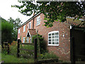
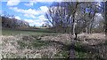
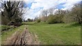
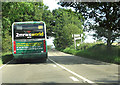
Photos of NR9 5QT

Area Information
NR9 5QT is a small residential cluster situated within England, covering an area of 87.2 hectares. You will find a population of 2,468 residents spread across this space, resulting in a density of just 74 people per square kilometre. This low density indicates a quiet, spacious environment where properties do not crowd one another. Living in NR9 5QT means you are part of a defined postcode area that functions as a distinct pocket of settlement rather than a sprawling urban zone. The area offers a sense of separation from dense city living while remaining connected to the wider region. Your daily life here is shaped by the specific boundaries of this 87.2 hectare zone, providing a contained community feel. Prospective buyers looking for a specific postcode area covering a small residential cluster will find this location matches that description precisely. The character of the neighbourhood is defined by its residential nature and the modest scale of its footprint. You can expect a setting that prioritises space and tranquility over high-density convenience.
- Area Type
- Postcode
- Area Size
- 87.2 hectares
- Population
- 2468
- Population Density
- 74 people/km²
Homes in NR9 5QT are characterised by a settled market where ownership is the norm. The accommodation type data shows that houses are the standard dwelling across this postcode. With a home ownership rate of 78%, you are more likely to find owner-occupied properties than rental units. This high percentage of owner-occupied homes suggests that buyers who move into the area tend to stay for the long term. The housing stock consists primarily of houses, aligning with the low population density of 74 people per square kilometre. You will not encounter a significant cluster of rental conversions or student accommodations. Instead, the market reflects a demand for family-sized housing suited to households with a median age of 47. When viewing properties in this small cluster, expect to deal primarily with owners looking to sell their longstanding residences. The nature of the housing stock means there is a limited supply of flats or converted apartments. Buyers should focus on traditional house structures within the 87.2 hectare area.
House Prices in NR9 5QT
Showing 15 properties
| Address | Type | Beds | Baths | Last Sale Price | Last Sale Date | |
|---|---|---|---|---|---|---|
| 6 Sparham Hill, Sparham, NR9 5QT | house | 2 | 2 | £235,000 | Sep 2024 | |
| Park View, Sparham Hill, Sparham, NR9 5QT | Bungalow | 3 | 1 | £370,000 | Nov 2022 | |
| 7 Sparham Hill, Sparham, NR9 5QT | house | - | - | £225,000 | Feb 2021 | |
| 1 Sparham Hill, Sparham, NR9 5QT | Semi-detached | 3 | - | £152,000 | Dec 2015 | |
| Hill House, Sparham Hill, Sparham, NR9 5QT | Detached | 4 | - | - | - | |
| 3 Sparham Hill, Sparham, NR9 5QT | Semi-detached | - | - | - | - | |
| 4 Sparham Hill, Sparham, NR9 5QT | Semi-detached | - | - | - | - | |
| Hill House Annexe, Sparham Hill, Sparham, NR9 5QT | Semi-detached | - | - | - | - | |
| Workshop At Sparham Hill Cottage, Sparham Hill, Sparham, NR9 5QT | Industrial | - | - | - | - | |
| 3-4 Sparham Hill, Sparham, NR9 5QT | house | - | - | - | - |
Energy Efficiency in NR9 5QT
Lifestyle in NR9 5QT is supported by a selection of retail amenities within practical reach of your home. You have access to five main retail locations inside the postcode boundary or immediate vicinity. Notable shops include Budgens Lenwade, Morrisons Daily, and Spar, providing essential grocery and daily essentials. These venues offer convenience for those who prefer not to travel far for their weekly shopping needs. The presence of a Spar and Budgens suggests accessible convenience stores for top-up shops and quick purchases. Morrisons Daily indicates the availability of slightly larger grocery options nearby. Residents can manage their household shopping trips efficiently using these local outlets. The cluster of amenities creates a self-sufficient lifestyle where basic needs are met without leaving the immediate neighbourhood. Your daily routine will be facilitated by the proximity of these specific food retailers. While the area is residentially focused, the nearby shops ensure you do not face significant struggles in finding daily necessities.
Amenities
Schools
Schools near NR9 5QT offer a mix of local educational options for families in the area. Bawdeswell Community Primary School operates within the vicinity and holds a good Ofsted rating. Lyng Church of England Primary School serves as another key educational institution nearby. Families also have access to Lyng Church of England Primary Academy, providing an extensive local primary school network. Additionally, the Tutorial Centre is located in the local area, offering alternative educational or training facilities. The presence of multiple primary schools means you have several choices for early education within a short distance. You can choose between Bawdeswell Community Primary School or Lyng based on your specific preferences. The school types listed are exclusively primary, catering to children from the early years up to the teenage years. For residents with school-age children, NR9 5QT provides direct access to recognised local institutions without the need for daily long-distance commuting to larger towns.
| Rank | School | Type | Entry gender | Ages |
|---|
Explore more schools in this area
Go to Schools tabDemographics
The community in NR9 5QT reflects an established population with significant stability. The median age stands at 47 years, and the most common age range for residents is 30 to 64 years. Adults dominate the demographic landscape, suggesting the area attracts families and established professionals seeking permanence. Home ownership is very high at 78%, indicating that the majority of households have purchased their homes rather than renting. This level of ownership points to long-term residents who have invested in the area over time. Houses form the predominant accommodation type, meaning you will find traditional housing structures rather than high-rise flats or apartments. The predominant ethnic group is White, reflecting the broader demographics of the region. With a home ownership rate of 78%, the area maintains a traditional character typical of settled English neighbourhoods. Almost all residents live in houses, reinforcing the suburban or semi-rural feel of NR9 5QT. The age profile ensures a mature community where many families have likely lived for decades.
Household Size
Accommodation Type
Tenure
Ethnic Group
Religion
Household Composition
Age
Household Deprivation
NS-SEC
Explore more demographic insights in this area
Go to Demographics tabPlanning
Planning Constraints
- Flood RiskPremium
- Ramsar Wetland SitesPremium
- Area of Outstanding Natural BeautyPremium
- Protected Nature ReservePremium
- Protected WoodlandPremium