Area Overview for NR9 5LA
Photos of NR9 5LA
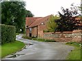
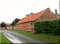
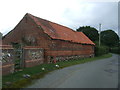
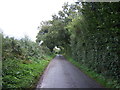
22 photos from this area
Area Information
Key information about the NR9 5LA including its size, population, and administrative classification.
- Area Type
- Postcode
- Area Size
- 59.5 hectares
- Population
- 1462
- Population Density
- 51 people/km²
House Prices in NR9 5LA
9
Properties
£917,500
Average Sold Price
£585,000
Lowest Price
£1,250,000
Highest Price
Showing 9 properties
| Address | Type | Beds | Baths | Last Sale Price | Last Sale Date | |
|---|---|---|---|---|---|---|
| Nethercraigs, Weston Green Road, Weston Longville, NR9 5LA | Bungalow | 3 | 1 | £585,000 | Nov 2023 | |
| Pump Farm, Weston Green Road, Weston Longville, NR9 5LA | house | 6 | - | £1,250,000 | Mar 2020 | |
| Green Lodge, Weston Green Road, Weston Longville, NR9 5LA | house | - | - | - | - | |
| Mobile Home, Field Maple Barn, Weston Green Road, Weston Longville, NR9 5LA | Mobile Home | - | - | - | - | |
| Holey Oak, Honingham Road, Weston Longville, NR9 5LA | Land | - | - | - | - | |
| Holly Barn, Weston Green Road, Weston Longville, NR9 5LA | Bungalow | - | - | - | - | |
| Annexe 2, Pump Farm, Weston Green Road, Weston Longville, NR9 5LA | Flat | - | - | - | - | |
| Annexe, Pump Farm, Weston Green Road, Weston Longville, NR9 5LA | Flat | - | - | - | - | |
| Field Maple Barn, Weston Green Road, Weston Longville, NR9 5LA | Bungalow | - | - | - | - |
Energy Efficiency in NR9 5LA
Amenities
Schools
| Rank | School | Type | Entry gender | Ages |
|---|
Explore more schools in this area
Go to Schools tabDemographics
Household Size
Two person
most common
Accommodation Type
Houses
most common
Tenure
75
majority
Ethnic Group
White
most common
Religion
N/A
most common
Household Composition
N/A
most common
Age
47
median
Adults (30-64 years)
most common
Household Deprivation
N/A
with no deprivation
NS-SEC
35
in Lower managerial occupations
Explore more demographic insights in this area
Go to Demographics tabPlanning
Planning Constraints
- Flood RiskPremium
- Ramsar Wetland SitesPremium
- Area of Outstanding Natural BeautyPremium
- Protected Nature ReservePremium
- Protected WoodlandPremium