Area Overview for NR9 5JX
Photos of NR9 5JX
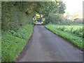
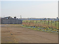
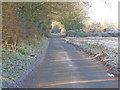
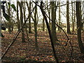
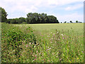
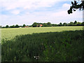
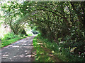
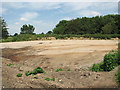
19 photos from this area
Area Information
Key information about the NR9 5JX including its size, population, and administrative classification.
- Area Type
- Postcode
- Area Size
- 17.4 hectares
- Population
- 1462
- Population Density
- 51 people/km²
House Prices in NR9 5JX
14
Properties
£242,563
Average Sold Price
£117,500
Lowest Price
£330,000
Highest Price
Showing 14 properties
| Address | Type | Beds | Baths | Last Sale Price | Last Sale Date | |
|---|---|---|---|---|---|---|
| 2A Post Office Lane, Weston Longville, NR9 5JX | Detached | 4 | 3 | £330,000 | Nov 2023 | |
| Conesford, Post Office Lane, Weston Longville, NR9 5JX | Bungalow | 3 | 2 | £325,000 | Jun 2023 | |
| Gainsborough House, Post Office Lane, Weston Longville, NR9 5JX | house | - | - | £325,000 | Sep 2021 | |
| Tintagel, Post Office Lane, Weston Longville, NR9 5JX | Chalet | 3 | 2 | £258,000 | Oct 2017 | |
| Rema, Post Office Lane, Weston Longville, NR9 5JX | Bungalow | - | - | £190,000 | Jun 2011 | |
| 8 Post Office Lane, Weston Longville, NR9 5JX | Bungalow | - | - | £145,000 | Dec 2010 | |
| Holly Tree House, Post Office Lane, Weston Longville, NR9 5JX | house | - | - | £250,000 | Nov 2006 | |
| Maristow, Post Office Lane, Weston Longville, NR9 5JX | Semi-detached | - | - | £117,500 | Aug 2002 | |
| 4 Post Office Lane, Weston Longville, NR9 5JX | Chalet | 3 | 1 | - | - | |
| 10 Post Office Lane, Weston Longville, NR9 5JX | Detached | - | - | - | - |
Page 1 of 2
Energy Efficiency in NR9 5JX
Amenities
Schools
| Rank | School | Type | Entry gender | Ages |
|---|
Explore more schools in this area
Go to Schools tabDemographics
Household Size
Two person
most common
Accommodation Type
Houses
most common
Tenure
75
majority
Ethnic Group
White
most common
Religion
N/A
most common
Household Composition
N/A
most common
Age
47
median
Adults (30-64 years)
most common
Household Deprivation
N/A
with no deprivation
NS-SEC
35
in Lower managerial occupations
Explore more demographic insights in this area
Go to Demographics tabPlanning
Planning Constraints
- Flood RiskPremium
- Ramsar Wetland SitesPremium
- Area of Outstanding Natural BeautyPremium
- Protected Nature ReservePremium
- Protected WoodlandPremium